The Locks
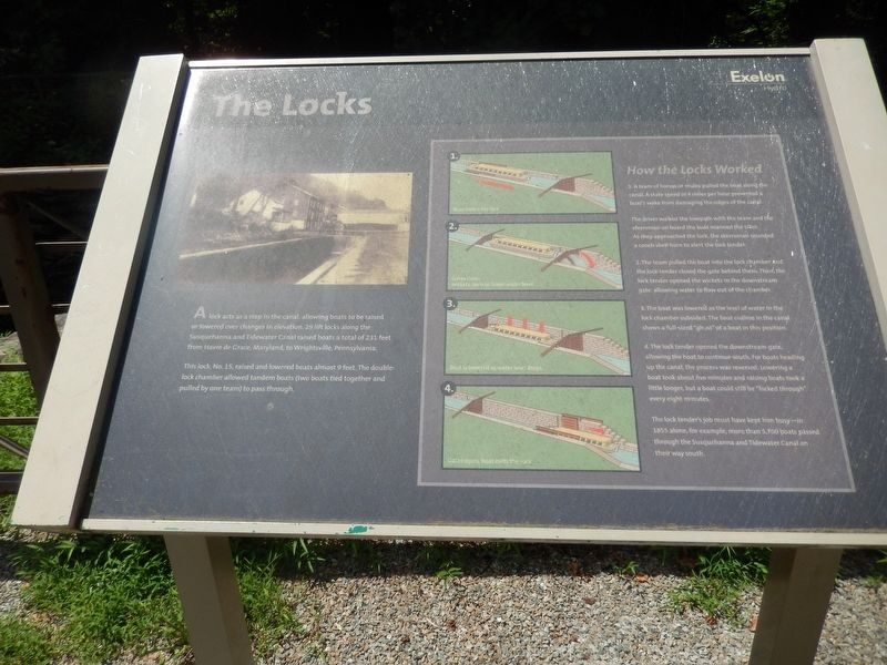
A lock acts as a step in the canal, allowing boats to be raised or lowered over changes in elevation. 29 lift locks along the Susquehanna and Tidewater Canal raised boats a total of 231 feet from Havre de Grace, Maryland, to Wrightsville, Pennsylvania.
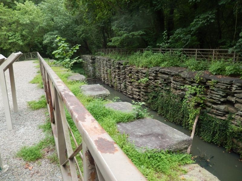
This lock, No. 15, raised and lowered boats almost 9 feet. The double lock chamber allowed tandem boats (two boats tied together and pulled by one team) to pass through.
How the Locks Worked
1. A team of horses or mules pulled the boat along the canal. A state speed of 4 miles per hour prevented a boat's wake from damaging the edges of the canal.
The driver walked the towpath with the team and the steersman on board the boat manned the tiller. As they approached the lock, the steersman sounded a conch shell horn to alert the lock tender.
2. The team pulled the boat into the lock chamber and the lock tender closed the gate behind them. Then, the lock tender opened the wickets in the downstream gate, allowing water to flow out of the chamber.
3 The boat was lowered as the level of water in the lock chamber subsided. The boat outline in the canal shows a full-sized "ghost" of a boat in this position.
5. The lock tender opened the downstream gate, allowing the boat to continue south. For boats heading up the canal, the process was reversed. Lowering a
boat took about five minutes and raising boats took a little longer, but a boat could still be "locked through" every eight minutes.
The lock tender's job must have kept him busy - in 1855 alone, for example, more than 5,700 boats passed through the Susquehanna and Tidewater Canal on their way south.
Topics and series. This historical marker is listed in this topic list: Waterways & Vessels. In addition, it is included in the Susquehanna and Tidewater Canal series list. A significant historical year for this entry is 1855.
Location. 39° 48.015′ N, 76° 18.485′ W. Marker is near Airville, Pennsylvania, in York County. Marker is on River Road. Marker is just north of Muddy Run Access. Touch for map. Marker is in this post office area: Airville PA 17302, United States of America. Touch for directions.
Other nearby markers. At least 8 other markers are within 6 miles of this marker, measured as the crow flies. The Susquehanna & Tidewater Canal (here, next to this marker); The Canal Boats (within shouting distance of this marker); The Canal Community (within shouting distance of this marker); Parks are for People (approx. 1.3 miles away); Lock No. 12 (approx. 1.4 miles away); Survivor of the Past (approx. 1˝ miles away); The River, the Dams and the Lakes (approx. 2.9 miles away); Dedicated to the honor and sacrifice (approx. 5.1 miles away). Touch for a list and map of all markers in Airville.
Credits. This page was last revised on April 20, 2021. It was originally submitted on July 18, 2020, by Bill Pfingsten of Bel Air, Maryland. This page has been viewed 161 times since then and 19 times this year. Last updated on April 18, 2021, by Carl Gordon Moore Jr. of North East, Maryland. Photos: 1, 2. submitted on July 18, 2020, by Bill Pfingsten of Bel Air, Maryland.

