Florence in Fremont County, Colorado — The American Mountains (Southwest)
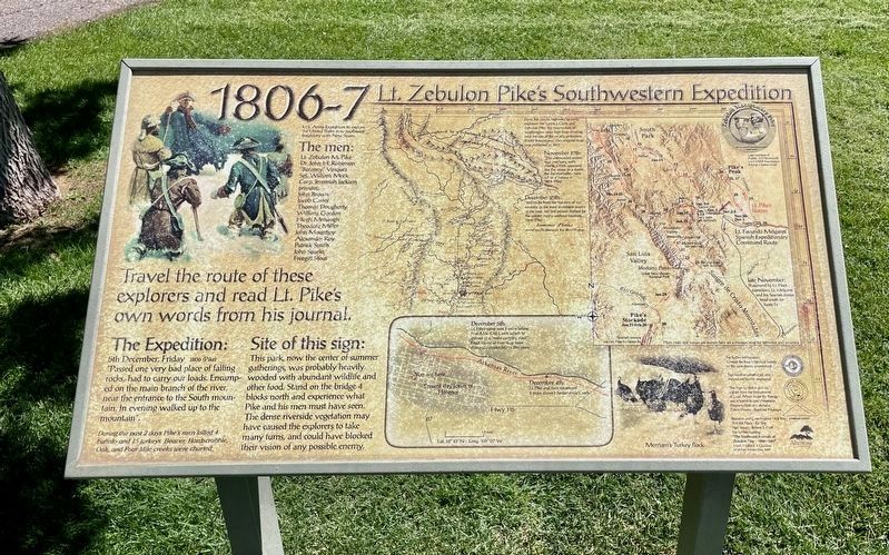
Lt. Zebulon Pike's Southwestern Expedition
1806-7
U.S. Army Expedition to explore the United States' new southwest boundary with New Spain
The men
Lt. Zebulon M. Pike • Dr. John H. Robinson • "Baroney" Vasquez • Sgt. William Meek • Corp. Jeremiah Jackson • Privates: John Brown, Jacob Carter, Thomas Dougherty, William Gordon, Hugh Menaugh, Theodore Miller, John Mountjoy, Alexander Roy, Patrick Smith, John Sparks, Freegift Stout
The Expedition:
5th December, Friday 1806 (Pike)
"Passed one very bad place of falling rocks, had to carry our loads. Encampment on the main branch of the river, near the entrance to the South mountains. In evening walked up to the mountain."
In the past 2 days Pike's men killed 4 deer and 15 turkeys. Beaver, Hardscrabble, and Four Mile creeks were charted.
Site of this sign:
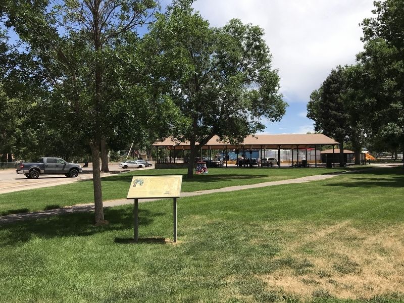
This park, now the center of summer gatherings, was probably heavily wooded with abundant wildlife and other food. Stand on the bridge 4 blocks north and experience what Pike and his men must have seen. The dense riverside vegetation may have caused the explorers to take many turns, and could have blocked their vision of any possible enemy.
Caption: Merriam's turkey flock (Lower right)
Topics. This historical marker is listed in this topic list: Exploration. A significant historical year for this entry is 1806.
Location. 38° 23.566′ N, 105° 7.007′ W. Marker is in Florence, Colorado, in Fremont County. Marker is at the intersection of North Pikes Peak Avenue (Colorado Route 67) and East 4th Street, on the right when traveling north on North Pikes Peak Avenue. Marker is located in Florence Pioneer Park. Touch for map. Marker is in this post office area: Florence CO 81226, United States of America. Touch for directions.
Other nearby markers. At least 8 other markers are within walking distance of this marker. James A. McCandless House (approx. 0.2 miles away); First Presbyterian Church (approx. 0.2 miles away); Early Agriculture & Ranching (approx. 0.2 miles away); Florence's Beginnings (approx. 0.2 miles away); City Drug (approx. 0.2 miles away); The Daniels Block Building (approx. 0.2 miles away); J. C. Penney (approx. 0.2 miles away); 120 W. Main Street (approx. 0.2 miles away). Touch for a list and map of all markers in Florence.
More about this marker. Similar marker located in Cañon City, Colorado.
Credits. This page was last revised on September 5, 2023. It was originally submitted on July 18, 2020, by Duane and Tracy Marsteller of Murfreesboro, Tennessee. This page has been viewed 202 times since then and 10 times this year. Photos: 1. submitted on September 5, 2023, by Mark Hilton of Montgomery, Alabama. 2. submitted on July 18, 2020, by Duane and Tracy Marsteller of Murfreesboro, Tennessee. • Andrew Ruppenstein was the editor who published this page.

