Bluffton in Beaufort County, South Carolina — The American South (South Atlantic)
The Barrel Landing Schoolhouse
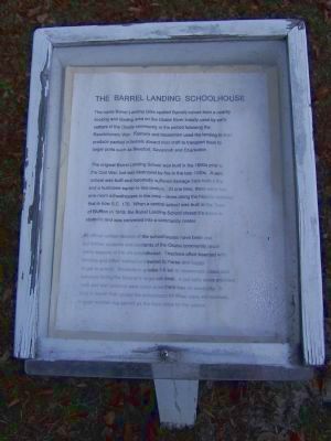
Photographed by Mike Stroud, December 18, 2008
1. The Barrel Landing Schoolhouse Marker
The name Barrel Landing (also spelled Barrell) comes from a nearby docking and landing area on the Okatie River initially used by early settlers of the Okatie community in the period following the Revolutionary War. Farmers and tradesmen used the landing to load produce packed in barrels aboard river craft to transport them to larger ports such as Beaufort, Savannah and Charleston
The original Barrel Landing School was built in the 1800s prior to the Civil War, but was destroyed by fire in the late 1800s. A new school was built and reportedly suffered damage from both a fire and a hurricane earlier this century. At one time, there were four one-room schoolhouses in the area - three along the historic roadway that is now S.C. 170. When a central school was built in the Town of Bluffton in 1919, the Barrel Landing School closed it's doors to students and was converted into a community center.
All official written records of the schoolhouses have been lost, but former students of the Okatie community recall many aspects of the old schoolhouse. Teachers often boarded with families and either walked or traveled by horse
this page online
Erected 1995 by Sun City Hilton Head and Beaufort County Council.
Topics. This historical marker is listed in this topic list: Education. A significant historical year for this entry is 1919.
Location. 32° 17.382′ N, 80° 56.383′ W. Marker is in Bluffton, South Carolina, in Beaufort County. It can be reached from Okatie Highway (State Highway 170) near Okatie Center Boulevard, on the right when traveling south. Touch for map. Marker is in this post office area: Okatie SC 29909, United States of America. Touch for directions.

Regionally, this marker is in the Lowcountry and on the Sea Islands. It is also in the American South, specifically in the Deep South, and on the Eastern Seaboard. Globally, it is in the North Atlantic Region, North America, the Western Hemisphere, the Western
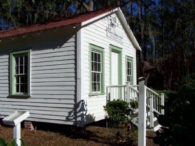
Photographed by Mike Stroud, December 2008
2. The Barrel Landing Schoolhouse Marker at left
Other nearby markers. At least 8 other markers are within 6 miles of this marker, measured as the crow flies: In Honor Of All Veterans (approx. 0.8 miles away); St. Luke's Church (approx. 1.2 miles away); Michael C. Riley Schools (approx. 5.6 miles away); First Zion Baptist Church (approx. 5.7 miles away); a different marker also named Bluffton (approx. 5.8 miles away); Cyrus Garvin / Cyrus Garvin House (approx. 5.8 miles away); Town of Bluffton, South Carolina (approx. 5.9 miles away); Campbell Chapel A.M.E. (approx. 5.9 miles away). Touch for a list and map of all markers in Bluffton.
Another marker is no longer nearby. Bluffton, S.C. (was approx. 5.3 miles away but has been confirmed missing).
Regarding The Barrel Landing Schoolhouse. The Barrel Landing Schoolhouse and Community Center was restored during the spring of 1995 and officially dedicated on July 20, 1995. The dedication
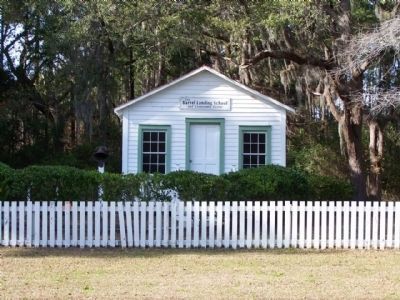
Photographed by Mike Stroud, 2008
3. The Barrel Landing Schoolhouse
Photographed by Mike Stroud, 2008
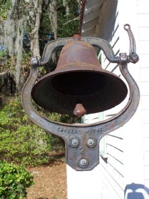
4. The Barrel Landing Schoolhouse Bell
The dedication ceremony was heralded by the ringing of the Barrel Landing School bell by the great-grandchildren of former students.
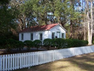
Photographed by Mike Stroud, 2008
5. The Barrel Landing Schoolhouse as seen from Hwy SC 170
Credits. This page was last revised on January 20, 2026. It was originally submitted on January 15, 2009, by Mike Stroud of Bluffton, South Carolina. This page has been viewed 4,320 times since then and 402 times this year. Photos: 1, 2, 3, 4, 5. submitted on January 15, 2009, by Mike Stroud of Bluffton, South Carolina. • Kevin W. was the editor who published this page.
