Near Howard in Fremont County, Colorado — The American Mountains (Southwest)
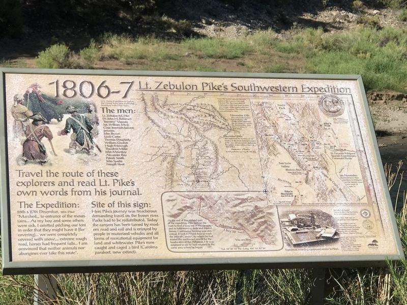
Lt. Zebulon Pike's Southwestern Expedition
1806-7
Inscription.
Travel the route of these explorers and read Lt. Pike's own words from his journal
U.S. Army Expedition to explore the United States' new southwest boundary with New Spain
The men
Lt. Zebulon M. Pike • Dr. John H. Robinson • "Baroney" Vasquez • Sgt. William Meek • Corp. Jeremiah Jackson • Privates: John Brown, Jacob Carter, Thomas Dougherty, William Gordon, Hugh Menaugh, Theodore Miller, John Mountjoy, Alexander Roy, Patrick Smith, John Sparks, Freegift Stout
The Expedition:
26th & 27th December 1806 (Pike)
"Marched...to entrance of the mountains...As my boy and some others were sick, I omitted pitching our tent in order that they might have it [for covering]...we were completely covered with snow,...extreme rough road, horses had frequent falls...I am convinced that neither animals nor aborigines ever take this route".
Site of this sign:
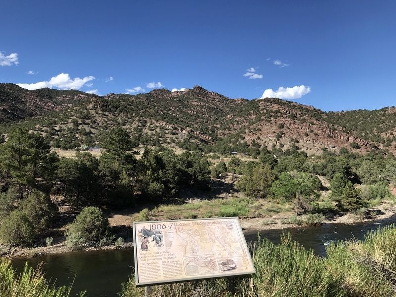
Here Pike's journey was treacherous demanding travel on the frozen river. Packs had to be redistributed. Today the canyon has been tamed by modern road and rail and is enjoyed by people in motorized vehicles and all forms of recreational equipment for land and whitewater. Pike's men caught and caged a bird (Carolina parakeet, now extinct).
Map, center bottom:
At the end of this ill-fated part of the expedition, Pike split up his men to find a way out of the canyon and to keep moving sleds and injured horses. Continuous hunting was also critical. It took 6-7 hard days to reach the area of Cañon City where he had started the northward search for the headwaters of the Arkansas. He was surprised to see he had returned to the same area where he began.
Captions
Map, top center: • From the careful logbooks by early explorers like Lewis & Clark and Zebulon Pike, the mapmakers of Washington were kept busy creating new images of the mostly unknown Rocky Mountains. This original map was published in 1807.
• November 27th: "The unbounded prairie was overhung with clouds, which appeared like the ocean in a storm..the thermometer..here fell to 4° below 0." 1806 (Pike)
• December 25th: "800 miles from the frontiers of our country, in the most inclement season of the year, not one person clothed for the winter, many without blankets..." 1806 (Pike)
Map, right: Lt. Facundo Melgares' Spanish Expeditionary Command Route
• Late November: Shadowed by Lt. Pike's expedition, Lt. Melgares and his Spanish troops headed south for Santa Fe.
Bottom right: Expedition recording equipment similar to Pike's.
Topics. This historical marker is listed in this topic list: Exploration. A significant historical date for this entry is December 26, 1806.
Location.
38° 28.541′ N, 105° 53.184′ W. Marker is near Howard, Colorado, in Fremont County. Marker is on U.S. 50, 0.4 miles east of Swissvale Road, on the left when traveling east. Marker is located on a pullout along the Arkansas River with ample parking. Touch for map. Marker is in this post office area: Howard CO 81233, United States of America. Touch for directions.
Other nearby markers. At least 6 other markers are within 14 miles of this marker, measured as the crow flies. Chaffee County Honor Roll Board (approx. 7.1 miles away); The Salida Steam Plant (approx. 7.1 miles away); The Jackson Hotel (approx. 10.6 miles away); The Cotopaxi Jewish Agricultural Colony 1882-1884 (approx. 12.7 miles away); Finding Our Roots / New Faces Along the River / Pike Explores the Valley (approx. 13.4 miles away); Christmas 1806 (approx. 13.4 miles away).
Credits. This page was last revised on July 23, 2020. It was originally submitted on July 21, 2020, by Duane and Tracy Marsteller of Murfreesboro, Tennessee. This page has been viewed 287 times since then and 16 times this year. Photos: 1, 2. submitted on July 21, 2020, by Duane and Tracy Marsteller of Murfreesboro, Tennessee. • Andrew Ruppenstein was the editor who published this page.

