Near Weatherly in Carbon County, Pennsylvania — The American Northeast (Mid-Atlantic)
Engineering Marvel
Samuel Breck, N. Beach, and Owen Rice
inspectors, Pennsylvania Canal Commission
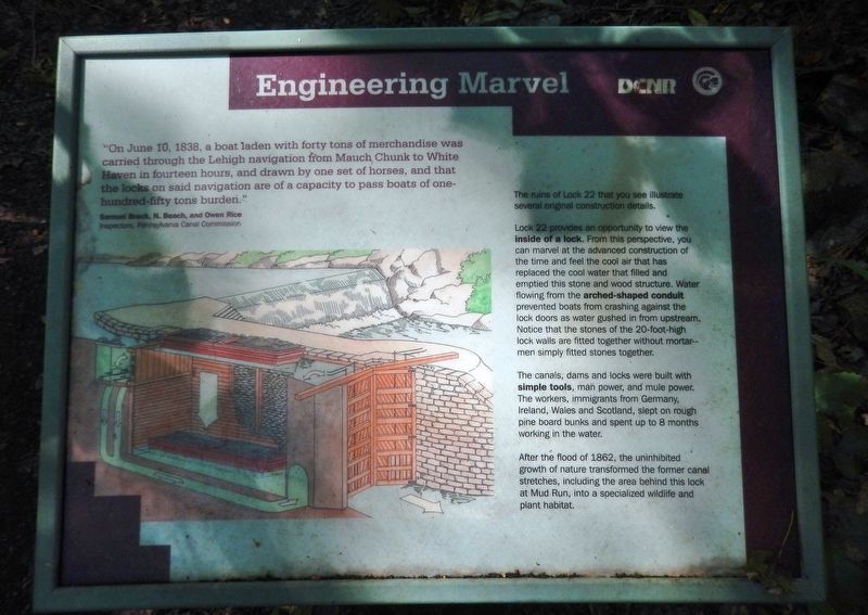
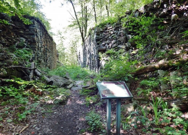
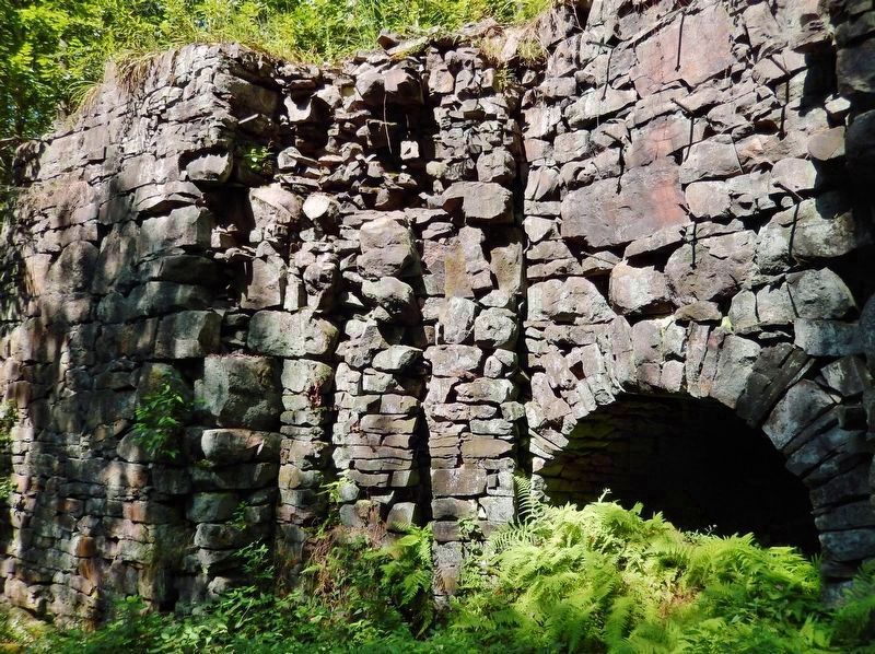
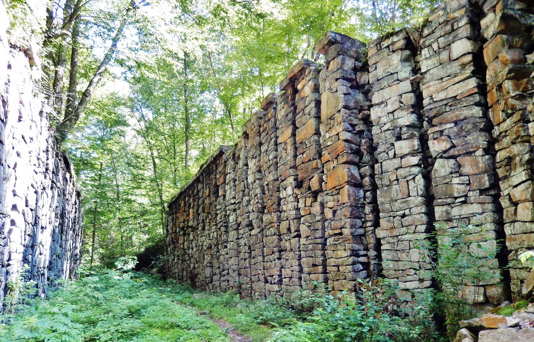
The ruins of Lock 22 that you see illustrate several original construction details.
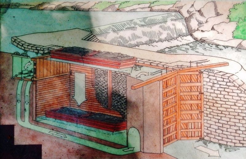
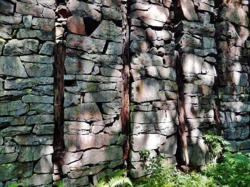
Lock 22 provides an opportunity to view the inside of a lock. From this perspective, you can marvel at the advanced construction of the time and feel the cool air that has replaced the cool water that filled and emptied this stone and wood structure. Water flowing from the arched-shaped conduit prevented boats from crashing against the lock doors as water gushed in from upstream. Notice that the stones of the 20-foot-high lock walls are fitted together without mortar — men simply fitted stones together.
The canals, dams and locks were built with simple tools, man power, and mule power. The workers, immigrants from Germany, Ireland, Wales and Scotland, slept on rough pine board bunks and spent up to 8 months working in the water.
After the flood of 1862, the uninhibited growth of nature transformed the former canal stretches, including the area behind this lock at Mud Run, into a specialized wildlife and plant habitat.
Erected by Pennsylvania Department of Conservation and Natural Resources.
Topics and series. This historical marker is listed in these topic lists: Architecture • Industry & Commerce • Waterways & Vessels. In addition, it is included in the Lehigh Canal, and the Pennsylvania Canal series lists. A significant historical date for this entry is June 10, 1838.
Location. 40° 59.258′ N, 75° 42.812′ W. Marker is near Weatherly, Pennsylvania, in Carbon County. Marker can be reached from Rockport Road, one mile east of South Lehigh Gorge Drive. Marker is located at the north end of the Lehigh Canal Lock 22 ruins, near the Lehigh Gorge Trail (Delaware and Lehigh Trail), in Lehigh Gorge State Park, about 3 miles northeast of the Rockport trailhead and parking lot. Touch for map. Marker is in this post office area: Weatherly PA 18255, United States of America. Touch for directions.
Other nearby markers. At least 8 other markers are within 5 miles of this marker, measured as the crow flies. A Revolution in Canal Technology (about 400 feet away, measured in a direct line); Disaster at Mud Run (about 400 feet away); From Rails to Trails (approx. 2.6 miles away); Lehigh Gorge State Park (approx. 2.6 miles away); Audubon Spoke for the Trees (approx. 2.6 miles away); Railroad Intersection (approx. 3.4 miles away); River Ran Black (approx. 4.3 miles away); a different marker also named River Ran Black (approx. 4.3 miles away). Touch for a list and map of all markers in Weatherly.
More about this marker. Access to the marker is via bicycle, horseback, kayak/canoe, or foot.
Also see . . . Lehigh Canal (Wikipedia). The upper Lehigh was a turbulent river with steep sides; a large portion was in a ravine, the Lehigh Gorge. The upper-canal design relied on deep-lift locks, lifting a maximum of 58 feet. The upper canal design's 20 dams, 29 locks and a number of reservoirs provided working flow even in dry summers. (Submitted on July 24, 2020, by Cosmos Mariner of Cape Canaveral, Florida.)
Credits. This page was last revised on July 25, 2020. It was originally submitted on July 23, 2020, by Cosmos Mariner of Cape Canaveral, Florida. This page has been viewed 129 times since then and 11 times this year. Photos: 1, 2, 3, 4, 5, 6. submitted on July 24, 2020, by Cosmos Mariner of Cape Canaveral, Florida.
