Quinton Township near Salem in Salem County, New Jersey — The American Northeast (Mid-Atlantic)
In Memory Of
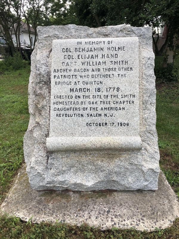
Col. Benjamin Holme
Col. Elijah Hand
Capt. William Smith
Erected 1908 by Oak Tree Chapter, Daughters of the American Revolution, Salem, N.J.
Topics and series. This memorial is listed in these topic lists: Settlements & Settlers • War, US Revolutionary. In addition, it is included in the Daughters of the American Revolution (DAR) series list. A significant historical date for this entry is March 18, 1778.
Location. 39° 32.86′ N, 75° 24.819′ W. Memorial is near Salem, New Jersey, in Salem County. It is in Quinton Township. It is on East Main Street (New Jersey Route 49) just east of Quinton Alloway Road (County Road 581), on the left when traveling east. Touch for map. Memorial is at or near this postal address: 6 E Main St, Salem NJ 08079, United States of America. Touch for directions.

Regionally, this memorial is in Greater Wilmington, in South Jersey, and in Greater Philadelphia. It is also in the
this page online
Other nearby markers. At least 8 other markers are within 4 miles of this marker, measured as the crow flies: Quinton’s Bridge (about 400 feet away, measured in a direct line); Veterans Memorial (approx. 0.4 miles away); Cornelia Hancock (approx. 2½ miles away); Mt. Pisgah African Methodist Episcopal Church (approx. 2.7 miles away); Lambert Street School (approx. 2.8 miles away); Mt. Hope United Methodist Church (approx. 2.8 miles away); Memorial Baptist Church (approx. 3.2 miles away); Salem Friends Meeting House (approx. 3.2 miles away). Touch for a list and map of all markers in Salem.

Credits. This page was last revised on February 7, 2023. It was originally submitted on July 27, 2020, by Devry Becker Jones of Washington, District of Columbia. This page has been viewed 353 times since then and 39 times this year. Photos: 1, 2. submitted on July 27, 2020, by Devry Becker Jones of Washington, District of Columbia.
