Negaunee in Marquette County, Michigan — The American Midwest (Great Lakes)
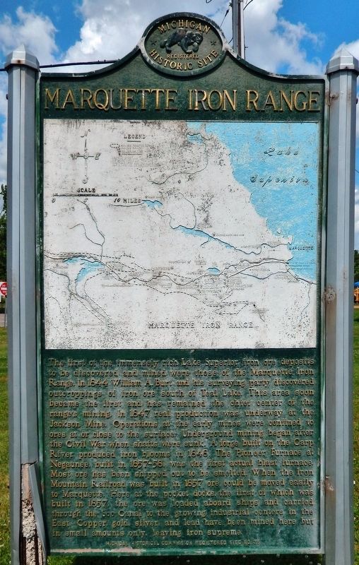
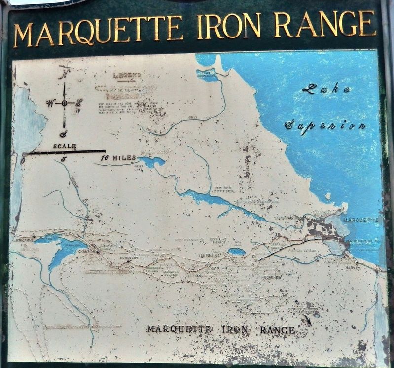
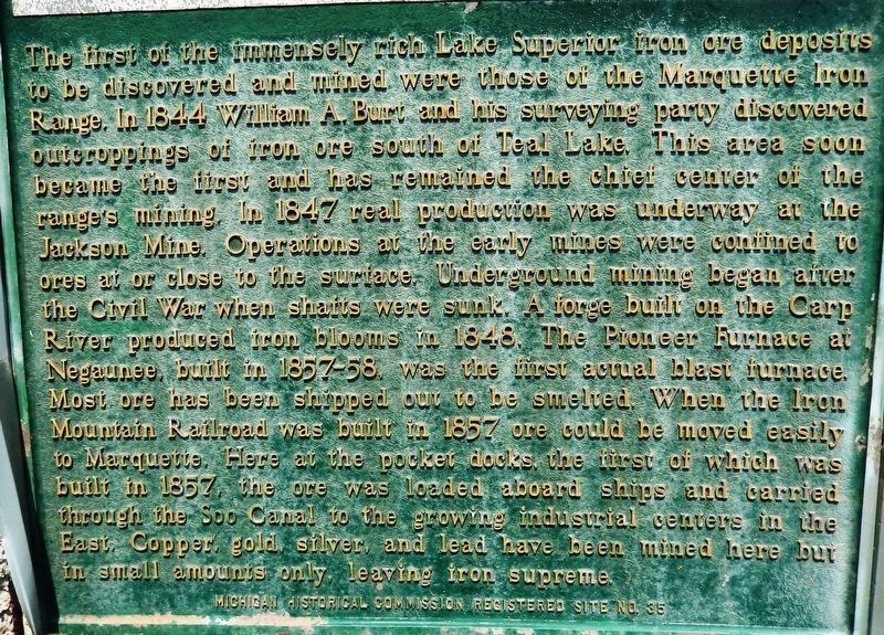
Marquette Iron Range
Erected 1957 by Michigan Historical Commission. (Marker Number S35.)
Topics and series. This historical marker is listed in these topic lists: Industry & Commerce • Railroads & Streetcars • Waterways & Vessels. In addition, it is included in the Michigan Historical Commission series list. A significant historical year for this entry is 1844.
Location. 46° 30.732′ N, 87° 36.158′ W. Marker is in Negaunee, Michigan, in Marquette County. Marker is at the intersection of U.S. 41 and Maple Street, on the right when traveling east on U.S. 41. Marker is located at the south end of Miners Park. Touch for map. Marker is in this post office area: Negaunee MI 49866, United States of America. Touch for directions.
Other nearby markers. At least 8 other markers are within 10 miles of this marker, measured as the crow flies. Jackson Mine (about 500 feet away, measured in a direct line); Ishpeming: Historic Ski Center (approx. 3.1 miles away); Swedes on the Iron Range (approx. 3.8 miles away); Italians on the Marquette Iron Range (approx. 3.8 miles away); 1921 CR 510 Bridge (approx. 4.2 miles away); 2010 CR 510 Bridge (approx. 4.2 miles away); Bishop Baraga House (approx. 9.9 miles away); Northern Michigan University (approx. 10.1 miles away). Touch for a list and map of all markers in Negaunee.
Also see . . .
1. History of the Iron Ore Trade. Iron ore was discovered on the Marquette Range on September 19, 1844 by
William A. Burt, United States Deputy Surveyor, and party who were surveying in the Upper Peninsula of Michigan. Burt was the inventor of the solar compass and it was the remarkable variations in the direction of the needle that caused him to ask his party to seek about for that which disturbed it. Outcroppings of ore were found in great abundance; in fact, a mere rip of sod revealed the ore. (Submitted on July 31, 2020, by Cosmos Mariner of Cape Canaveral, Florida.)
2. Charles Thompson Harvey. After his successful enterprise as Soo Canal engineer, Charles Harvey moved west to Marquette, arriving in 1857. He organized the Pioneer Iron Company and engineered the building of the first charcoal blast furnace in the Upper Peninsula near the Jackson Mine, Negaunee. (Submitted on July 31, 2020, by Cosmos Mariner of Cape Canaveral, Florida.)
3. Iron Mountain Railroad. Feb. 22, 1855: First common carrier railroad in the Upper Peninsula, the Iron Mountain Railroad, was chartered; its Negaunee-Marquette line was completed by August 1857. (An earlier road, the “Iron Mountain Railway,” was a privately owned horse-powered tramway.) (Submitted on July 31, 2020, by Cosmos Mariner of Cape Canaveral, Florida.)
4. Ore dock (Wikipedia). As the mines continued to develop and railways were put in place, the volume of ore increased,
far outstripping the local production capacity. In 1855, the Soo Locks opened, and the volume of ore shipped increased, with a total of 1447 tons shipped on various brigs and schooners. The first dock specifically for the ore trade was built in 1857 in Marquette. It was flat rather than elevated, and the vessels were loaded by men using wheelbarrows. Activity also continued in Marquette's Lower Harbor. (Submitted on July 31, 2020, by Cosmos Mariner of Cape Canaveral, Florida.)
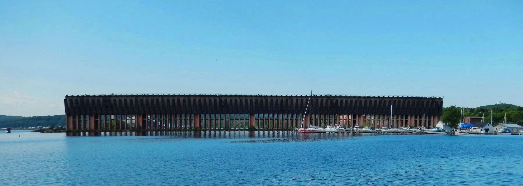
Photographed By Cosmos Mariner, August 1, 2017
5. Lower Harbor Ore Dock, Marquette, Michigan
(from Wikipedia) The Duluth, South Short and Atlantic Railway, in order to remain competitive, completed construction of a new dock in 1932. This dock was constructed of steel and concrete, 85.5 feet high, 969 feet long, with 150 pockets.
Credits. This page was last revised on July 31, 2020. It was originally submitted on July 30, 2020, by Cosmos Mariner of Cape Canaveral, Florida. This page has been viewed 359 times since then and 35 times this year. Photos: 1, 2, 3, 4, 5. submitted on July 31, 2020, by Cosmos Mariner of Cape Canaveral, Florida.
