Oldtown in Baltimore, Maryland — The American Northeast (Mid-Atlantic)
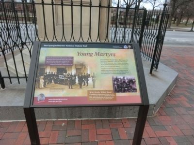
Young Martyrs
Star-Spangled Banner National Historic Trail
— National Park Service, U.S. Department of the Interior —
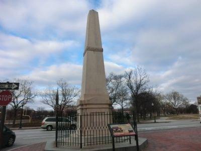
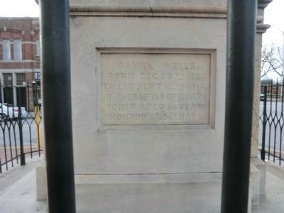
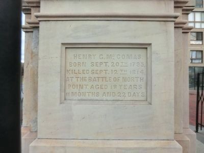
Daniel Wells, 19 and Henry McComas, 18, made history September 12, 1814, when they allegedly killed British commander Major General Robert Ross. The two sharpshooters fired simultaneously. Both were quickly shot dead by British soldiers.
Considered heroes, Wells and McComas were buried together and exhumed twice before finally being laid to rest here with great fanfare in 1858. A funeral song and dramatic play commemorated the reburial.
Who Really Killed Ross?
A monument to Aquila Randall stands near the place where Ross fell prior to the Battle of North Point. Some accounts claim 24-year-old Randall fired the shot that killed the British general.
“And in the glorious list of the patriots, whose blood has consecrated that starry flag, unborn ages of freeman shall read with pride, the names of the Boy Martyrs of Baltimore.”
Closing lines of the Boy Martyrs, Clifton W. Tayleure, 1858.
Erected by National Park Service, U.S. Department of the Interior.
Topics and series. This historical marker is listed in this topic list: War of 1812. In addition, it is included in the Star Spangled Banner National Historic Trail series list. A significant historical date for this entry is September 12, 1814.
Location. 39° 17.868′ N, 76° 36.102′ W. Marker is in Baltimore, Maryland. It is in Oldtown. Marker is at the intersection of Monument Street and Asquith Street on Monument Street. Touch for map. Marker is at or near this postal address: 645 Aisquith St, Baltimore MD 21202, United States of America. Touch for directions.
Other nearby markers. At least 8 other markers are within walking distance of this marker. Dr. Charles W. Simmons (approx. ¼ mile away); Old Dunbar High School (approx. ¼ mile away); First Baptist Church (approx. ¼ mile away); Sweet Prospect Baptist Church (approx. 0.3 miles away); Joe Gans and the Goldfield Hotel (approx. 0.3 miles away); 1781 Friends Meeting House (approx. 0.4 miles away); The General’s Highway (approx. 0.4 miles away); On to Yorktown (approx. 0.4 miles away). Touch for a list and map of all markers in Baltimore.
Credits. This page was last revised on February 20, 2021. It was originally submitted on December 22, 2014, by Don Morfe of Baltimore, Maryland. This page has been viewed 990 times since then and 42 times this year. Last updated on July 31, 2020, by Carl Gordon Moore Jr. of North East, Maryland. Photos: 1, 2, 3, 4. submitted on December 22, 2014, by Don Morfe of Baltimore, Maryland. • Bill Pfingsten was the editor who published this page.


