Crushing Gold Ore
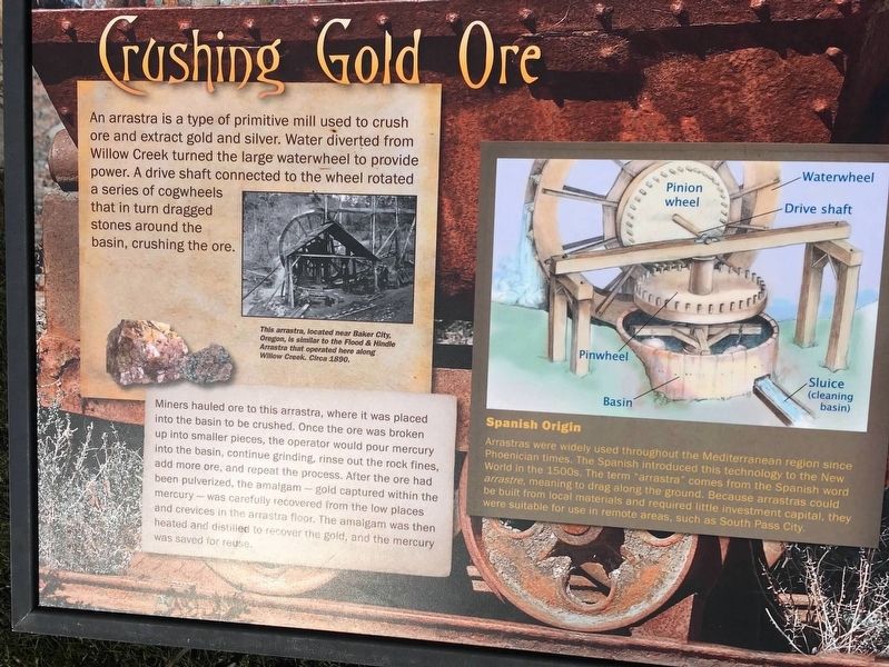
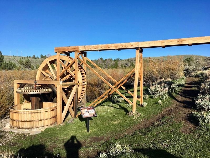
Miners hauled ore to this arrastra, where it was placed into the basin to be crushed. Once the order was broken up into smaller pieces, the operator would pour mercury into the basin, continue grinding, rinse out the rock fines, add more ore, and repeat the process. After the ore had been pulverized, the amalgam-gold captured within the mercury was carefully recovered from the low places and crevices on the a arrastra floor. The amalgam was then heated and distilled to recover the gold, and the mercury was saved for reuse.
Spanish Origin
Arrastras were widely used throughout the Mediterranean region since Phoenician times. The Spanish introduced this technique to the New World in the 1500s. The term “arrastra” comes from the Spanish word arrastre, meaning to drag along the ground. Because arrastras could be built from local materials and required little investment capital, they were suitable for use in remote areas, such as South Pass City.
Picture caption: This arrastra, located
near Baker City, Oregon, is similar to the Flood and Hindle Arrastra that operated here along Willow Creek. Circa 1890.
Topics. This historical marker is listed in this topic list: Industry & Commerce. A significant historical year for this entry is 1890.
Location. 42° 28.195′ N, 108° 48.405′ W. Marker is in South Pass City, Wyoming, in Fremont County. Located on the Flood & Hindle Trail, South Pass State Historic Site. Touch for map. Marker is at or near this postal address: 125 South Pass Main Street, Lander WY 82520, United States of America. Touch for directions.
Other nearby markers. At least 8 other markers are within 5 miles of this marker, measured as the crow flies. First Masonic Lodge in Wyoming (approx. 0.2 miles away); How a Stamp Mill Works (approx. 0.3 miles away); South Pass City (approx. 0.3 miles away); Esther Hobart Morris (approx. half a mile away); South Pass City: Wyoming’s Biggest Gold Boom and Bust (approx. 0.6 miles away); The Carissa Mine: Cycle of Boom and Bust (approx. 0.6 miles away); South Pass and South Pass City (approx. 1.6 miles away); Atlantic City: Surviving the Bust (approx. 4.3 miles away). Touch for a list and map of all markers in South Pass City.
Also see . . . South Pass City State Hist. Site. (Submitted on August 2, 2020, by Connor Olson of Kewaskum, Wisconsin.)
Credits. This page was last revised on August 10, 2020. It was originally submitted on August 2, 2020, by Connor Olson of Kewaskum, Wisconsin. This page has been viewed 400 times since then and 140 times this year. Photos: 1, 2. submitted on August 2, 2020, by Connor Olson of Kewaskum, Wisconsin. • Andrew Ruppenstein was the editor who published this page.

