Stockton in San Joaquin County, California — The American West (Pacific Coastal)
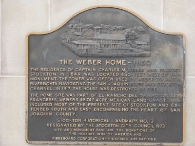
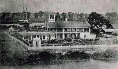
Weber Point Home – 1850
The home site was part of El Rancho del Campo de los Franceses, Weber’s 48,747 acre Mexican land grant. This included most of the present site of Stockton and extended south and east encompassing the heart of San Joaquin County.
Erected 1973 by The site and monument were donated by Holiday Inns of America and Fibreboard Corporation – Pickering Operations. (Marker Number 13.)
Topics. This historical marker is listed in these topic lists: Industry & Commerce • Settlements & Settlers • Waterways & Vessels. A significant historical year for this entry is 1849.
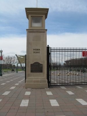
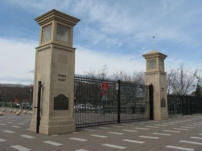
Location. 37° 57.323′ N, 121° 17.534′ W. Marker is in Stockton, California, in San Joaquin County. Marker is at the intersection of Center Street and Miner Street when traveling south on Center Street. Marker is located at the entrance to Weber Point Park. Touch for map. Marker is in this post office area: Stockton CA 95202, United States of America. Touch for directions.
Other nearby markers. At least 8 other markers are within walking distance of this marker. Weber Point (a few steps from this marker); World War II Memorial (about 300 feet away, measured in a direct line); Chinese 1976 Bicentennial Monument (about 400 feet away); The Sister City Story (about 400 feet away); Captain Charles M. Weber Residence (about 500 feet away); The Compass Rose (about 600 feet away); We Shall Never Forget (about 600 feet away); Firefighters Memorial (about 600 feet away). Touch for a list and map of all markers in Stockton.
Regarding Weber Point Home – 1850. This site was designated Stockton Historical Landmark No.13 by the Stockton City Council 1973 and as California Registered Historical Landmark No.165 on January 11, 1935.
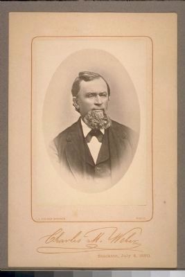
Also see . . . The Family History of Charles Weber. Karl David Weber, left Bavaria at the age of 22, on October 6, 1836. After his arrival in New Orleans, he headed to Texas where he joined Sam Houston’s forces. Returning to New Orleans, he intended to go north to visit relatives in Illinois, but in St. Louis he joined the emigrant group that opened the California Trail, the Bidwell-Bartleson Party. The original group was composed of 69 men and one woman of whom 31 men and the one woman and her baby girl were the first company of American immigrants to enter California over land. They had to abandon their wagons in the Nevada desert and continued on with their cattle. Eventually they were forced to eat their oxen and then their mules. When they arrived in San Joaquin Valley after a six month journey, the group had very few possessions. They finally came to rest at John Marsh’s rancho at the base of Mt. Diablo on November 4, 1841. Shortly after his arrival, Karl called himself Charles. (Submitted on February 9, 2009, by Syd Whittle of Mesa, Arizona.)
Reproduced from the Libr Archives of the Pioneer Museum and Haggin Galleries
5. Residence of Captain Charles M. Weber
Description on postcard:
RESIDENCE OF CAPTAIN CHARLES M. WEBER, FOUNDER OF STOCKTON, 1850. Near El Dorado and Channel Sts. This was the first elaborate residence in the San Joaquin Valley. It burned down about 1917. The site is now occupied by the Holiday Inn.
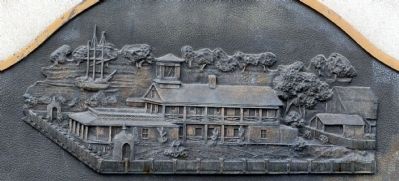
(This is the same image that is engraved on the marker. See photo #4)
(This is the same image that is engraved on the marker. See photo #4)
Credits. This page was last revised on June 28, 2022. It was originally submitted on February 8, 2009. This page has been viewed 2,183 times since then and 54 times this year. Last updated on June 27, 2022. Photos: 1, 2, 3, 4. submitted on February 8, 2009, by Syd Whittle of Mesa, Arizona. 5. submitted on February 9, 2009, by Syd Whittle of Mesa, Arizona. 6. submitted on February 8, 2009, by Syd Whittle of Mesa, Arizona.
