Burlingame in San Mateo County, California — The American West (Pacific Coastal)
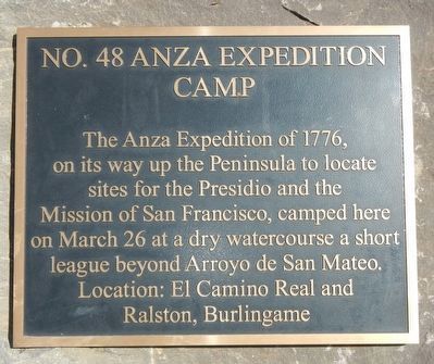
Anza Expedition Camp
Topics and series. This historical marker is listed in these topic lists: Exploration • Hispanic Americans. In addition, it is included in the California Historical Landmarks, the El Camino Real, “The King's Highway” (California), and the Juan Bautista de Anza National Historic Trail series lists. A significant historical date for this entry is March 26, 1776.
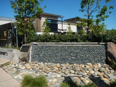
Location. 37° 34.556′ N, 122° 20.866′ W. Marker is in Burlingame, California, in San Mateo County. Marker is at the intersection of El Camino Real (California Route 82) and Howard Street, on the right when traveling north on El Camino Real. Touch for map. Marker is at or near this postal address: 200 El Camino Real, Burlingame CA 94010, United States of America. Touch for directions.
Other nearby markers. At least 8 other markers are within 2 miles of this marker, measured as the crow flies. Burlingame Railroad Station (approx. 0.3 miles away); Burlingame Train Station (approx. 0.3 miles away); The Amelia Voller House (approx. one mile away); Higurashi-en (approx. 1.2 miles away); Mission Hospice (approx. 1.3 miles away); Historic Camp Site (approx. 1.4 miles away); First Business Structure (approx. 1.4 miles away); Pacific City (approx. 1˝ miles away). Touch for a list and map of all markers in Burlingame.
Regarding Anza Expedition Camp. This is California Historical Landmark No. 48.
Credits. This page was last revised on August 8, 2020. It was originally submitted on March 26, 2016. This page has been viewed 525 times since then and 52 times this year. Last updated on August 7, 2020, by Craig Baker of Sylmar, California. Photos: 1, 2. submitted on March 26, 2016, by Barry Swackhamer of Brentwood, California. • J. Makali Bruton was the editor who published this page.

