Blairsden in Plumas County, California — The American West (Pacific Coastal)
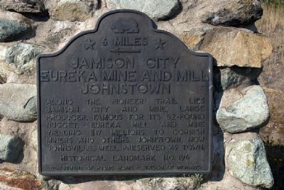
Jamison City, Eureka Mine and Mill, Johnstown
← 6 Miles
Along the Pioneer Trail lies Jamison City and Mine. Large producer, famous for its 52-pound nugget; Eureka Mill and Mine yielding $17 millions to Cornish miners and others. Johnstown, now Johnsville, well preserved '49 town.
Erected 1935 by Department of Public Works — Division of Highways. (Marker Number 196.)
Topics and series. This historical marker is listed in these topic lists: Natural Resources • Settlements & Settlers. In addition, it is included in the California Historical Landmarks series list.
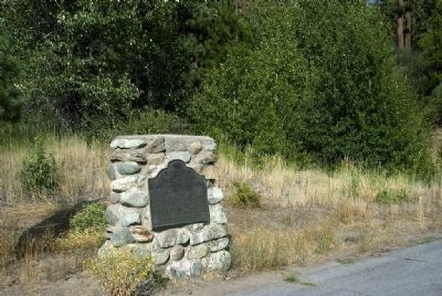
Location. 39° 47.069′ N, 120° 37.185′ W. Marker is in Blairsden, California, in Plumas County. Marker is at the intersection of California Route 70 and California Route 89, on the right when traveling west on State Route 70. Located on the north-east corner. Touch for map. Marker is in this post office area: Blairsden-Graeagle CA 96103, United States of America. Touch for directions.
Other nearby markers. At least 8 other markers are within 6 miles of this marker, measured as the crow flies. A different marker also named Jamison City, Eureka Mine and Mill, Johnstown (approx. 0.8 miles away); Johnsville Firehouse (approx. 4.4 miles away); Longboard Ski Races (approx. 4.4 miles away); Pioneer Ski Area of America (approx. 4.6 miles away); Emigrant Trail (approx. 4.6 miles away); Winter in the Sierra (approx. 4.7 miles away); Thar’s Gold in Them Hills! (approx. 4.7 miles away); Vardanega Spring (approx. 5.8 miles away).
Also see . . .
1. Eureka Tunnel - Plumas Eureka Mine. Show Caves of the World website entry (Submitted on August 24, 2009, by Karen Key of Sacramento, California.)
2. Eureka. California Gold Explorers website entry:
Contains nice photos of the site (Submitted on August 24, 2009, by Karen Key of Sacramento, California.)
Credits. This page was last revised on April 9, 2021. It was originally submitted on August 24, 2009. This page has been viewed 1,362 times since then and 41 times this year. Last updated on August 7, 2020, by Craig Baker of Sylmar, California. Photos: 1, 2. submitted on August 24, 2009, by Karen Key of Sacramento, California. • J. Makali Bruton was the editor who published this page.

