Near Bismarck in Burleigh County, North Dakota — The American Midwest (Upper Plains)
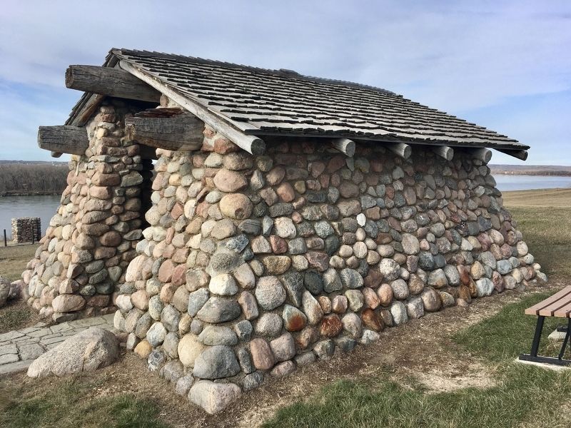
Stone Shelter
— Double Ditch State Historic Site —
Today, Double Ditch State Historic Site is listed in the National Register of Historic Places.
We ask you, as a visitor, to help us preserve this site and to remember to take nothing but photographs. The past belongs to everyone, so please leave all artifacts behind for the information they represent and for future visitors to enjoy.
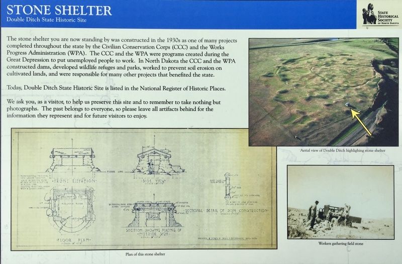
Photo Captions:
Bottom left: Plan of the stone shelter
Top right: Aerial view of Double Ditch highlighting stone shelter
Bottom right: Workers gathering field stone
Erected by State Historical Society of North Dakota.
Topics and series. This historical marker is listed in this topic list: Government & Politics.
Location. 46° 56.186′ N, 100° 54.053′ W. Marker is near Bismarck, North Dakota, in Burleigh County. Marker can be reached from Double Ditch Loop, 0.4 miles north of North Dakota Route 1804, on the right when traveling north. Touch for map. Marker is in this post office area: Bismarck ND 58503, United States of America. Touch for directions.
Other nearby markers. At least 8 other markers are within walking distance of this marker. Double Ditch State Historic Site (here, next to this marker); Homes (about 300 feet away, measured in a direct line); Square Buttes (about 500 feet away); Archaeological Excavations in 1905 (about 600 feet away); Mandans and the Practice of Farming (about 600 feet away); Mandan Origin Stories (about 700 feet away); Final Occupation of Double Ditch (about 700 feet away); Ditch 2 (approx. 0.2 miles away). Touch for a list and map of all markers in Bismarck.
Also see . . .
1. Wikipedia article about the Double Ditch State Historic Site. Double Ditch is named for the two visible trenches that once served as fortifications for the village. (Submitted on July 31, 2020.)
2. Double Ditch State Historic Site. (Submitted on August 2, 2020, by Connor Olson of Kewaskum, Wisconsin.)
Credits. This page was last revised on August 8, 2020. It was originally submitted on July 30, 2020, by Connor Olson of Kewaskum, Wisconsin. This page has been viewed 182 times since then and 5 times this year. Last updated on August 8, 2020, by Connor Olson of Kewaskum, Wisconsin. Photos: 1, 2. submitted on July 30, 2020, by Connor Olson of Kewaskum, Wisconsin. • Mark Hilton was the editor who published this page.
Editor’s want-list for this marker. A wide shot of the marker and its surroundings. • Can you help?

