Cumberland Township near Gettysburg in Adams County, Pennsylvania — The American Northeast (Mid-Atlantic)
Daniel's Brigade
Rodes's Division - Ewell's Corps
— Army of Northern Virginia —
Army of Northern Virginia
Ewell's Corps Rodes's Division
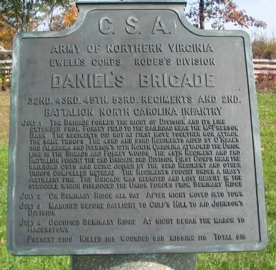
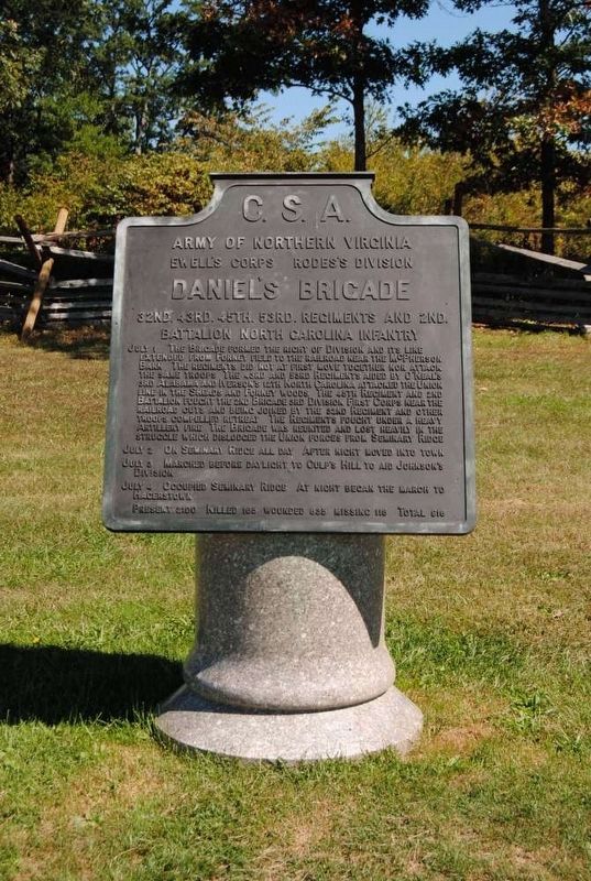
Daniel's Brigade
32nd. 43rd. 45th. 53rd. Regiments and 2nd.
Battalion North Carolina Infantry
July 1 The Brigade formed the right of Division and its line extended from Forney field to the railroad near the McPherson Barn. The regiments did not at first move together nor attack the same troops. The 43rd and 53rd Regiments aided by O'Neal's 3rd Alabama and Iverson's 12th North Carolina attacked the Union line in the Sheads and Forney woods. The 45th Regiment and 2nd Battalion fought the 2nd Brigade 3rd Division First Corps near the railroad cuts and being joined by the 32nd Regiment and other troops compelled retreat. The Regiments fought under a heavy Artillery fire. The Brigade was reunited and lost heavily in the struggle which dislodged the Union forces from Seminary Ridge.
July 2 On Seminary Ridge all day. After night moved into town.
July 3 Marched before daylight to Culp's Hill to aid Johnson's Division.
July 4 Occupied Seminary Ridge. At night began the march to Hagerstown.
Present 2100. Killed 165 wounded 635 missing 116. Total 916.
Erected 1910 by Gettysburg National Military Park Commission.
Topics. This historical marker is listed in this topic list: War, US Civil.
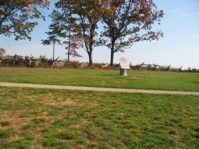
Location. 39° 50.925′ N, 77° 14.613′ W. Marker is near Gettysburg, Pennsylvania, in Adams County. It is in Cumberland Township. Marker is on North Confederate Avenue, on the left when traveling north. Located near the Eternal Peace Light Memorial (auto tour stop 2) in Gettysburg National Military Park. Touch for map. Marker is in this post office area: Gettysburg PA 17325, United States of America. Touch for directions.
Other nearby markers. At least 8 other markers are within walking distance of this marker. Hardaway Alabama Artillery (a few steps from this marker); The King William Artillery (within shouting distance of this marker); Eternal Light Peace Memorial (within shouting distance of this marker); a different marker also named Eternal Light Peace Memorial (within shouting distance of this marker); Rodes's Division (within shouting distance of this marker); Rodes Attacks (within shouting distance of this marker); A Dedication (within shouting distance of this marker); The Orange Artillery (within shouting distance of this marker). Touch for a list and map of all markers in Gettysburg.
Related markers. Click here for a list of markers that are related to this marker. Daniel's Brigade at Gettysburg.
Also see . . . Report of Brig. Gen. Junins Daniel. Gen. Daniel described
his attack on the right of Iverson's Brigade:
Seeing that the enemy was strengthening himself on my right, and was occupying the cut and the hill to the right and left of it in great force, that General Iverson's left had been broken, and that one of the enemy's flags had almost gotten in his rear, I saw the necessity of carrying the hill at all hazards, and ordered Colonel Brabble to advance across the cut, keeping his left on the cut and his line perpendicular to it, and to carry the battery at the barn, and drive in the line of infantry between the barn and the hill. This advance of Colonel Brabble took the enemy in flank. At the same time, I ordered Captain Hammond to proceed to the left, and order all my troops to advance with the center, of which portion I had the immediate command, and also to endeavor to get all the troops on my left to advance with me, as I intended to carry the hill. (Submitted on January 19, 2009, by Craig Swain of Leesburg, Virginia.)

Photographed By Craig Swain, November 1, 2008
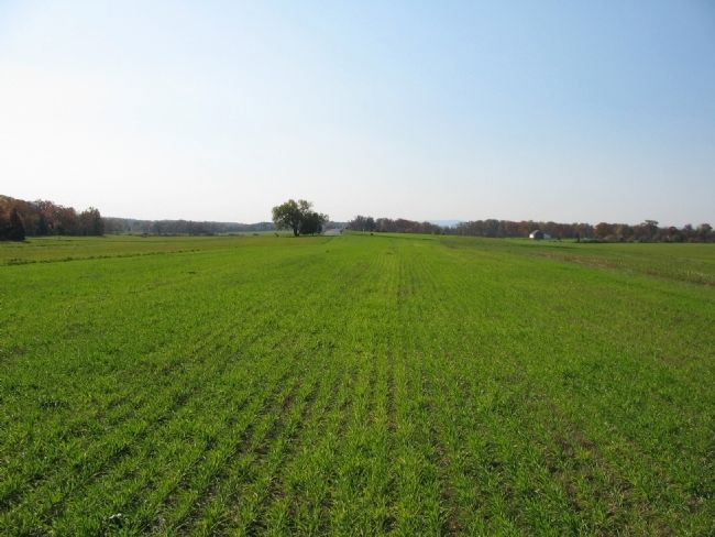
4. Daniel's Brigade Advances
Looking from the middle of Forney's fields to the south. To the left are the woods along Oak Ridge, where Cutler's Brigade defended. To the right out of frame is Buford Avenue. In the far center is the north end of Reynolds Avenue, with the rise of the road the location of the second railroad cut. To the distant right center is McPherson's Barn. Daniel's Brigade swept further south than Iverson's Brigade, but were stopped by Cutler's men in the woods. Part of the Brigade fell back along the high ground on present day Buford Avenue. The other half of the Brigade held the ground around the second railroad cut.
Credits. This page was last revised on February 7, 2023. It was originally submitted on January 19, 2009, by Craig Swain of Leesburg, Virginia. This page has been viewed 1,231 times since then and 19 times this year. Photos: 1, 2. submitted on January 19, 2009, by Craig Swain of Leesburg, Virginia. 3. submitted on July 21, 2016, by Brian Scott of Anderson, South Carolina. 4. submitted on January 19, 2009, by Craig Swain of Leesburg, Virginia.


