Atmore in Escambia County, Alabama — The American South (East South Central)
Williams Station, Alabama 1866-1897
⎯⎯⎯
Atmore, Alabama
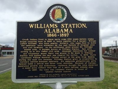
Photographed by Mark Hilton, March 11, 2014
1. Williams Station, Alabama 1866-1897 Marker
1866-1897
In 1897, town
this page online
On May 23, 1907, Atmore became an incorporated municipality. The town celebrated this centennial milestone at Heritage Park in May 2007.
Erected 2010 by the Alabama Tourism Department, Atmore Area Chamber of Commerce and the City of Atmore.
Topics and series. This historical marker is listed in these topic lists: Industry & Commerce • Railroads & Streetcars • Settlements & Settlers. In addition, it
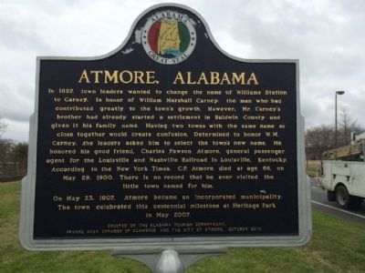
Photographed by Mark Hilton, March 11, 2014
2. Atmore Alabama Marker
Location. 31° 1.446′ N, 87° 29.535′ W. Marker is in Atmore, Alabama, in Escambia County. It is on East Nashville Avenue (U.S. 31) 0.1 miles west of Presley Street, on the right when traveling west. Touch for map. Marker is in this post office area: Atmore AL 36502, United States of America. Touch for directions.

Regionally, this marker is in the American South and specifically in the Deep South. Globally, it is in North America, a Gulf of Mexico state, the Western Hemisphere, the Western World, and the Anglosphere. Historically, it finds itself in what was once New Spain, the territory of the Mississippian Culture, one of the Confederate States of America, and the Antebellum South.
Other nearby markers. At least 6 other markers are within 11 miles of this marker, measured as the crow flies: Railroad Bill (a few steps from this marker); Watson Cabin (approx. 0.4 miles away); Escambia County Training School (approx. 0.9 miles away); Canoe Station (approx. 4.9 miles away); Perdido Vineyards (approx. 9.3 miles away); History of Lottie, Alabama
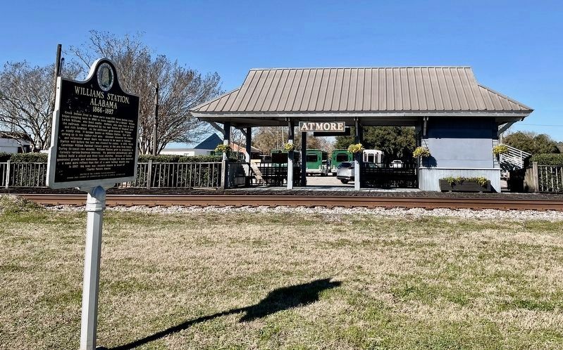
Photographed by Mark Hilton, February 6, 2022
3. Williams Station, Alabama 1866-1897 / Atmore, Alabama Marker
Credits. This page was last revised on February 6, 2022. It was originally submitted on March 12, 2014. This page has been viewed 2,430 times since then and 124 times this year. Last updated on August 11, 2020. Photos: 1, 2. submitted on March 12, 2014, by Mark Hilton of Montgomery, Alabama. 3. submitted on February 6, 2022, by Mark Hilton of Montgomery, Alabama.
