Floyd in Oneida County, New York — The American Northeast (Mid-Atlantic)
Town of Floyd
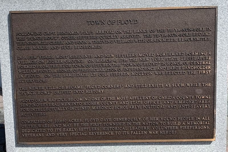
Town of Floyd
Following Capt Benjamin Pike's arrival on the banks of the Te-Ya-Nun-Soke in the "Punch Bowl", other settlers quickly arrived. The Te-Ya-Nun-Soke became the Nine Mile Creek and soon a thriving village with grain mills, blacksmiths, glass maker and such blossomed.
In a few years most residents and new settlers moved northward forming a village on higher ground. On March 4 1796, the New York State Legislature formed from the huge Town of Steuben the "Town of Floyd" in honor of General William Floyd, a signer of the Declaration of Independence and large landholder in Floyd. On the same date, Lt. Col Stephen Moulton was elected the first supervisor.
The newer village became "Floyd Corners" and still exists as such, while the "Punch Bowl” drifted into history.
Floyd grew rapidly becoming one of the most affluent of Oneida County towns sending several men into higher county and state offices and a magnet area for intellectually-inclined Masonic, scholarly, political and anti-slavery activities
Comprised of 20,650 acres, Floyd gave generously of her young people in all of the wars, and may be the first township in the nation to build a memorial dedicated to its early settlers, historical leaders, volunteer firepersons, veterans and very special reverence to its fallen war heroes
Topics. This memorial is listed in this topic list: Settlements & Settlers. A significant historical date for this entry is March 4, 1796.
Location. 43° 13.174′ N, 75° 20.001′ W. Marker is in Floyd, New York, in Oneida County. Memorial is at the intersection of Old Floyd Road and New Floyd Road (New York State Route 365), on the right when traveling south on Old Floyd Road. Touch for map. Marker is in this post office area: Rome NY 13440, United States of America. Touch for directions.
Other nearby markers. At least 8 other markers are within 4 miles of this marker, measured as the crow flies. Lt. Col Stephen Moulton Sr. (here, next to this marker); Moulton Cemetery (approx. ¼ mile away); Floyd (approx. 0.3 miles away); Camroden Church (approx. 2.6 miles away); In the Valley homes was great mourning (approx. 3.4 miles away); Alliances Drawn (approx. 3.4 miles away); A Clash of Cultures (approx. 3.4 miles away); The Rally (approx. 3.4 miles away). Touch for a list and map of all markers in Floyd.
Credits. This page was last revised on August 14, 2020. It was originally submitted on August 11, 2020, by Steve Stoessel of Niskayuna, New York. This page has been viewed 151 times since then and 22 times this year. Photo 1. submitted on August 11, 2020, by Steve Stoessel of Niskayuna, New York. • Michael Herrick was the editor who published this page.
