History of the Tiburon Trestle
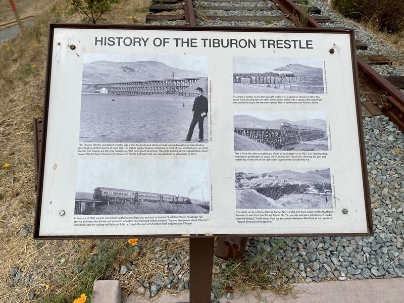
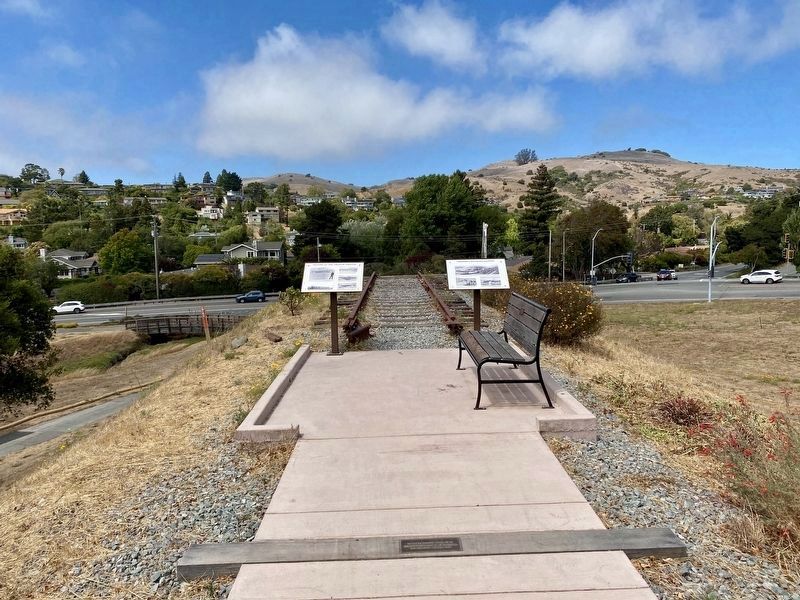
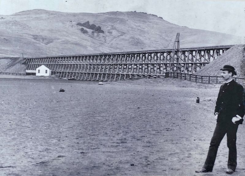
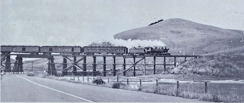
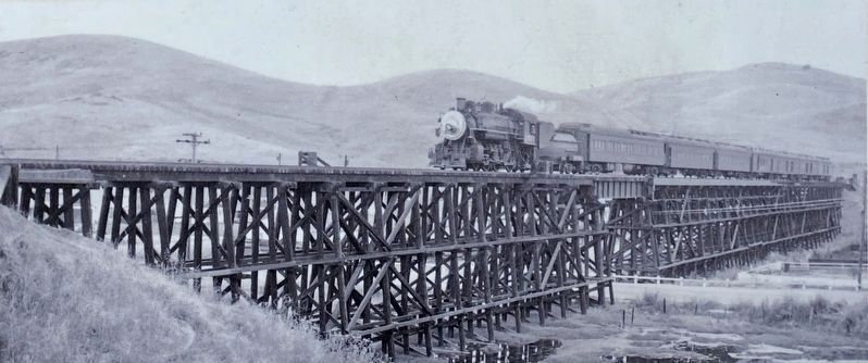
(Upper left photo:) The Tiburon Trestle, completed in 1883, was a 750-foot redwood structure that spanned mostly marshland before attaching to earthen berms at each end. The trestle support beams, which are in front of you, and the berm, on which Trestle Trail travels, are the only remnants of this once grand structure. The white building is the original Reed school house. The 40-feet of historic Northwestern Pacific Railroad track was reassembled by volunteers in 2017.
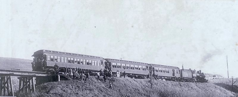
(Lower left photo:) In January of 1941, people scrambled up the berm where you are now to board a "Last Ride” train. Passenger rail service between San Rafael and Sausalito would be discontinued within a month. You can learn more about Tiburon's railroad history by visiting the Railroad & Ferry Depot Museum at Shoreline Park in downtown Tiburon.
(Upper right photo:) This train is similar to one that brought mobster Al Capone to Tiburon in 1934. The entire train carrying him and other convicts was rolled onto a barge at the waterfront and pushed by tug to the recently-opened federal penitentiary on Alcatraz Island.
(Middle right photo:) This is Train #3, after completing a Ukiah to San Rafael run in 1952. It is "deadheading," meaning no passengers or cargo are on board, into Tiburon for cleaning the cars and restocking.
It was one of the last steam locomotives to make this run.
(Lower right photo:) The white circle is the location of Tunnel No. 1, a 568-foot bore made in 1884 that trains
traveled to and from San Rafael. Tunnel No. 1's concrete entrance still stands; it can be
seen by hiking 1/2 mile north from the entrance to Belveron Mini Park at the corner of
Tiburon Blvd and Jefferson Ave.
Topics. This historical marker is listed in these topic lists: Bridges & Viaducts • Railroads & Streetcars. A significant historical month for this entry is January 1941.
Location. 37° 53.831′ N, 122° 29.295′ W. Marker is in Tiburon, California, in Marin County. Marker is on Tiburon Boulevard, on the left when traveling north. Touch for map. Marker is in this post office area: Belvedere Tiburon CA 94920, United States of America. Touch for directions.
Other nearby markers. At least 8 other markers are within walking distance of this marker. Tiburon's Railroad History (here, next to this marker); Welcome to Trestle Trail (about 600 feet away, measured in a direct line); Shapero Bridge (about 600 feet away); Saving and Protecting Our Bay (about 600 feet away); The Trestle and Blackie's Pasture (about 700 feet away); Feed Lot For Oysters (approx. ¼ mile away); Del Mar (approx. 0.4 miles away); Railroad Gives Way to Strollers, Cyclists and Joggers (approx. one mile away). Touch for a list and map of all markers in Tiburon.
More about this marker. The marker is located at the end/top of the south end of the berm that formerly supported the track and trestle, in the park known as "Blackie's Pasture". The marker is visible when driving north on Tiburon Boulevard, just before the boulevard makes a 270 degree turn to the west when driving away from Tiburon. However, when in Blackie's Pasture, the marker itself is not easy to see - one needs to walk to the path at the beginning of the berm (path is not marked), but from there it is about a 3 minute gentle uphill walk to the marker.
Credits. This page was last revised on December 21, 2020. It was originally submitted on August 12, 2020, by Andrew Ruppenstein of Lamorinda, California. This page has been viewed 474 times since then and 59 times this year. Photos: 1, 2, 3, 4, 5, 6. submitted on August 12, 2020, by Andrew Ruppenstein of Lamorinda, California.
