Tiburon in Marin County, California — The American West (Pacific Coastal)
Tiburon's Railroad History
Photographed by Andrew Ruppenstein, August 11, 2020
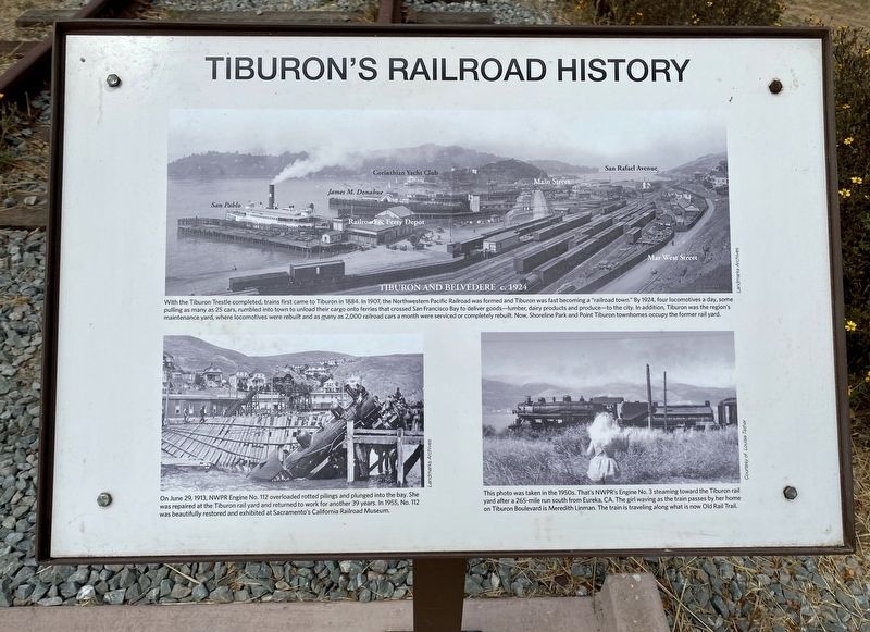
1. Tiburon's Railroad History Marker
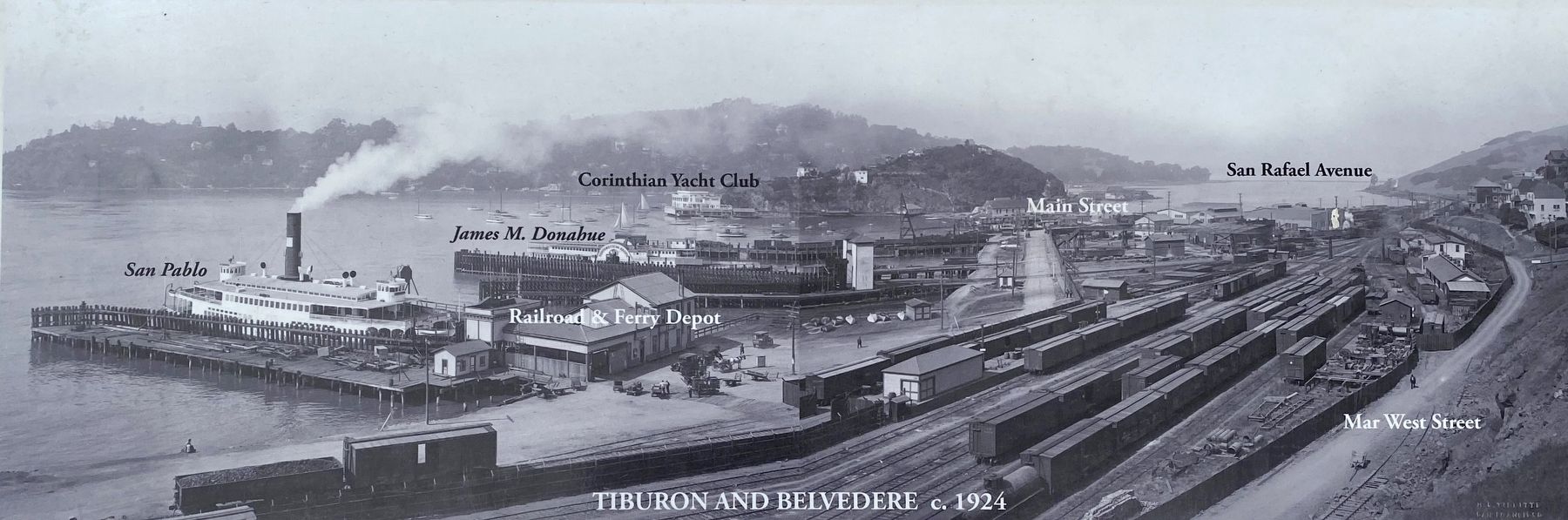
(Upper photo:) With the Tiburon Trestle completed, trains first came to Tiburon in 1884. In 1907, the Northwestern Pacific Railroad was formed and Tiburon was fast becoming a "railroad town.” By 1924, four locomotives a day, some pulling as many as 25 cars, rumbled into town to unload their cargo onto ferries that crossed San Francisco Bay to deliver goods - lumber, dairy products and produce - to the city. In addition, Tiburon was the region's maintenance yard, where locomotives were rebuilt and as many as 2,000 railroad cars a month were serviced or completely rebuilt. Now, Shoreline Park and Point Tiburon townhomes occupy the former rail yard.
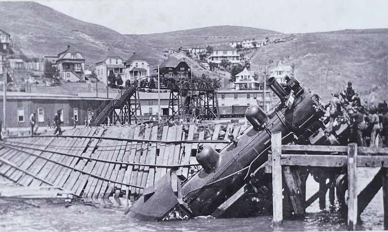
(Lower left photo:) On June 29, 1913, NWPR Engine No. 112 overloaded rotted pilings and plunged into the bay. She was repaired at the Tiburon rail yard and returned to work for another 39 years. In 1955, No. 112 was beautifully restored and exhibited at Sacramento's California Railroad Museum.
(Lower right photo:) This photo was taken in the 1950s. That's NWPR's Engine No. 3 steaming toward the Tiburon rail yard after a 265-mile run south from Eureka, CA. The
this page online
Topics and series. This historical marker is listed in this topic list: Railroads & Streetcars. In addition, it is included in the Northwestern Pacific Railroad series list. A significant historical date for this entry is June 29, 1913.
Location. 37° 53.832′ N, 122° 29.293′ W. Marker is in Tiburon, California, in Marin County. It is on Tiburon Boulevard, on the left when traveling north. Touch for map. Marker is in this post office area: Belvedere Tiburon CA 94920, United States of America. Touch for directions.

Regionally, this marker is in the San Francisco Bay Area, in the North Coast, and specifically on the Coast Ranges. It is also on the American Pacific Coast. Globally, it is in North America, on the Ring of Fire, on the Pacific Rim, in the Western Hemisphere, in the Western World, and in the Anglosphere. Historically, it finds itself in what was once New Spain and also Mexico’s Alta California.
Other nearby markers. At least 8 other markers are within walking distance of this marker:
Photographed by Andrew Ruppenstein, August 11, 2020
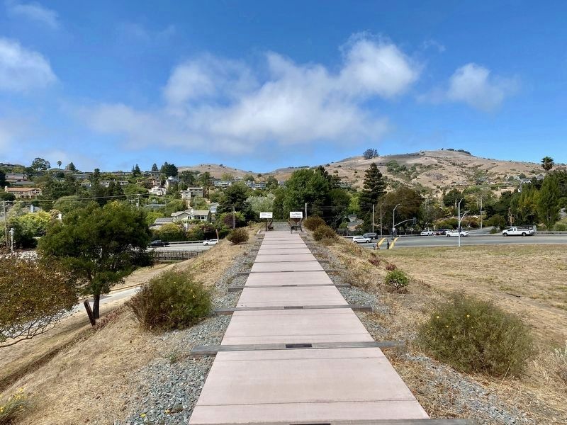
2. Tiburon's Railroad History Marker - wide view
The subject marker is the one on the right.
More about this marker. The marker is located at the end/top of the south end of the berm that formerly supported the track and trestle, in the park known as "Blackie's Pasture". The marker is visible when driving north on Tiburon Boulevard, just before the boulevard makes a 270 degree turn to the west when driving away from Tiburon. However, when in Blackie's Pasture, the marker itself is not easy to see - one needs to walk to the path at the beginning of the berm (path is not marked), but from there it is about a 3 minute gentle uphill walk to the marker.
Courtesy of the Landmarks Archive, circa 1924
3. Marker detail: Upper photo (See marker body text for caption)
Courtesy of the Landmarks Archives, June 29, 1913
4. Marker detail: Lower left photo (See marker body text for caption)
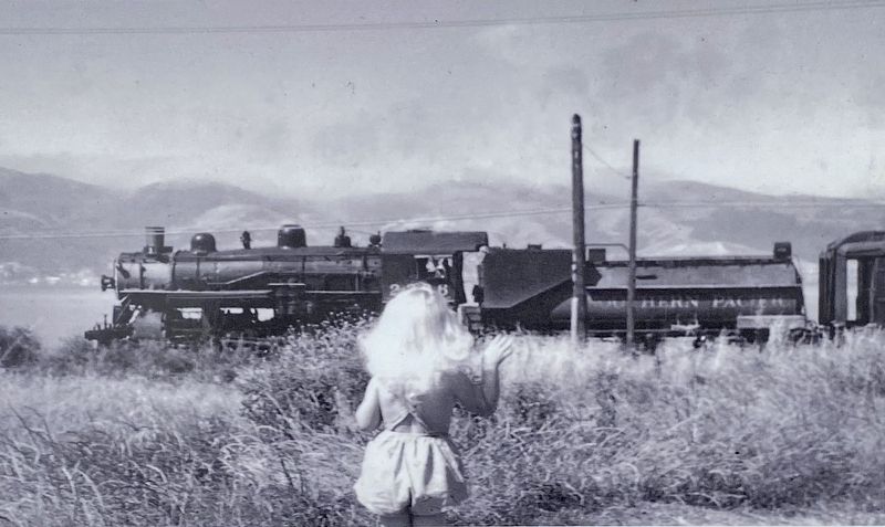
Courtesy of Louise Tether, circa 1950s
5. Marker detail: Lower left photo (See marker body text for caption)
Credits. This page was last revised on August 12, 2020. It was originally submitted on August 12, 2020, by Andrew Ruppenstein of Lamorinda, California. This page has been viewed 2,375 times since then and 191 times this year. Photos: 1, 2, 3, 4, 5. submitted on August 12, 2020, by Andrew Ruppenstein of Lamorinda, California.
