Cross Keys in Rockingham County, Virginia — The American South (Mid-Atlantic)
Mill Creek Church
War Strikes Peaceful Homes and Fields
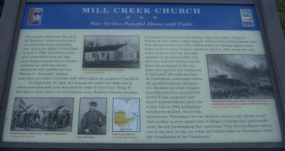
On September 30, 1864, this became the center of a wide area in which barns and mills were destroyed by order of Union Gen. Philip H. Sheridan to deny food to the Confederate army. Brethren Church members had farmed here since the 18th century. They were called “Dunkers” because of their belief in adult baptism. Their articles of faith forbade them from taking another man’s life, holding slaves, or rebelling against established authority. After Virginia seceded on April 17, 1861, young men who could not prove that they had been members of the church before that date were liable for military service. Some who attempted to flee the state were captured and imprisoned in Richmond. The state and then the Confederate government eventually passed temporary exemption acts. Dunkers and other conscientious objectors were excused from service if they confirmed their church membership and paid a fee or fine. Late in 1864, as Southern enlistments declined, the act was discontinued. Throughout the war, Brethren farmers who refused to sell their produce to army agents were in danger of having their goods confiscated, thereby handicapping their operations. They were prodigious cultivators of the land, as they are today, and helped make the Shenandoah Valley the “breadbasket of the Confederacy.”
Erected by Shenandoah Valley Battlefields Foundation and Virginia Civil War Trails.
Topics and series. This historical marker is listed in this topic list: War, US Civil. In addition, it is included in the Virginia Civil War Trails series list. A significant historical month for this entry is April 1926.
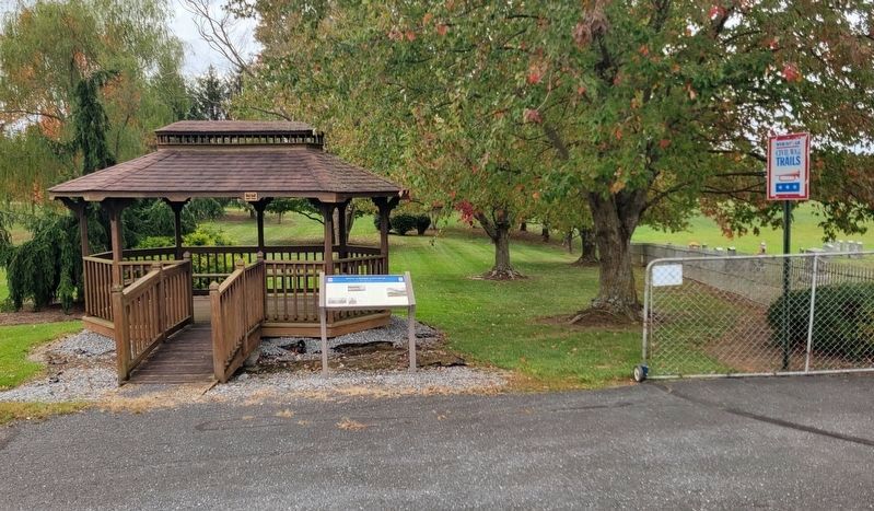
Location. 38° 20.252′ N, 78° 49.193′ W. Marker is in Cross Keys, Virginia, in Rockingham County. Marker is on Port Republic Road (Route 659), on the right when traveling east. Touch for map. Marker is in this post office area: Port Republic VA 24471, United States of America. Touch for directions.
Other nearby markers. At least 8 other markers are within 2 miles of this marker, measured as the crow flies. Mill Creek Church and Cemetery (within shouting distance of this marker); Battle of Cross Keys (approx. 0.9 miles away); Cross Keys Battlefield (approx. 0.9 miles away); To the Talbot Boys (approx. one mile away); a different marker also named Battle of Cross Keys (approx. one mile away); a different marker also named Battle of Cross Keys (approx. one mile away); a different marker also named Battle of Cross Keys (approx. 1.1 miles away); a different marker also named Battle of Cross Keys (approx. 1.1 miles away). Touch for a list and map of all markers in Cross Keys.
More about this marker. In the upper center is a photo of Mill Creek Church, Civil War-era photo – Courtesy Janet Downs. On the lower left is a sketch of Young Dunkers in Sheridan’s camp seeking passes – Courtesy John Heatwole. Next to it is a portrait of Gen. Sheridan and a map of the burned area, also courtesy John Heatwole. On the right is “Shenandoah Valley, Sept. 1864," by Alfred R. Waud, showing the devastation wrought by Sheridan’s army. – Courtesy Library of Congress
Credits. This page was last revised on October 18, 2023. It was originally submitted on February 17, 2009, by Robert H. Moore, II of Winchester, Virginia. This page has been viewed 2,263 times since then and 55 times this year. Last updated on August 13, 2020, by Bradley Owen of Morgantown, West Virginia. Photos: 1. submitted on February 17, 2009, by Robert H. Moore, II of Winchester, Virginia. 2. submitted on October 18, 2023, by Bradley Owen of Morgantown, West Virginia. 3. submitted on April 17, 2021, by Bradley Owen of Morgantown, West Virginia. • Bernard Fisher was the editor who published this page.


