Near McLean in Fairfax County, Virginia — The American South (Mid-Atlantic)
Original Federal Boundary Stone, District of Columbia, Northwest 2
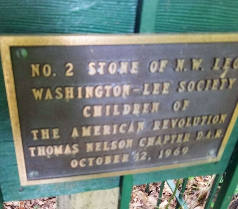
Photographed by Roberto Bernate, September 22, 2018
1. Original Federal Boundary Stone, District of Columbia, Northwest 2 Marker
Washington-Lee Society
Children of
The American Revolution
Thomas Nelson Chapter D.A.R.
October 12, 1969
Erected 1969 by Washington-Lee Society, Children of the American Revolution; Thomas Nelson Chapter of the Daughters of the American Revolution. (Marker Number NW2.)
Topics and series. This historical marker is listed in this topic list: Charity & Public Work. In addition, it is included in the Daughters of the American Revolution (DAR), and the Original Federal Boundary Stones series lists. A significant historical year for this entry is 1791.
Location. 38° 54.833′ N, 77° 8.759′ W. Marker is near McLean, Virginia, in Fairfax County. It can be reached from 38th Street North 0.2 miles west of 37th Road North. Located at the extreme rear of address nearest the property line. Touch for map. Marker is at or near this postal address: 5145 38th Street North, Arlington VA 22207, United States of America. Touch for directions.

Regionally, this marker is in the Washington Metropolitan Area and in Northern Virginia. It is also in the American South, specifically in the Upper South, in the Mid-Atlantic,
this page online
Other nearby markers. At least 8 other markers are within one mile of this marker, measured as the crow flies: John Saegmuller House (approx. 0.6 miles away); Little Falls Road (approx. 0.6 miles away); Chesterbrook (approx. 0.6 miles away); George Nicholas Saegmuller (approx. 0.7 miles away); Original Federal Boundary Stone, District of Columbia, Northwest 1 (approx. one mile away); Original Federal Boundary Stone, District of Columbia, Northwest 3 (approx. one mile away); Walker Chapel (approx. 1.1 miles away); Minor's Hill (approx. 1.1 miles away). Touch for a list and map of all markers in McLean.
Also see . . . Boundary Stones of the District of Columbia. (Submitted on October 11, 2019.)
Credits. This page was last revised on May 16, 2022. It was originally submitted on October 11, 2019, by Roberto Bernate of Arlington, Virginia. This page has been viewed 578 times since then and 40 times this year. Last updated on August 15, 2020, by Roberto Bernate of Arlington, Virginia. Photo 1. submitted on October 11, 2019, by Roberto Bernate of Arlington, Virginia. • Devry Becker Jones was the editor who published this page.
Editor’s want-list for this marker. A clear daylight photo of the marker. • A photo of the marker in context. • A photo of the boundary stone. • Can you help?
