Taylor Run in Alexandria, Virginia — The American South (Mid-Atlantic)
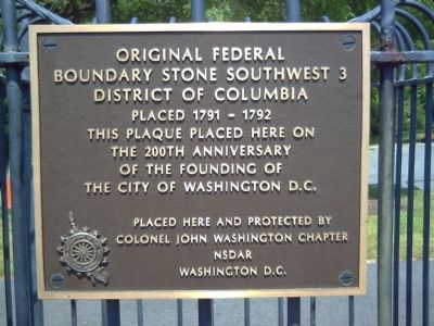
Original Federal Boundary Stone, District of Columbia, Southwest 3
Boundary Stone Southwest 3
District of Columbia
Placed 1791-1792
This plaque placed here on the 200th anniversary of the founding of the City of Washington D.C.
Placed here and protected by Colonel John Washington Chapter
NSDAR
Washington D.C.
Erected by National Society, Daughters of the American Revolution.
Topics and series. This historical marker is listed in this topic list: Political Subdivisions. In addition, it is included in the Daughters of the American Revolution, and the Original Federal Boundary Stones series lists. A significant historical year for this entry is 1791.
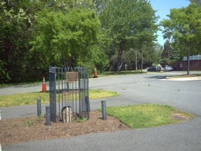
Location. 38° 49.239′ N, 77° 4.76′ W. Marker is in Alexandria, Virginia. It is in Taylor Run. Marker is on King Street (Virginia Route 7) near Scroggins Road, on the right when traveling south. Marker is in the north end of the First Baptist Church parking lot. Touch for map. Marker is at or near this postal address: 2932 King St, Alexandria VA 22302, United States of America. Touch for directions.
Other nearby markers. At least 8 other markers are within walking distance of this marker. Life of a Creek (within shouting distance of this marker); Mills and Molassas (about 300 feet away, measured in a direct line); A Chinquapin House (approx. 0.2 miles away); Listen for Chipmunks (approx. 0.2 miles away); Fun in the Forest (approx. 0.2 miles away); A Native American Village (approx. ¼ mile away); Life of a Forest (approx. 0.3 miles away); Chinquapin Trek (approx. 0.3 miles away). Touch for a list and map of all markers in Alexandria.
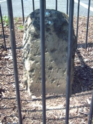
More about this marker. This stone has been removed from its original setting and and reset in concrete.
Also see . . .
1. DC DAR website on Boundary Stones. (Submitted on May 7, 2008, by Kevin W. of Stafford, Virginia.)
2. Boundary Stones of the District of Columbia. (Submitted on May 7, 2008, by Kevin W. of Stafford, Virginia.)
Credits. This page was last revised on January 27, 2023. It was originally submitted on May 7, 2008, by Kevin W. of Stafford, Virginia. This page has been viewed 2,320 times since then and 24 times this year. Last updated on August 17, 2020, by Roberto Bernate of Arlington, Virginia. Photos: 1, 2, 3. submitted on May 7, 2008, by Kevin W. of Stafford, Virginia. • Devry Becker Jones was the editor who published this page.


