Paducah in McCracken County, Kentucky — The American South (East South Central)
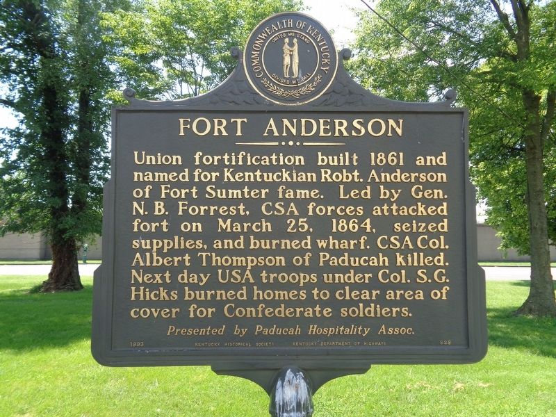
Fort Anderson
Erected 1993 by Kentucky Historical Society & Kentucky Department of Highways, presented by Paducah Hospital Assoc. (Marker Number 828.)
Topics and series. This historical marker is listed in these topic lists: Forts and Castles • War, US Civil. In addition, it is included in the Kentucky Historical Society series list.
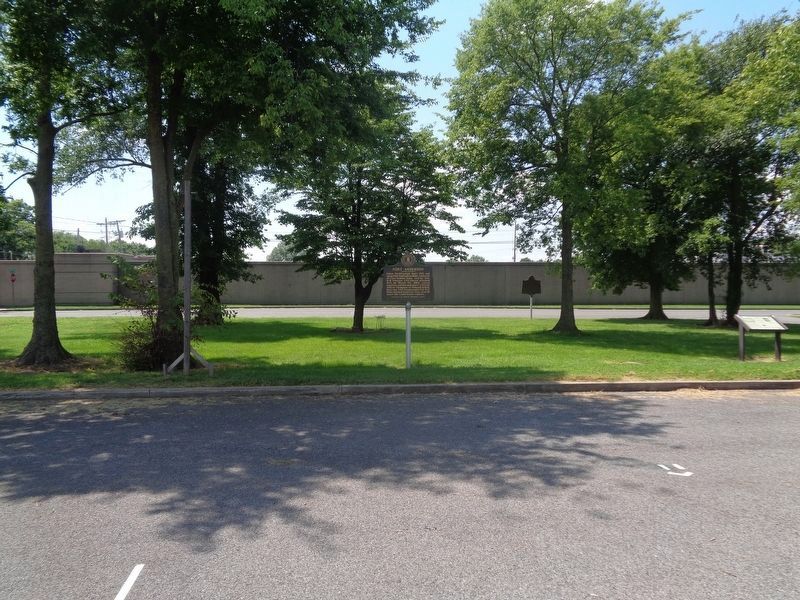
Location. 37° 5.564′ N, 88° 36.183′ W. Marker is in Paducah, Kentucky, in McCracken County. Marker can be reached from Park Avenue east of North 5th Street. Marker is in front of the parking lot of Paducah Convention Center. Touch for map. Marker is at or near this postal address: 431 Park Ave, Paducah KY 42001, United States of America. Touch for directions.
Other nearby markers. At least 8 other markers are within walking distance of this marker. Battle of Paducah-March 1864 (a few steps from this marker); Grant's Proclamation (a few steps from this marker); A Paducah CSA Hero (within shouting distance of this marker); 8th U.S. Colored Heavy Artillery (within shouting distance of this marker); Death of Albert Thompson (within shouting distance of this marker); Quilt Title: …And Our Flag Was Still There!, 2013 (within shouting distance of this marker); Quilt Title: Corona II: Solar Eclipse, 1989 (within shouting distance of this marker); The Flood Wall / The 1937 Flood (about 300 feet away, measured in a direct line). Touch for a list and map of all markers in Paducah.
More about this marker. Unlike some Kentucky Historical Society markers, this one repeats on both sides.
Credits. This page was last revised on August 18, 2020. It was originally submitted on August 18, 2020, by Jason Voigt of Glen Carbon, Illinois. This page has been viewed 458 times since then and 106 times this year. Photos: 1, 2. submitted on August 18, 2020, by Jason Voigt of Glen Carbon, Illinois.

