Marker Logo
THE HISTORICAL
MARKER DATABASE
“Bite-Size Bits of Local, National, and Global History”
Marysville in Lewis and Clark County, Montana — The American West (Mountains)
 

A Booming Little Place
 
 
A Booming Little Place Marker image. Click for full size.
Photographed by Doreen Thomson
1. A Booming Little Place Marker
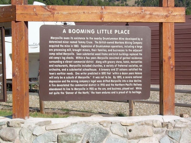
Inscription. Marysville owes its existence to the nearby Drumlummon Mine developed by a determined miner named Tommy Cruse. The British-owned Montana Mining Company acquired the mine in 1883. Expansion of Drumlummon operations, including a large ore processing mill, brought miners, their families, and businesses to the adjacent camp called Marysville. Soon substantial wood-frame and brick buildings replaced the old camp's log shacks. Within a few years Marysville consisted of genteel residences surrounding a vibrant commercial district. Along with grocery stores, hotels, mercantiles and restaurants, Marysville included churches, a variety of fraternal societies, an orchestra, and a substantial schoolhouse. A brewery and 27 saloons satisfied the town's earthier needs. One writer predicted in 1892 that "within a dozen years Helena will only be a suburb of Marysville.” It was not to be. By 1895, a severe national depression and the mining company's legal woes drifted Marysville into a slow decline. A fire devastated the commercial district in 1910 and the Northern Pacific Railway abandoned its line to Marysville in 1925 as the
Paid Advertisement
Click or scan to see
this page online
ore, and business, played out. While not quite the "Denver of the North,” the town endures and is proud of its heritage.
 
Topics. This historical marker is listed in these topic lists: Industry & CommerceSettlements & Settlers. A significant historical year for this entry is 1870.
 
Location. 46° 44.903′ N, 112° 17.984′ W. Marker is in Marysville, Montana, in Lewis and Clark County. It is at the intersection of 1st Street and Grand Street, on the right when traveling west on 1st Street. The marker is on 1st Street which is the short street before Marysville Road becomes Belmont Drive. Touch for map. Marker is in this post office area: Marysville MT 59640, United States of America. Touch for directions.

Regionally, this marker is in Central Montana, in Gold West Country and in Greater Helena. It is also in the American Mountain West and in the Lewis & Clark Corridor. Globally, it is in North America, the Rocky Mountains, the Western Hemisphere, the Western World, and the Anglosphere. Historically, it finds itself in what was once Rupert’s Land and also the Louisiana Purchase.

Other nearby markers. At least 8 other
<i>Marysville, MT.</i> image. Click for full size.
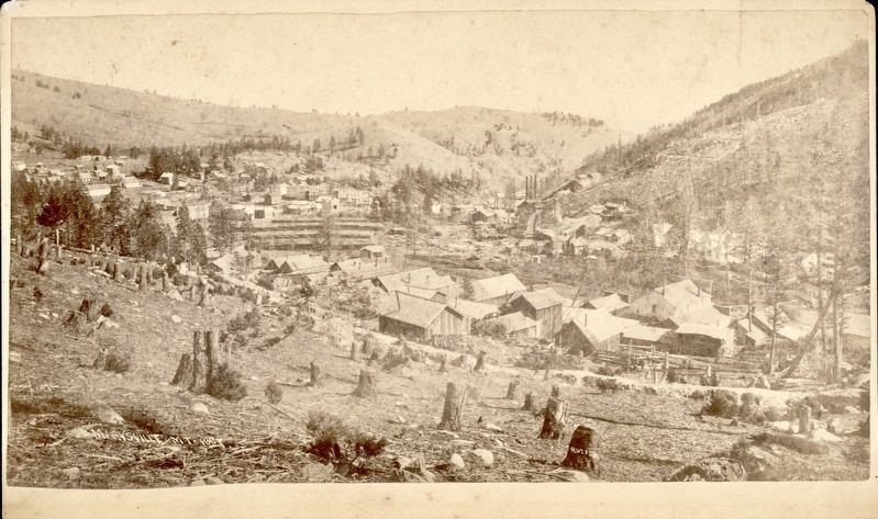
Thomas H. Rutter (photo courtesy of the Denver Public Library), 1887
2. Marysville, MT.
"Frame commercial buildings and frame or log houses in Marysville (Lewis and Clark County), Montana. Shows mine buildings with smokestacks and tree stumps on hillsides."
markers are within 12 miles of this marker, measured as the crow flies: Marysville, Montana (here, next to this marker); Marysville General Store (within shouting distance of this marker); The Marysville House (within shouting distance of this marker); Marysville School House (about 500 feet away, measured in a direct line); Marysville Shaffer House (about 500 feet away); Methodist Episcopal Church of Marysville (about 700 feet away); Silver City Cemetery (approx. 5.7 miles away); Over a Billion Years of Montana's Geological History (approx. 11.9 miles away). Touch for a list and map of all markers in Marysville.
 
More about this marker. Marker is well kept and fully visible from the road.
 
 
Credits. This page was last revised on August 21, 2020. It was originally submitted on August 9, 2020, by Doreen Thomson of Calgary, Alberta Canada. This page has been viewed 507 times since then and 39 times this year. Last updated on August 19, 2020, by Doreen Thomson of Calgary, Alberta Canada. Photos:   1. submitted on August 9, 2020, by Doreen Thomson of Calgary, Alberta Canada.   2. submitted on August 9, 2020. • Andrew Ruppenstein was the editor who published this page.
 
Editor’s want-list for this marker. A wide shot of the marker and its surroundings. • Can you help?

m=155021

CeraNet Cloud Computing sponsors the Historical Marker Database.
This website earns income from purchases you make after using our links to Amazon.com. We appreciate your support.
Paid Advertisement
Aug. 9, 2026