Beverly in Randolph County, West Virginia — The American South (Appalachia)
Occupied Beverly
Caught in the Midst of Conflict
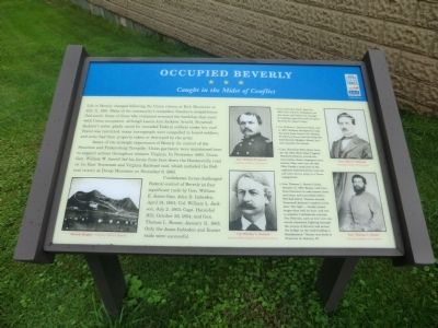
Photographed by Don Morfe, July 31, 2012
1. Occupied Beverly Marker
Aware of the strategic importance of Beverly for control of the Staunton and Parkersburg Turnpike, Union garrisons were maintained here to support actions throughout western Virginia. In November 1863, Union Gen. William W. Averell led his forces from here down the Huntersville road on his East Tennessee and Virginia Railroad raid, which included the Federal victory at Droop Mountain on November 6, 1863.
Confederate forces challenged Federal control of Beverly in four significant raids by Gen. William E. Jones—Gen. John D. Imboden, April 24, 1863; Col. William L. Jackson, July 2, 1863; Capt. Hannibal Hill, October 29, 1864 and Gen. Thomas
this page online
• Jones-Imboden Raid, April 24, 1863: Gen John D. Imboden's cavalry drove out Union Col. George R. Latham's garrison and occupied Beverly for about 5 days.
• Col. William L. Jackson's Raid, July 2, 1863: Jackson attempted to take the town from Union Col. Thomas M. Harris's forces, but the Federals held Beverly Heights (Mount Iser) and repelled the attack.
• Capt. Hannibal Hill's Raid, October 29, 1864: Hill's 62nd Virginia Mounted Infantry struck the town before dawn, hoping to seize horses. They rode into the 8th Ohio Cavalry camp just as the regiment had formed for roll call and were driven away in a fierce engagement.
• Gen. Thomas L. Rosser's Raid, January 11, 1865: Rosser rode here from Staunton to take horses, food, and arms, and succeeded where Hill had failed. Thomas Arnold, Stonewall Jackson's nephew, wrote that "the fight...hardly lasted longer than half an hour, and was a complete Confederate success. The Federals, such as were not captured, retreated, fighting through the streets of Beverly and across the bridge on the road leading to Buckhannon." Rosser was back in Staunton by January 18.
Erected by West Virginia Civil War Trails.
Topics and series. This historical marker is listed in this topic list: War, US Civil. In addition, it is included in the West Virginia Civil War Trails series list. A significant historical date for this entry is July 11, 1861.
Location. This marker has been replaced by another marker nearby. It was located near 38° 50.46′ N, 79° 52.524′ W. Marker was in Beverly, West Virginia, in Randolph County. It was at the intersection of Main Street (U.S. 219) and Railroad Street on Main Street. Touch for map. Marker was in this post office area: Beverly WV 26253, United States of America. Touch for directions.

Regionally, this marker was in West Virginia’s Potomac Highlands. It was also in the American South, specifically in the Upper South, in Appalachia, and specifically in Southern Appalachia. Globally, it was in North America, the Western Hemisphere, the Western World, and the Anglosphere. Historically, it found itself in what was once the territory of the Mississippian Culture.
Other nearby markers. At least 8 other markers are within walking distance of this location: The First Campaign (here, next to this marker); Beverly (here, next to this marker); a different marker also named Occupied Beverly (here, next to this marker); a different marker also named Beverly (here, next to this marker); Blackman-Bosworth Store (a few steps from this marker); 1813 Randolph County Jail (a few steps from this marker); a different marker also named Beverly (a few steps from this marker); Robert Foyles & Family (within shouting distance of this marker). Touch for a list and map of all markers in Beverly.
Related marker. Click here for another marker that is related to this marker. This marker has been replaced with the linked marker.
Credits. This page was last revised on February 5, 2025. It was originally submitted on August 23, 2012. This page has been viewed 1,135 times since then and 31 times this year. Last updated on August 21, 2020, by Carl Gordon Moore Jr. of North East, Maryland. Photo 1. submitted on August 23, 2012, by Don Morfe of Baltimore, Maryland. • J. Makali Bruton was the editor who published this page.
