Greenup in Cumberland County, Illinois — The American Midwest (Great Lakes)
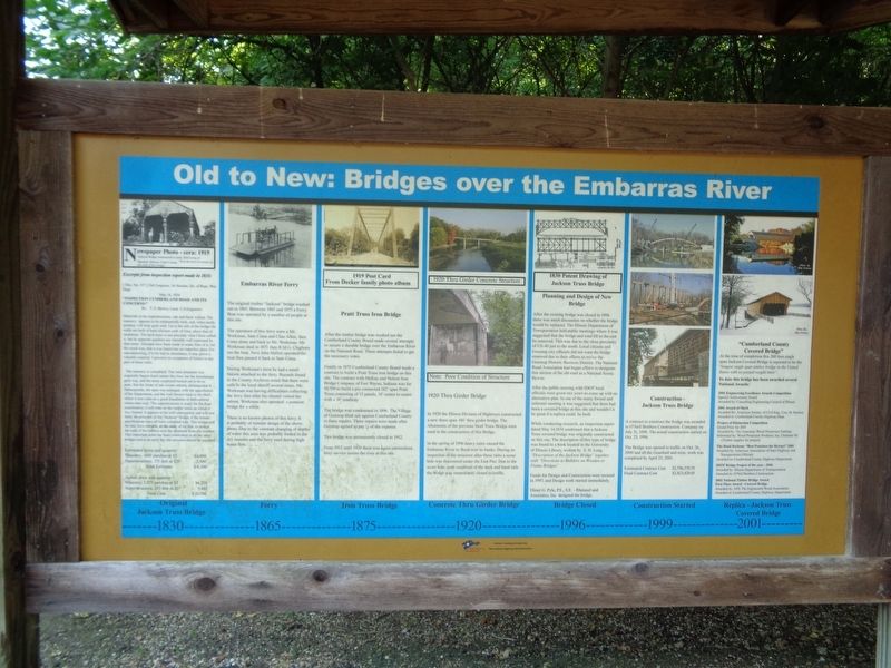
Old to New: Bridges over the Embarras River
[column 1:]
1830 - Original Jackson Truss Bridge
Excerpts from inspection report made in 1833:
[Doc. No. 117] 23d Congress, 1st Session, HO. Of Reps. War Dept.
"Inspection Cumberland Road and its concerns:"
By: T.S. Brown, Lieut. U.S. Engineers
Materials in the superstructure, oak and black walnut. The masonry appears to be substantially built, and, when neatly pointed, will look quite well. Up to the sills of the bridge the walls are built of hard silicious carb of lime, above that of sandstone. The hard stone is not precisely what I have called it, but its apparent qualities are tolerably well expressed by that name. Attempts have been made to make lime of it, but the result was, that it was fused into an imperfect glass. For macadamizing, if to be had in abundance, it may prove a valuable material. I perceive no symptoms of failure in any part of these walls.
The masonry is completed. The west abutment was originally begun much nearer the river, but the foundations gave way, and the stone employed turned out to be so poor, that the frosts of one winter entirely disintegrated it. Subsequently, the span was enlarged, with the approbation of the Department, and the wall thrown back to the bluff, where it now rests on a good foundation of dark-colored rotten slate rock. The superstructure is ready for the final examination; it still rests on the timber bents on which it was framed. It appears to be well constructed, and will test fairly the principle of the "Jackson" bridge, if the minute specifications have all been complied with. This bridge and the last, have overjets, at the ends, of six feet, to protect the ends of the timbers next the abutment from the weather. This important point has been overlooked in all the other bridges and at an early day the omission should be supplied.
Estimated price and quantity
Masonry, 1600 perches at $3 $4,800
Superstructure, 175 feet at $20 3,500
Total Estimate $8,300
Actual price and quantity
Masonry, 2,073 perches at $3 $6,219
Superstructure, 203 feet at $27 5,481
Total Cost $11,700
[column 2:]
1865 - Ferry
Embarras River Ferry
The original timber "Jackson" bridge washed out in 1865. Between 1865 and 1875 a Ferry Boat was operated by a number of people at this site.
The operators of this ferry were a Mr. Workman, Sam Cisna and Chas Allen, then Cisna alone and back to Mr. Workman. Mr. Workman died in 1871 then R.M.G. Cleghorn ran the boat. Next John Hallett operated the boat then passed it back to Sam Cisna.
During
Workman's term he had a small Saloon attached to the ferry. Records found in the County Archives noted that there were calls to the local sheriff several times. Mr. Workman was having difficulties collecting the ferry fees after his clientel visited the saloon. Workman also operated a pontoon bridge for a while.
There is no known photos of this ferry. It is probably of simular design of the above photo. Due to the constant changing of depths of water this area was probably forded in the dry seasons and the ferry used during high water flow.
[column 3:]
1875 - Iron Truss Bridge
Pratt Truss Iron Bridge
After the timber bridge was washed out the Cumberland County Board made several attempts to secure a durable bridge over the Embarras River on the National Road. These attempts failed to get the necessary votes.
Finally in 1875 Cumberland County Board made a contract to build a Pratt Truss iron bridge on this site. The contract with McKay and Nelson Iron Bridge Company of Fort Wayne, Indiana was for $9,700 to build a pin connected 182' span Pratt Truss consisting of 13 panels, 14' center to center with a 16' roadway.
The bridge was condemned in 1896. The Village of Greenup filed suit against Cumberland County to force repairs. These repairs were made after Greenup agreed to pay 1/2 of the expense.
This bridge was permanently closed in 1912.
From 1912 until 1920 there was again intermittent ferry service across the river at this site.
[column 4:]
1920 - Concrete Thru Girder Bridge
In 1920 the Illinois Division of Highways constructed a new three span 186' thru girder bridge. The Abutments of the previous Steel Truss Bridge were used in the construction of this Bridge.
In the spring of 1996 heavy rains caused the Embarras River to flood over its banks. During an inspection of the structure after these rains a scour hole was discovered under the East Pier. Due to the scour hole, poor condition of the deck and hand rails of the bridge was immediately closed to traffic.
[column 5:]
1996 - Bridge Closed
Planning and Design of New Bridge
After the existing bridge was closed in 1996 there was much discussion on whether the bridge would be replaced. The Illinois Department of Transportation held public meetings where it was suggested that the bridge and road fill to the east be removed. This was due to the close proximity of US-40 just to the south. Local citizens and Greenup city officials did not want the bridge removed due to their efforts to revive the Greenup Historic Business District. The National Road Association had begun efforts to designate this section of the old road as a National Scenic Byway.
After the public meeting with IDOT local officials were given two years to come up with an alternative plan. In one of the many formal and informal meeting it was suggested that there had been a covered bridge at this site and wouldn't it be great if a replica could be built.
While conducting research, an inspection report dated May 14, 1834 confirmed that a Jackson Truss covered bridge was originally constructed on this site. The description of this type of bridge was found in a book located in the University of Illinois Library, written by S.H. Long "Description of the Jackson Bridge" together with "Directions to Builders on Wooden or Frame Bridges"
Funds for Design and construction were secured in 1997, and Design work started immediately.
Elmer G. Pyle, P.E., S.E. - Rhutasel and Associates, Inc designed the bridge.
[column 6:]
1999 - Construction Started
Construction - Jackson Truss Bridge
A contract to construct the bridge was awarded to O'Neil Brothers Construction Company on July 31, 1998. The actual construction started on Oct. 23, 1998.
The Bridge was opened to traffic on Oct. 26, 2000 and all the Guardrail and misc. work was completed by April 25, 2001.
Estimated Contract Cost $2,796,570.70
Final Contract Cost $2,823,429.45
[column 7:]
2001 - Replica - Jackson Truss Covered Bridge
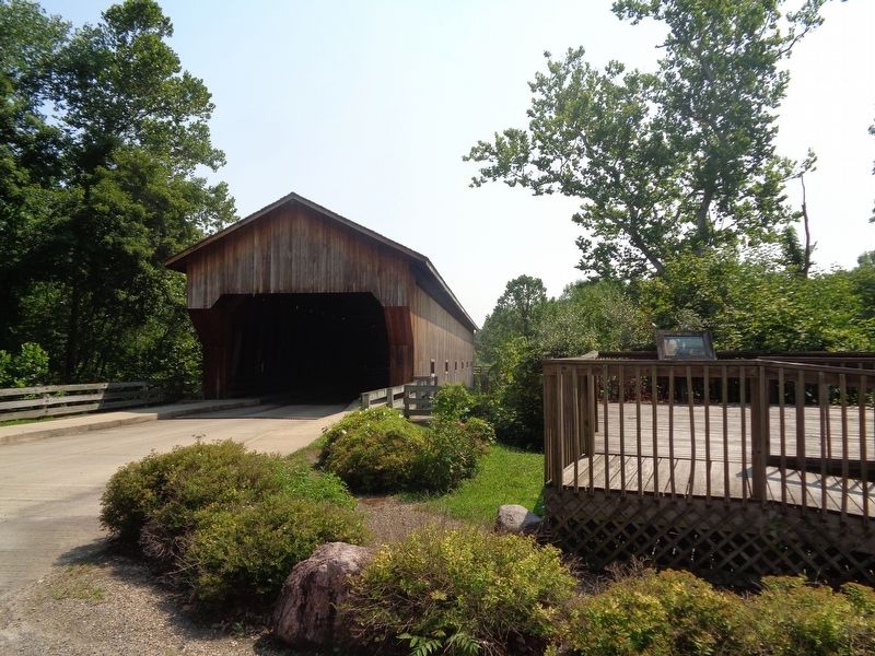
"Cumberland County Covered Bridge"
At the time of completion this 200 foot single span Jackson Covered Bridge is reported to be the "longest single span timber bridge in the United States with no posted weight limit".
To date this bridge has been awarded several National Awards:
2001 Engineering Excellence Awards Competition
Special Achievement Award
Awarded by: Consulting Engineering Council of Illinois
2001 Award of Merit
Awarded by: American Society of Civil Eng., Cen. Ill. Section
Awarded to: Cumberland County Highway Dept.
Project of Distinction Competition
Grand Prize for 2001
Awarded by: The American Wood Preservers Institute
Submitted by: Wood Protection Products, Inc. Charlotte NC
(Timber supplier for project)
The Road Beckons: "Best Practices for Byways" 2001
Awarded by: American Association of State Highway and Transportation Officials
Awarded to: Cumberland County Highway Department
IDOT Bridge Project of the year - 2001
Awarded by: Illinois Department of Transportation
Awarded to: O'Neil Brothers Construction
2002 National Timber Bridge Award
First Place Award - Covered Bridge
Awarded by: APA The Engineered Wood Association
Awarded to: Cumberland County Highway Department
Erected by America's Byways.
Topics and series. This historical marker is listed in these topic lists: Bridges & Viaducts • Waterways & Vessels. In addition, it is included in the Covered Bridges, and the The Historic National Road series lists. A significant historical date for this entry is May 14, 1834.
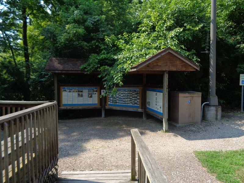
Location. 39° 14.307′ N, 88° 11.272′ W. Marker is in Greenup, Illinois, in Cumberland County. Marker is on Cumberland Road north of U.S. 40, on the right when traveling east. Marker is near a platform, near the west end of the Cumberland County Covered Bridge. Touch for map. Marker is at or near this postal address: 1417 Cumberland Rd, Greenup IL 62428, United States of America. Touch for directions.
Other nearby markers. At least 8 other markers are within 2 miles of this marker, measured as the crow flies. "The Road that Built the Nation" (here, next to this marker); Construction of the Cumberland County Covered Bridge (here, next to this marker); Cumberland County Covered Bridge (a few steps from this marker); Greenup (approx. 1.3 miles away); Site of Barbour Inn (approx. 1.3 miles away); First Hotel (approx. 1.3 miles away); Greenup Township Carnegie Library (approx. 1.3 miles away); Abraham Lincoln Well (approx. 1.3 miles away). Touch for a list and map of all markers in Greenup.
Credits. This page was last revised on September 4, 2020. It was originally submitted on August 29, 2020, by Jason Voigt of Glen Carbon, Illinois. This page has been viewed 253 times since then and 22 times this year. Photos: 1, 2, 3. submitted on September 3, 2020, by Jason Voigt of Glen Carbon, Illinois.


