Weston in Lewis County, West Virginia — The American South (Appalachia)
Weston in the Civil War
Target of Raids
— Jones-Imboden Raid —
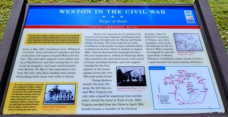
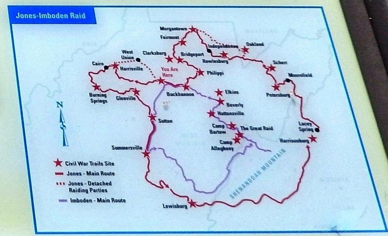
Early in May 1863, Confederate Gens. William E. "Grumble" Jones and John D. Imboden and their cavalrymen and wagons occupied Weston for two days. They had taken separate routes before uniting at Buckhannon and then coming here to rest, round up stragglers, and await reinforcements from Beverly. On May 6, they separated to continue the raid, with Jones heading west toward Parkersburg while Imboden rode south to Sutton.
Weston was important for its location at the junction of two major highways, the Staunton and Parkersburg Turnpike and the Weston and Gauley Bridge Turnpike. The town endured two other Confederate raids besides the Jones-Imboden Raid, including one by Gen. Albert G. Jenkins in August 1862, when he destroyed the telegraph line here. His men looted stores, robbed the Exchange Bank (then located in the white brick house at the corner of Center and Bank Streets), and took supplies intended for the first patients at the insane asylum across the river 300 yards south of here.
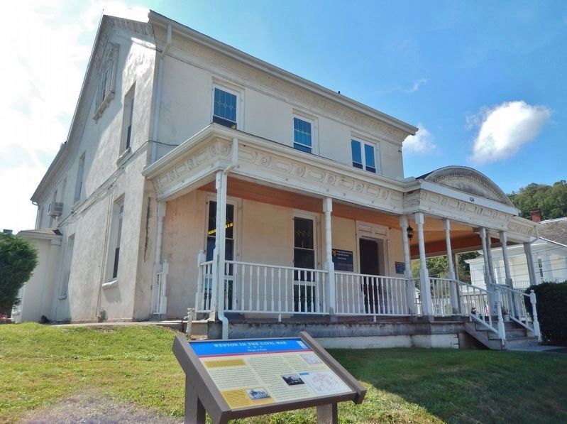
George Jackson Arnold, the man who wrote the bill that created West Virginia (the only state created by separating from another state), owned the house in front of you. After Virginia seceded from the Union in April 1861, Arnold became a member of the General Assembly under the Restored Government of Virginia and, when requested, drew up the bill although he did not favor it. When it passed, he resigned his seat and came home to Weston. Whenever Confederate raiders struck, he hid in a space beneath the house, fearing retribution.
(photo captions)
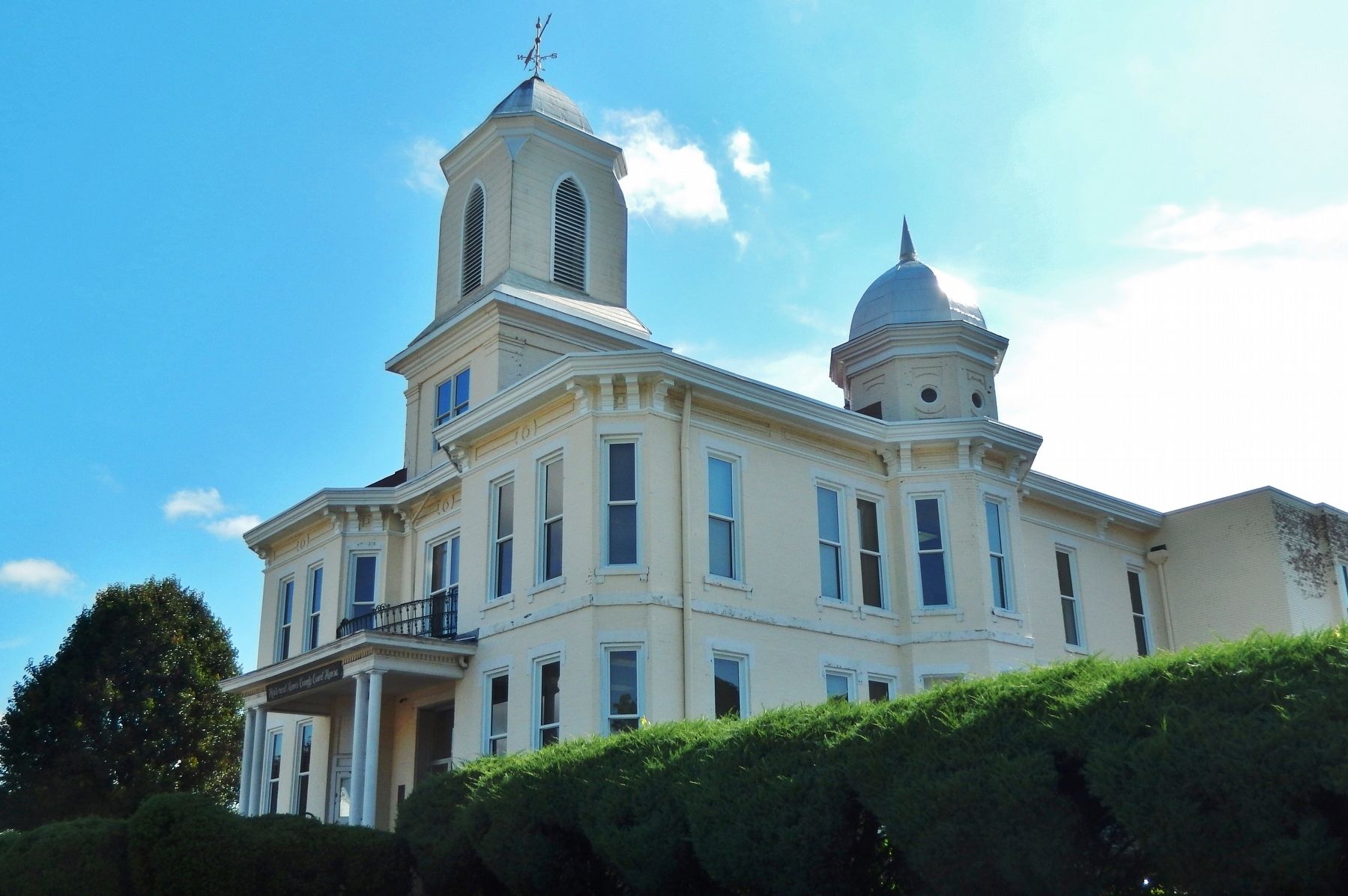
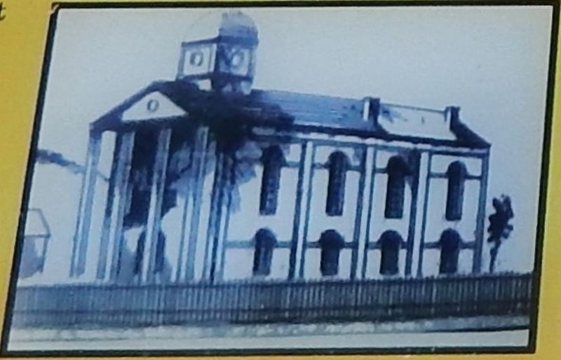
• Louis County Courthouse — Courtesy Otis L. Reed
• Arnold-Edwards House — Courtesy West Virginia University Archives
• Weston in the Civil War — Courtesy Otis L. Reed
Erected by West Virginia Civil War Trails.
Topics and series. This historical marker is listed in these topic lists: Railroads & Streetcars • War, US Civil. In addition, it is included in the West Virginia Civil War Trails series list. A significant historical date for this entry is April 20, 1863.
Location.
Courtesy Otis L. Reed
2. Marker detail: Former Lewis County Courthouse
The county courthouse to your left was completed in 1886 to replace the antebellum courthouse, which had burned. The earlier building had splendid columns across the front and a decorative cupola above. During the war, it was sometimes used as a Union hospital, and future president Rutherford B. Hayes, a Union officer, wrote of visiting the sick there.
Other nearby markers. At least 8 other markers are within walking distance of this marker. Brannon-Whelan House (within shouting distance of this marker); Lewis County War Memorial (within shouting distance of this marker); Henry Flesher (within shouting distance of this marker); Weston (within shouting distance of this marker); The Exchange Bank of Virginia and the Lewis Maxwell House (within shouting distance of this marker); Weston's First Bank/Bennett House (about 300 feet away, measured in a direct line); Shirtman (about 500 feet away); Tierney-Farnsworth Building (about 500 feet away). Touch for a list and map of all markers in Weston.
Also see . . . Jones–Imboden Raid (Wikipedia). The raid was aimed at disrupting traffic on the vital Baltimore and Ohio Railroad and reasserting Confederate authority western Virginia in an effort to derail the growing statehood movement in the region. Raiders claimed success from a military vantage, and also captured valuable supplies and gained recruits. From a political standpoint, however, the raid failed, for it had little effect on pro-statehood sentiment, and West Virginia was admitted as the 35th state of the Union in June. (Submitted on September 2, 2020, by Cosmos Mariner of Cape Canaveral, Florida.)
Credits. This page was last revised on September 2, 2020. It was originally submitted on August 31, 2020, by Cosmos Mariner of Cape Canaveral, Florida. This page has been viewed 360 times since then and 59 times this year. Photos: 1. submitted on September 1, 2020, by Cosmos Mariner of Cape Canaveral, Florida. 2, 3, 4, 5. submitted on September 2, 2020, by Cosmos Mariner of Cape Canaveral, Florida.
