Near Shevlin in Clearwater County, Minnesota — The American Midwest (Upper Plains)
Old Northwest Territory
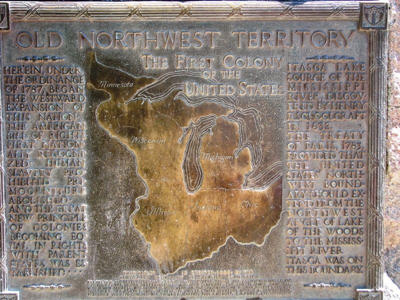
The First Colony of the United States
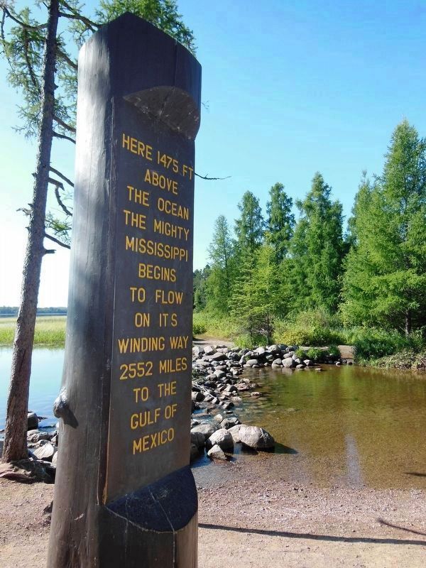
Itasca Lake source of the Mississippi River, discovered by Henry R. Schoolcraft in 1832. The Treaty of Paris, 1783, provided that the United States’ northwest boundary should extend from the northwest angle of Lake of the Woods to the Mississippi River. Itasca was on this boundary.
This tablet erected, 1938, by the Northwest Territory Celebration Commission
Franklin D. Roosevelt, President of the United States; George White, Chairman; Mrs. Leland E. Duxbury, Mrs. George Baxter Averill, Mrs. John S. Heaume, Mrs. Samuel James Campbell, Mrs. Bonnie Farwell, Mrs. George D. Schermerhorn, Vice Chairmen; Congressman Robert T. Sechest, Treasurer; Rev. Joseph E. Nanz, Secretary; United States Senators Arthur H. Vandenbergh, Frederick Van Nuys; Congressman Thomas A. Jenkins; Paul V. McNutt, E.M. Hawes, Exec. Director
Erected 1938 by Northwest Territory Celebration Commission.
Topics. This historical marker is listed in these topic lists: Exploration • Settlements & Settlers • Waterways & Vessels. A significant historical year for this entry is 1787.
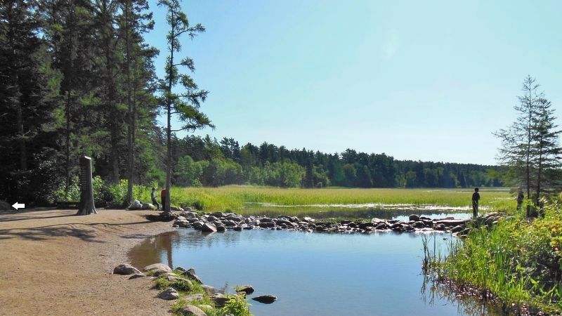
Location. 47° 14.394′ N, 95° 12.454′ W. Marker is near Shevlin, Minnesota, in Clearwater County. Marker can be reached from County Road 117, 0.3 miles south of County Road 122. Marker is located at the Mississippi Headwaters site at the north end of Lake Itasca. Access is via the park trail, east from Mary Gibbs Mississippi Headwaters Center about 2/10 mile. Touch for map. Marker is in this post office area: Shevlin MN 56676, United States of America. Touch for directions.
Other nearby markers. At least 8 other markers are within 4 miles of this marker, measured as the crow flies. Search for the Mississippi's Source (about 400 feet away, measured in a direct line); Patterson's Homestead (about 700 feet away); Itasca State Park Centennial (approx. 0.2 miles away); Theodore and Johanna Wegmann (approx. 0.3 miles away); Wegmann Store Replica (approx. 0.3 miles away); Geology of Minnesota (approx. 2.4 miles away); From a Day When Trees Were Trees (approx. 3½ miles away); Itasca Lake (approx. 3.6 miles away). Touch for a list and map of all markers in Shevlin.
Also see . . .
1. Northwest Ordinance (Wikipedia). In 1787 it created the Northwest Territory, the new nation's first organized
incorporated territory, from lands beyond the Appalachian Mountains, between British North America and the Great Lakes to the north and the Ohio River to the south. The upper Mississippi River formed the territory's western boundary. Pennsylvania was the eastern boundary. Throughout the Revolutionary War, the region was part of the British Province of Quebec. The region was ceded to the United States in the Treaty of Paris of 1783. (Submitted on September 6, 2020, by Cosmos Mariner of Cape Canaveral, Florida.)
2. Northwest Territory (Wikipedia). Established in 1787 by the Congress of the Confederation through the Northwest Ordinance, it was nation's the first post-colonial organized incorporated territory. At the time of its creation, the territory included all the land west of Pennsylvania, northwest of the Ohio River and east of the Mississippi River below the Great Lakes. It ceased to exist March 1, 1803, when the southeastern portion of the territory was admitted to the Union as the state of Ohio, and the remainder attached to Indiana Territory. (Submitted on September 6, 2020, by Cosmos Mariner of Cape Canaveral, Florida.)
3. Northwest Territory. Despite the promises of Britain to withdraw from the Northwest following the War for Independence, many fur traders and trappers remained behind. During
the 1780s, there were far more British citizens on this American soil than Americans. And the natives, naturally enough, did not recognize the region as anyone’s possession but their own. (Submitted on September 6, 2020, by Cosmos Mariner of Cape Canaveral, Florida.)
Credits. This page was last revised on September 7, 2020. It was originally submitted on September 5, 2020, by Cosmos Mariner of Cape Canaveral, Florida. This page has been viewed 272 times since then and 24 times this year. Photos: 1, 2, 3. submitted on September 6, 2020, by Cosmos Mariner of Cape Canaveral, Florida.


