Near Millville in Jefferson County, West Virginia — The American South (Appalachia)
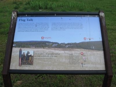
Flag Talk
Harpers Ferry National Historical Park
— National Park Service, U.S. Department of the Interior —
I do not desire...to open [fire] until all are ready on both sides of the river.
Message flagged from Jackson to Walker and McLaws.
(Sidebar): Flagging
Although fog or mist could interfere, the flag system was widely used and an effective form of communication during the Civil War. Only one flag or torch was used at a time. Three simple motions could be combined to signal a message.
Erected by National Park Service, U.S. Department of the Interior.
Topics. This historical marker is listed in these topic lists: Communications • War, US Civil.
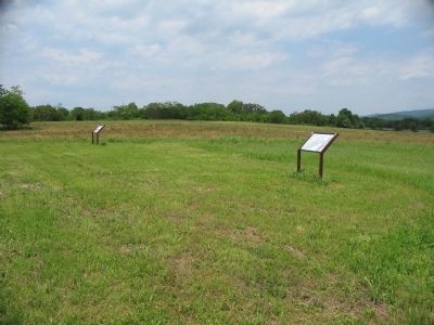
Location. 39° 18.969′ N, 77° 46.771′ W. Marker is near Millville, West Virginia, in Jefferson County. Marker can be reached from Bloomery Road (County Road 27), on the right when traveling south. Located in the south section of the School House Ridge unit of the Harpers Ferry National Historic Park. The marker is along a walking trail just south of the William L. Wilson Freeway (US 340). The trail is best reached from the parking area on Bloomary Road (CR 27). Touch for map. Marker is in this post office area: Millville WV 25432, United States of America. Touch for directions.
Other nearby markers. At least 8 other markers are within walking distance of this marker. Battle of Harpers Ferry (a few steps from this marker); Fake Attack - September 14th (approx. 0.3 miles away); Destined for Antietam (approx. 0.3 miles away); Allstadt House (approx. 0.4 miles away); Confederates Converge (approx. 0.4 miles away); Assessing the Obstacle (approx. 0.4 miles away); Battle of Harpers Ferry / Jackson Arrives (approx. half a mile away); No Man's Land (approx. half a mile away). Touch for a list and map of all markers in Millville.
More about this marker. The background of the marker is a panoramic view of Bolivar Heights, and the mountains east of Harpers Ferry. The locations of Confederate signal stations on Maryland and Loudoun Heights are indicated. An inset illustration shows Jackson's spotting scope and a painting of Jackson reviewing the terrain. In the side bar are examples of daylight flags, dusk/dawn flags, and night torches.
Also see . . . 1862 Battle of Harpers Ferry. National Park Service summary of the battle. (Submitted on May 26, 2008, by Craig Swain of Leesburg, Virginia.)

Photographed By Craig Swain, May 17, 2008
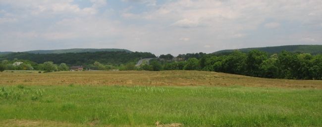
3. Confederate Signal Stations
In a view similar to the background of the marker, locations of the two important Confederate signal stations overlook Bolivar Heights and Harpers Ferry. US 340 crosses over Bolivar Heights in the center of the photograph. In the distant left is Maryland Heights, where McLaws' Division was posted. On the right is Loudoun Heights, occupied by Walker's Division during the battle.
Credits. This page was last revised on September 7, 2020. It was originally submitted on May 26, 2008, by Craig Swain of Leesburg, Virginia. This page has been viewed 1,039 times since then and 9 times this year. Last updated on September 6, 2020, by Bradley Owen of Morgantown, West Virginia. Photos: 1, 2, 3. submitted on May 26, 2008, by Craig Swain of Leesburg, Virginia. • Devry Becker Jones was the editor who published this page.

