Cumberland Township near Gettysburg in Adams County, Pennsylvania — The American Northeast (Mid-Atlantic)
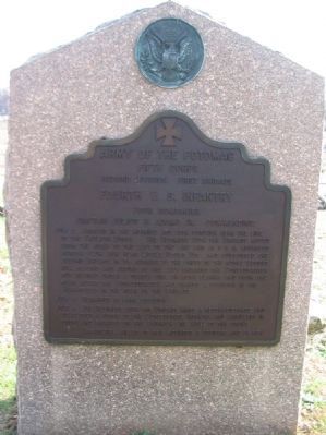
Fourth U.S. Infantry
First Brigade - Second Division
— Fifth Corps —
Inscription.
Fifth Corps
Second Division First Brigade
Fourth U.S. Infantry
Four Companies
Captain Julius W. Adams Jr. Commanding
July 2 Arrived in the morning and took position near the line of the Twelfth Corps. The Regiment with the Brigade moved from the right to the left of the line and at 5 p.m. advanced across Plum Run near Little Round Top and supported the Second Brigade in its advance to the crest of the Rocky wooded hill beyond and facing to the left engaged the Confederates but retired under a deadly fire on both flanks and from the rear after the Confederates had gained a position in the Wheatfield in the rear of the Brigade.
July 3 Remained in same position.
July 4 The Regiment with the Brigade made a reconnoissance and developed a force of the Confederate Infantry and Artillery in front and engaged on the skirmish line well to the front.
Casualties killed 10 men wounded 2 officers and 28 men.
Erected 1907 by Gettysburg National Military Park Commission.
Topics. This historical marker is listed in this topic list: War, US Civil. A significant historical date for this entry is July 2, 1863.
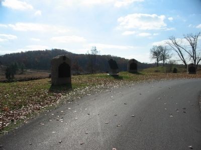
Location. 39° 47.697′ N, 77° 14.454′ W. Marker is near Gettysburg, Pennsylvania, in Adams County . It is in Cumberland Township. Marker is on Ayres Avenue, on the left when traveling south. Located on a loop in Ayres Avenue near the Wheatfield and Day's Hill, in Gettysburg National Military Park. Touch for map. Marker is in this post office area: Gettysburg PA 17325, United States of America. Touch for directions.
Other nearby markers. At least 8 other markers are within walking distance of this marker. First Brigade (a few steps from this marker); Sixth U.S. Infantry (a few steps from this marker); Twelfth U.S. Infantry (within shouting distance of this marker); Third U.S. Infantry (within shouting distance of this marker); Tenth U.S. Infantry (within shouting distance of this marker); Eleventh U.S. Infantry (within shouting distance of this marker); Second Brigade (within shouting distance of this marker); 13th Pennsylvania Reservers (within shouting distance of this marker). Touch for a list and map of all markers in Gettysburg.
Additional commentary.
1. Report of Captain Julius W. Adams
From the Official Records, Series I, Volume XXVII/1 (S#43), report number 206, page 639:
We remained in this position about one hour, when we recrossed the road, and, forming line of battle at right angles to it, moved in the direction of Gettysburg. Leaving the city on our right, we halted at about 1 p.m. at about 2 miles from the position of our first line of battle. We lay on our arms here until 4 p.m.; then
moving to the front down a road, we took up position in line of battle below the crest of a slight eminence lying between the two ranges of hills occupied, respectively, by our own and the enemy's forces.
We remained here about half an hour, when, in consequence of the troops on our right retiring and thus exposing us to a flank fire, we were ordered to fall back. Retiring across the open ground, we formed line of battle in the edge of the woods skirting the hills occupied by our forces, where we remained until 7 p.m., and then changed our position to one about 300 yards to the left, where we encamped for the night.
— Submitted January 23, 2009, by Craig Swain of Leesburg, Virginia.
Credits. This page was last revised on February 7, 2023. It was originally submitted on January 23, 2009, by Craig Swain of Leesburg, Virginia. This page has been viewed 896 times since then and 19 times this year. Photos: 1, 2. submitted on January 23, 2009, by Craig Swain of Leesburg, Virginia.

