Fontana Village in Graham County, North Carolina — The American South (South Atlantic)
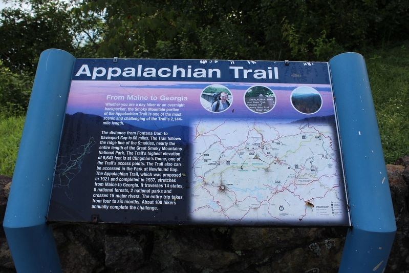
Appalachian Trail
From Maine to Georgia
The distance from Fontana Dam to Davenport Gap is 68 miles. The Trail follows the ridge line of the Smokies, nearly the entire length of the Great Smoky Mountain National Park. The Trail's highest elevation of 6,643 feet is a t Clingman's Dome, one of the Trail's access points The Trail also can be accessed in the Park at Newfound Gap. The Appalachian Trail, which was proposed in 1921 and completed in 1937, stretches from Maine to Georgia. It traverses 14 states, 8 national forests, 2 national parks and crosses 15 major rivers The entire trip takes from four to six months. About 100 hikers annually complete the challenge.
Topics. This historical marker is listed in this topic list: Parks & Recreational Areas. A significant historical year for this entry is 1921.
Location. 35° 26.963′ N, 83° 47.798′ W. Marker is in Fontana Village, North Carolina, in Graham County. Marker is on Fontana Dam Road (County Highway 1245) 0.9 miles north of Fontana Road (State Highway 28), on the right when traveling north. Touch for map. Marker is in this post office area: Fontana Dam NC 28733, United States of America. Touch for directions.
Other nearby markers. At least 8 other markers are within 6 miles of this marker, measured as the crow flies. Fontana Dam (approx. 0.3 miles away); Fontana Dam: (approx. 0.3 miles away); a different marker also named Appalachian Trail (approx. 0.3 miles away); Fontana's First Stewards: (approx. 0.4 miles away); Welcome to Fontana Dam (approx. half a mile away); The TVA System of Multi-purpose Dams (approx. half a mile away); a different marker also named Fontana Dam (approx. 0.6 miles away); Shaping the Flow of the Cheoah River (approx. 5.8 miles away). Touch for a list and map of all markers in Fontana Village.
Credits. This page was last revised on September 12, 2020. It was originally submitted on September 8, 2020, by Tom Bosse of Jefferson City, Tennessee. This page has been viewed 217 times since then and 17 times this year. Photos: 1, 2, 3. submitted on September 8, 2020, by Tom Bosse of Jefferson City, Tennessee. • Bernard Fisher was the editor who published this page.


