Near Valley Springs in Minnehaha County, South Dakota — The American Midwest (Upper Plains)
Ben Clare
Dakota Territory
Photographed by Roger Dean Meyer, October 24, 2012
1. Ben Clare Marker
Inscription.
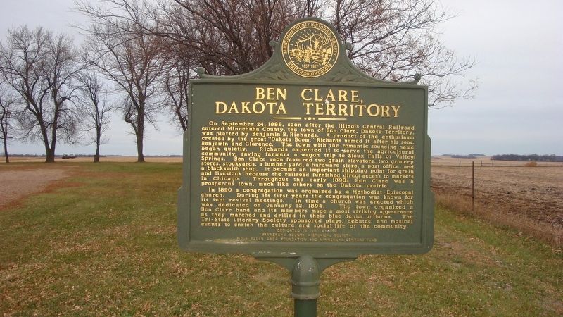
On September 24, 1888, soon after the Illinois Central Railroad entered Minnehaha County, the town of Ben Clare, Dakota Territory, was platted by Benjamin B. Richards. A product of the enthusiasm created by the great “Dakota Boom,” Richards named it after his sons, Benjamin and Clarence. The town with the romantic sounding name began quietly. Richards expected it to serve the agricultural community, saving farmers a wagon trip to Sioux Falls or Valley Springs. Ben Clare soon featured two grain elevators, two grocery stores, stockyards, a lumber yard, a hardware store, a post office, and a blacksmith shop. It became an important shipping point for grain and livestock because the railroad furnished direct access to markets in Chicago. Throughout the early 1890s Ben Clare was a prosperous town, much like others on the Dakota prairie.
In 1890 a congregation was organized by a Methodist-Episcopal church. During its first years the congregation was known for its tent revival meetings. In time a church was erected which was dedicated on January 12, 1894. The town organized a Ben Clare band and its members made a most striking
Click or scan to see this page online
appearance as they marched and drilled in their blue denim uniforms. The Tri-State Literary Society sponsored plays, debates, and musical events to enrich the culture and social life of the community.
Side Two
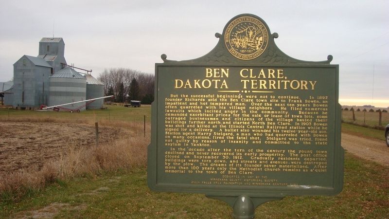
But the successful beginnings were not to continue. In 1892 founder Richards sold the Ben Clare town site to Frank Bowen, an impatient and hot tempered man. Over the next ten years Bowen often quarreled with his village neighbors. He filed numerous lawsuits which incited anger in the community. Because he demanded exorbitant prices for the sale or lease of town lots, some outraged businessmen and citizens of the village hauled their buildings farther north and started North Ben Clare. In 1903 Bowen was shot and killed at the Illinois Central Railroad station while he signed for a delivery. A bullet also wounded his twelve-year-old son. Station agent Harry Stelgard, a man who had quarreled with Bowen on many occasions, fired the fatal shot. Stelgard was tried, found not guilty by reason of insanity and committed to the state asylum in Yankton.
In the decade after the turn of the century the young town declined and never
Photographed by Roger Dean Meyer, October 24, 2012
2. Ben Clare Marker
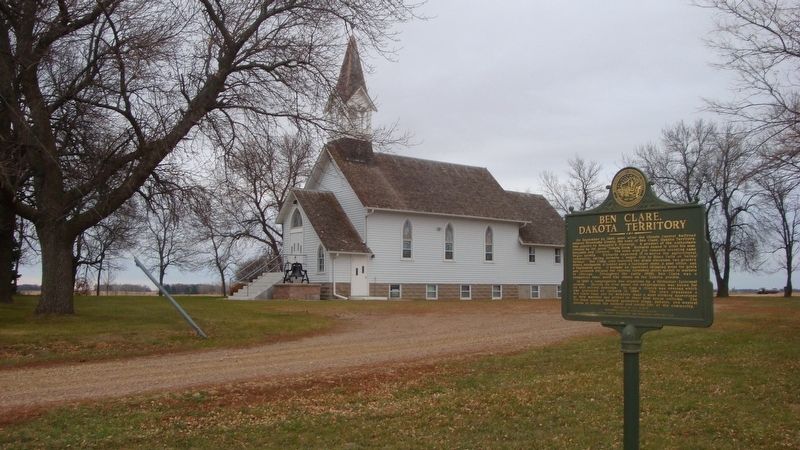
recovered its early prosperity. The post office closed on September 30, 1912. Gradually residents departed, buildings were torn down, and streets and avenues were destroyed by the plow. The dreams of its founder never materialized. After more than 100 years only the Methodist church remains as a quiet memorial to the town of Ben Clare.
Erected 1997 by Minnehaha County Historical Society, Sioux Falls Area Foundation and Minnehaha Century Fund.
Topics. This historical marker is listed in this topic list: Settlements & Settlers. A significant historical date for this entry is January 12, 1894.
Location. 43° 30.357′ N, 96° 28.639′ W. Marker is near Valley Springs, South Dakota, in Minnehaha County. It can be reached from Ben Clare Avenue half a mile south of 267th Street, on the left when traveling south. The marker can be reached by taking the drive-way to the Ben Clare United Methodist Church. Touch for map. Marker is at or near this postal address: 26762 Ben Clare Avenue, Valley Springs SD 57068, United States of America. Touch for directions.
Regionally, this marker is in East River and in Greater Sioux Falls. It is also in the American
Photographed by Roger Dean Meyer, October 24, 2012
3. Ben Clare Marker in front of Ben Clare United Methodist Church
Midwest, in the Lewis & Clark Corridor, in the Corn Belt, on the prairies, and on the Northern Plains. Globally, it is in North America, the Western Hemisphere, the Western World, and the Anglosphere. Historically, it finds itself in what was once Rupert’s Land and also the Louisiana Purchase.
Credits. This page was last revised on May 16, 2024. It was originally submitted on September 8, 2020, by Roger Dean Meyer of Yankton, South Dakota. This page has been viewed 769 times since then and 71 times this year. Photos:1, 2, 3. submitted on September 8, 2020, by Roger Dean Meyer of Yankton, South Dakota.