
Ticonderoga in Essex County, New York — The American Northeast (Mid-Atlantic)
Original Carillon Bridge
Photographed by Bill Coughlin, July 12, 2008
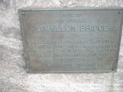
1. Original Carillon Bridge Marker
the original
Carillon Bridge
C. 1755
Called ‘The Long Bridge’ for over a century, the bridge was officially named Carillon in 1933. The present bridge was reconstructed in 1990 by Reale Construction Co., Inc.
Erected 1995 by Carillon Garden Club.
Topics. This historical marker is listed in this topic list: Bridges & Viaducts. A significant historical year for this entry is 1755.
Location. 43° 50.994′ N, 73° 24.842′ W. Marker is in Ticonderoga, New York, in Essex County. It is on Montcalm Street, on the right when traveling east. Marker is located in Carillon Park. Touch for map. Marker is in this post office area: Ticonderoga NY 12883, United States of America. Touch for directions.

Regionally, this marker is in Upstate New York, in the Adirondacks & North Country, and in the Champlain Valley. It is also in the American Northeast and in the Mid-Atlantic. Globally, it is in North America, the Great North Woods, the Western Hemisphere, the Western World, and the Anglosphere. Historically, it finds itself in what was once the Viceroyalty of New France, New Netherland, and one of the original Thirteen
this page online
Other nearby markers. At least 8 other markers are within walking distance of this marker: Carillon Park (here, next to this marker); Carillon Bridge (here, next to this marker); Gen. Henry Knox Trail (a few steps from this marker); a different marker also named Carillon Bridge (within shouting distance of this marker); A Way to the World (approx. 0.2 miles away); Samuel De Champlain (approx. ¼ mile away); Sharing the Flow (approx. 0.3 miles away); The Power of Water (approx. 0.3 miles away). Touch for a list and map of all markers in Ticonderoga.

Photographed by Bill Coughlin, July 12, 2008
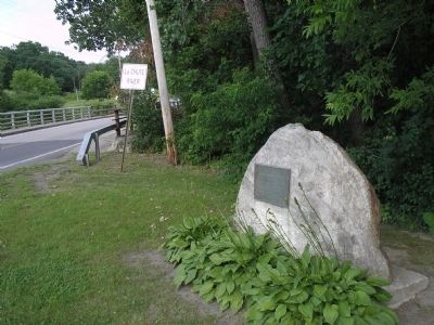
2. Marker in Carillon Park
This is one of several markers located in Carillon Park.
Photographed by Bill Coughlin, July 12, 2008
3. Original Carillon Bridge Marker
The reconstructed bridge can be seen behind the marker.
Photographed by Bill Coughlin, July 12, 2008
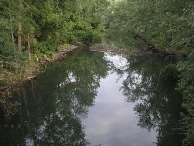
4. Carillon Bridge Crossing
The Carillon Bridge spanned the La Chute River at this point. It is located just behind the marker.
Credits. This page was last revised on June 16, 2016. It was originally submitted on January 24, 2009, by Bill Coughlin of Woodland Park, New Jersey. This page has been viewed 1,275 times since then and 17 times this year. Photos: 1, 2, 3, 4. submitted on January 24, 2009, by Bill Coughlin of Woodland Park, New Jersey.
