Hill City in Pennington County, South Dakota — The American Midwest (Upper Plains)
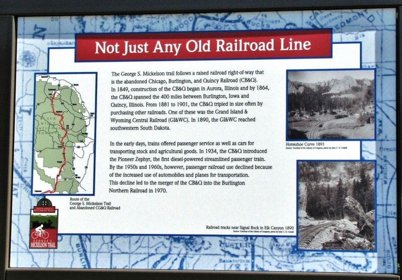
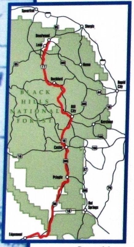
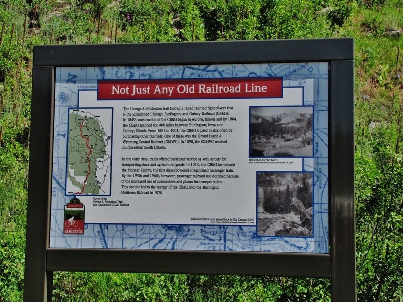
Not Just Any Old Railroad Line
In the early days, trains offered passenger service as well as cars for transporting stock and agricultural goods. In 1934, the CB&Q introduced the Pioneer Zephyr, the first diesel-powered streamlined passenger train. By the 1950s and 1960s, however, passenger railroad use declined because of the increased use of automobiles and planes for transportation. This decline led to the merger of the CB&Q into the Burlington Northern Railroad in 1970.
Topics. This historical marker is listed in these topic lists: Industry & Commerce • Parks & Recreational Areas • Railroads & Streetcars. A significant historical year for this entry is 1849.
Location. 43° 56.386′ N, 103° 34.842′ W. Marker is in Hill City, South Dakota, in Pennington County. Marker can be reached from Deerfield Road, 0.6 miles north of Main Street (U.S. 385), on the right when traveling north. Marker is located near milepost 62 on the Mickelson Rail Trail, just east of Deerfield Road. Touch for map. Marker is in this post office area: Hill City SD 57745, United States of America. Touch for directions.
Other nearby markers. At least 8 other markers are within walking distance of this marker. Black Hills Central Railroad's Famous Engine #7 (approx. 0.6 miles away); The Steam Locomotive (approx. 0.6 miles away); The Black Hills Central Railroad (approx. 0.6 miles away); Hill City Depot (approx. 0.6 miles away); Semaphore & Telegraph (approx. 0.6 miles away); BNSF Railroad Signal (approx. 0.7 miles away); Von Woehrman Building (approx. 0.7 miles away); Hill City (approx. ¾ mile away). Touch for a list and map of all markers in Hill City.
Also see . . .
1. Timeline of Black Hills Railroads. (Submitted on September 11, 2020, by Cosmos Mariner of Cape Canaveral, Florida.)
2. Grand Island and Wyoming Central Railroad (Wikipedia). In 1889 the railroad began building into the Black Hills to serve the mines built during the Black Hills Gold Rush. In 1890, the railroad reached Hill City and Englewood, and in 1891, service to Deadwood was established. A line to Spearfish was added in 1893. (Submitted on September 11, 2020, by Cosmos Mariner of Cape Canaveral, Florida.)
3. The Chicago, Burlington & Quincy Railroad. On May 26, 1934, the Burlington (CB&Q) staged one of the greatest transportation events of the Thirties - a 1,000-mile record breaking, non-stop run from Denver Colorado to the World's Fair on Chicago's lake front, where the Pioneer Zephyr climaxed the "Wings of a Century" transportation pageant. The highest speed attained was 112.5 miles per hour and the total fuel cost for the trip was $14.64! (Submitted on September 11, 2020, by Cosmos Mariner of Cape Canaveral, Florida.)
Credits. This page was last revised on September 11, 2020. It was originally submitted on September 10, 2020, by Cosmos Mariner of Cape Canaveral, Florida. This page has been viewed 153 times since then and 14 times this year. Photos: 1, 2, 3, 4, 5, 6. submitted on September 11, 2020, by Cosmos Mariner of Cape Canaveral, Florida.
