Near Beverly in Randolph County, West Virginia — The American South (Appalachia)
Rich Mountain
Rich Mountain Battlefield Civil War Site
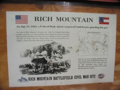
On July 11, 1861, a Federal flank attack surprised Confederates guarding this pass
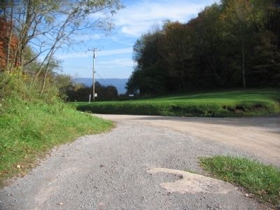
The battle of Rich Mountain took place here where the Staunton-Parkersburg turnpike crossed the crest of the mountain. About 2:30 pm, the Union forces began their attack down the hill on your right. The 310 Confederate troops on guard here with their one cannon took cover behind hastily erected log breastworks, farm buildings, and the rocks in the stable yard across the road.
After over two hours of fighting, the larger Federal force charged again and captured the cannon. The Confederates retreated into the woods and during the night abandoned Camp Garnett. General McClellan's army then took control of the turnpike and of northwestern Virginia.
Topics and series. This historical marker is listed in this topic list: War, US Civil. In addition, it is included in the Battlefield Trails - Civil War series list. A significant historical month for this entry is July 1814.
Location. 38° 51.973′ N, 79° 56.06′ W. Marker is near Beverly, West Virginia, in Randolph County. Marker is on Rich Mountain Road / Files Creek Road (County Route 37/8), on the right when traveling east. Located near the parking area for the Rich Mountain Battlefield. Touch for map. Marker is in this post office area: Beverly WV 26253, United States of America. Touch for directions.
Other nearby markers. At least 8 other markers are within walking distance of this marker. Welcome to Rich Mountain Battlefield (a few steps from this marker); Battle of Rich Mountain (within shouting distance of this marker); The Stable Yard (within shouting distance of this marker); General William S. Rosecrans (within shouting distance of this marker); Battle Of Rich Mountain (within shouting distance of this marker); The Hart House (about 300 feet away, measured in a direct line); Rich Mountain / Hart House (about 300 feet away); Site of Old Hart House (about 400 feet away). Touch for a list and map of all markers in Beverly.
Related markers. Click here for a list of markers that are related to this marker. To better understand the relationship, study each marker in the order shown.
Also see . . . Rich Mountain Battlefield History. An overview of the battle. (Submitted on October 24, 2009, by Craig Swain of Leesburg, Virginia.)

Photographed By Craig Swain, October 11, 2009
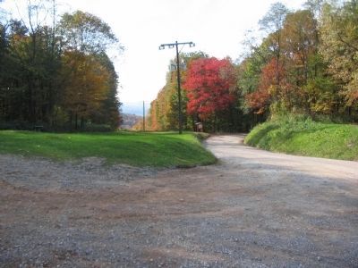
3. Rosecran's Advance and Confederate Defense
Federal General W.S. Rosecrans advanced his men up the mountain, using a path to the south of the Hart Home. In this view is the ground over which the Federals attacked to drive back the Confederate rear guard. The Confederates used a stable and natural features to form a defensive line, holding off the Federals for several hours.
Credits. This page was last revised on September 14, 2020. It was originally submitted on October 24, 2009, by Craig Swain of Leesburg, Virginia. This page has been viewed 1,138 times since then and 35 times this year. Last updated on September 13, 2020, by Bradley Owen of Morgantown, West Virginia. Photos: 1, 2, 3. submitted on October 24, 2009, by Craig Swain of Leesburg, Virginia. • Devry Becker Jones was the editor who published this page.

