Andrews in Cherokee County, North Carolina — The American South (South Atlantic)
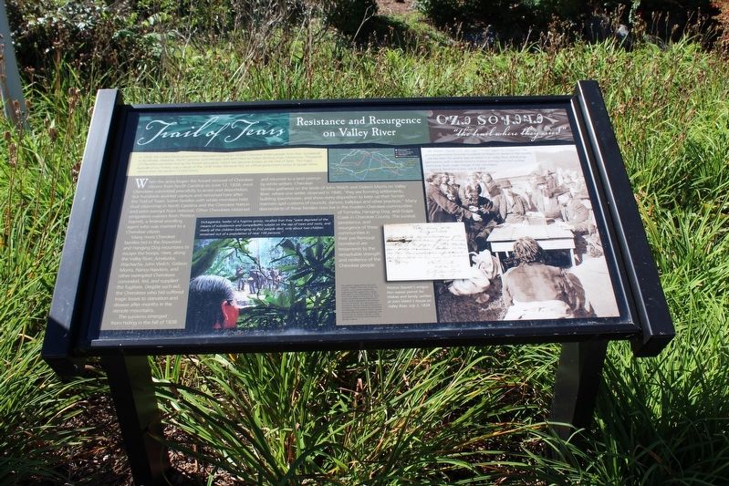
Resistance and Resurgence on Valley River
Trail of Tears
Photographed by Tom Bosse, September 5, 2020
1. Resistance and Resurgence on Valley River Marker
In 1838, the United States government deported more than 16,000 Cherokee Indian people from their homelands in Tennessee, Alabama, North Carolina, and Georgia, and sent them to Indian Territory (now Oklahoma). Thousands of Cherokees perished during the forced relocation, which has become known as the Trail of Tears. This tragic episode of our history was a result of the 1830 Indian Removal Act, an official government policy to purge native nations from the eastern United States.
When the army began the forced removal of Cherokee citizens from North Carolina on June 12, 1838, most Cherokees submitted peacefully to arrest and deportation, but hundreds avoided capture and remained here after the Trail of Tears. Some families with white members held duel citizenship in North Carolina and the Cherokee Nation and were exempt from removal. Other Cherokees obtained emigration waivers from Preston Starrett, a federal enrolling agent who was married to a Cherokee citizen.
Many more Cherokee families hid in the Snowbird and Hanging Dog mountains to escape the troops. Here, along the Valley River, Junaluska, Wachacha,
this page online
The survivors emerged from hiding in the fall of 1838 and returned to a land overrun by white settlers. Cherokee families gathered on the lands of John Welch and Gideon Morris on Valley River, where one settler observed in 1840, “they are forming settlements, building townhouses, and show every disposition to keep up their former manners and customers of councils, dances, ballplays and other practices”. Many descendants of these families now live in the modern Cherokee communities of Tomotla, Hanging Dog, and Grape Creek in Cherokee County. The survival, persistence, and resurgence of these communities in their pre-Removal homeland are testaments to the remarkable strength and resilience of the Cherokee people.
(captions)
…Mr. Preston Starritt [sic], who signs himself Agent for Emigration has…granted permission to some hundreds of Indians to remain in the country. …He has been
Photographed by Tom Bosse, September 5, 2020
2. Resistance and Resurgence on Valley River Marker
—General Abraham Eustis, July 3, 1838.
Dickageeska, leader of a fugitive group, recalled that the “were deprived of the means of subsistence and compelled to subsist on the sap of trees and roots, and nearly all the children belonging to [his] people died, only about two children remained out of a population of near 100 persons.”
Preston Starrett’s emigration waiver permit for Wakee and family, written at John Welch’s house on Valley River, July 2, 1838.
Erected by North Carolina Chapter of the Trail of Tears Association.
Topics and series. This historical marker is listed in this topic list: Indigenous Peoples and Communities. In addition, it is included in the Trail of Tears series list. A significant historical date for this entry is June 12, 1838.
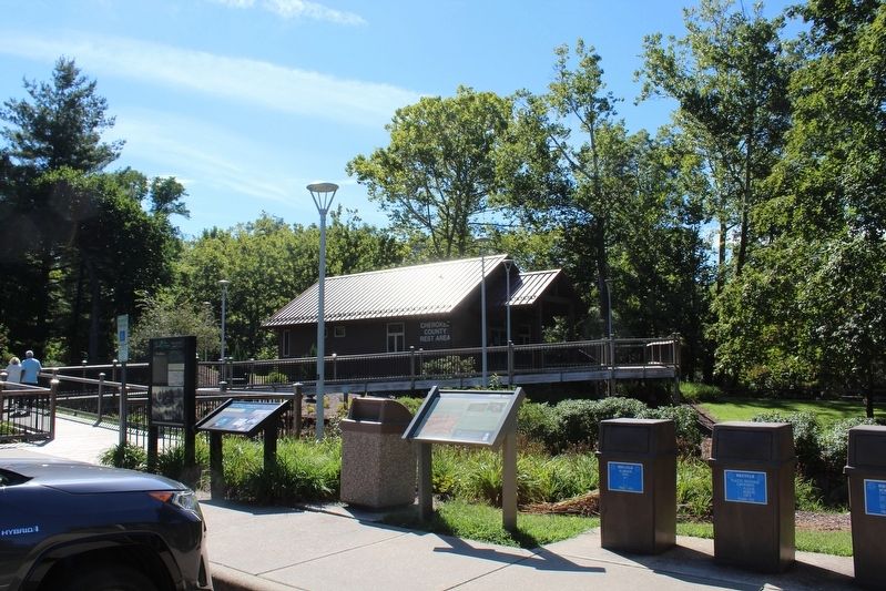
Location. 35° 12.318′ N, 83° 49.786′ W. Marker is in Andrews, North Carolina, in Cherokee County. It can be reached from the intersection of Locust Street and County Highway 1419, on the left when traveling north. Marker is located 0.1 miles west of the intersection at the Andrews Rest Area. Touch for map. Marker is in this post office area: Andrews NC 28901, United States of America. Touch for directions.

Regionally, this marker is in the Mountains. It is also in the American South, specifically in the Upper South, in Appalachia, and specifically in Southern Appalachia. Globally, it is in North America, the Western Hemisphere, the Western World, and the Anglosphere. Historically, it finds itself in what was once the original Cherokee Nation, the territory of the Mississippian Culture, one of the original Thirteen Colonies, one of the Confederate States of America, and the Antebellum South.
Other nearby markers. At least 8 other markers are within 8 miles of this marker, measured as the crow flies: Konehete (here, next to this marker); Fort Delaney (here, next to this marker); The Old Army Road (a few steps from this marker); Harold H. Hall (approx. 0.3 miles away); The "Peavine" Special (approx. 0.3 miles away); Valleytown Center (approx. 0.4 miles away); Andrews High School Veterans of Foreign Wars Memorial (approx. ¾ mile away); Junaluska (approx. 8 miles away). Touch for a list and map of all markers in Andrews.
Credits. This page was last revised on September 18, 2020. It was originally submitted on September 13, 2020, by Tom Bosse of Jefferson City, Tennessee. This page has been viewed 1,052 times since then and 68 times this year. Photos: 1, 2. submitted on September 13, 2020, by Tom Bosse of Jefferson City, Tennessee. • Bernard Fisher was the editor who published this page.
