Kingwood in Preston County, West Virginia — The American South (Appalachia)
Kingwood
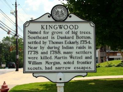
Photographed by Thomas Nevin, July 28, 2009
1. Kingwood Marker
Erected by West Virginia Archives & History.
Topics and series. This historical marker is listed in these topic lists: Indigenous Peoples and Communities • Settlements & Settlers. In addition, it is included in the West Virginia Archives and History series list. A significant historical year for this entry is 1754.
Location. 39° 28.315′ N, 79° 41.272′ W. Marker is in Kingwood, West Virginia, in Preston County. It is on Main Street (West Virginia Route 7) just west of South Price Street, on the left when traveling west. Touch for map. Marker is at or near this postal address: 101 W Main St, Kingwood WV 26537, United States of America. Touch for directions.

Regionally, this marker is in the American South, specifically in the Upper South, in Appalachia, and specifically in Northern Appalachia. Globally, it is in North America, the Western Hemisphere, the Western World,
this page online
Other nearby markers. At least 8 other markers are within walking distance of this marker: The Preston County Bell (a few steps from this marker); Vietnam Veterans Memorial (a few steps from this marker); Operation Desert Shield / Operation Desert Storm (within shouting distance of this marker); Preston County Courthouse (within shouting distance of this marker); Preston County Buckwheat Festival (within shouting distance of this marker); Preston County Civil War Monument (within shouting distance of this marker); Veterans Memorial (within shouting distance of this marker); Price's Tavern (within shouting distance of this marker). Touch for a list and map of all markers in Kingwood.
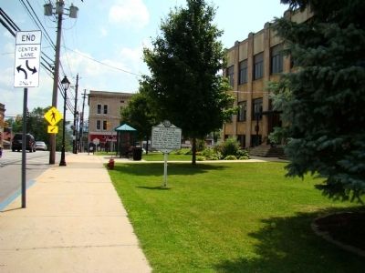
Photographed by Thomas Nevin, July 28, 2009
2. Looking East
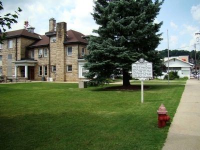
Photographed by Thomas Nevin, July 28, 2009
3. Looking West
Credits. This page was last revised on September 16, 2020. It was originally submitted on July 28, 2009, by Jacob Nevin of Bethesda, Maryland. This page has been viewed 1,370 times since then and 41 times this year. Last updated on September 16, 2020, by Bradley Owen of Morgantown, West Virginia. Photos: 1, 2, 3. submitted on July 28, 2009, by Jacob Nevin of Bethesda, Maryland. • Devry Becker Jones was the editor who published this page.
