Independence in Jackson County, Missouri — The American Midwest (Upper Plains)
Flournoy House
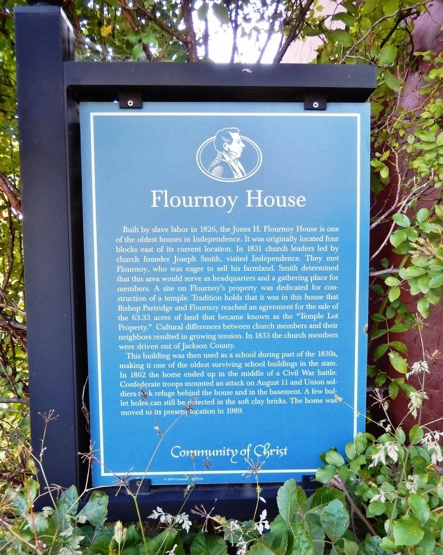
Built by slave labor in 1826, the Jones H. Flournoy House is one of the oldest houses in Independence. It was originally located four blocks east of its current location. In 1831 church leaders led by church founder Joseph Smith, visited Independence. They met Flournoy, who was eager to sell his farmland. Smith determined that this area would serve as headquarters and a gathering place for members. A site on Flournoy's property was dedicated for construction of a temple. Tradition holds that it was in this house that Bishop Partridge and Flournoy reached an agreement for the sale of the 63.33 acres of land that became known as the "Temple Lot Property." Cultural differences between church members and their neighbors resulted in growing tension. In 1833 the church members were driven out of Jackson County.
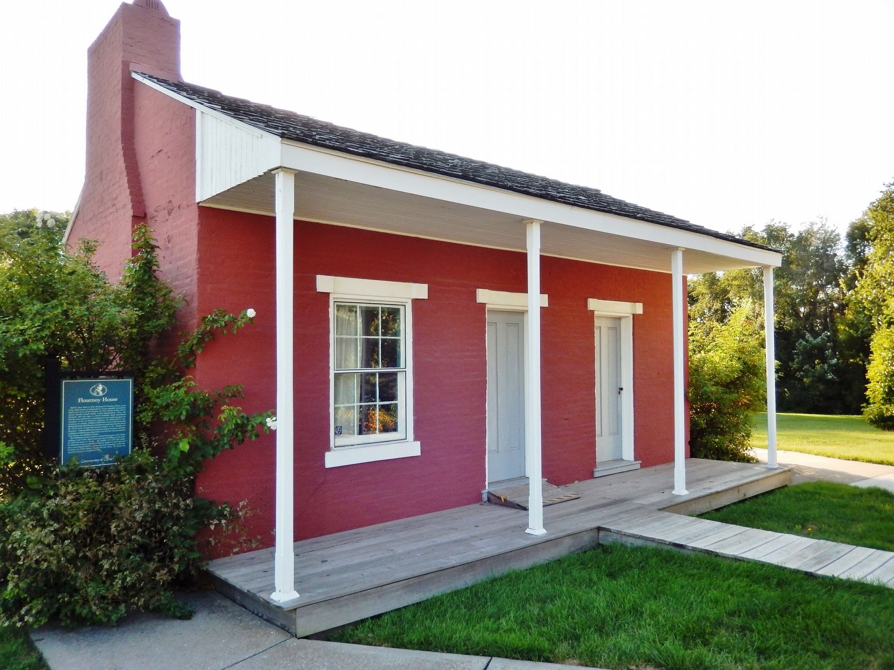
This building was then used as a school during part of the 1830s, making it one of the oldest surviving school buildings in the state. In 1862 the home ended up in the middle of a Civil War battle. Confederate troops mounted an attack on August 11 and Union soldiers took refuge behind the house and in the basement. A few bullet holes can still be detected in the soft clay bricks. The home was moved to its present location in 1989.
Erected 2003 by Community of Christ.
Topics. This historical marker is listed in these topic lists: Churches & Religion • Education • Settlements & Settlers • War, US Civil. A significant historical year for this entry is 1826.
Location. 39° 5.469′ N, 94° 25.738′ W. Marker is in Independence, Missouri, in Jackson County. Marker can be reached from West Lexington Avenue just west of South Bowen Street, on the right when traveling west. Marker is located at the southeast (left front) corner of the subject house. Touch for map. Marker is in this post office area: Independence MO 64050, United States of America. Touch for directions.
Other nearby markers. At least 8 other markers are within walking distance of this marker. Flournoy Home (a few steps from this marker); F.M. Smith Study (a few steps from this marker); The Stone Church (within shouting distance of this marker); Temple Lot (about 400 feet away, measured in a direct line); Temple Site (about 400 feet away); Confederate Line (about 500 feet away); Battle Line at Railroad Cut (approx. 0.3 miles away); Joseph T. Noland House (approx. 0.3 miles away). Touch for a list and map of all markers in Independence.
Related markers. Click here for a list of markers that are related to this marker. Flournoy House
Also see . . . Independence, Missouri Historic Places. Community of Christ website entry (Submitted on May 2, 2022, by Larry Gertner of New York, New York.)
Credits. This page was last revised on March 11, 2024. It was originally submitted on September 18, 2020, by Cosmos Mariner of Cape Canaveral, Florida. This page has been viewed 301 times since then and 30 times this year. Photos: 1, 2. submitted on September 18, 2020, by Cosmos Mariner of Cape Canaveral, Florida.

