Holly Pond in Cullman County, Alabama — The American South (East South Central)
First Baptist Church Holly Pond
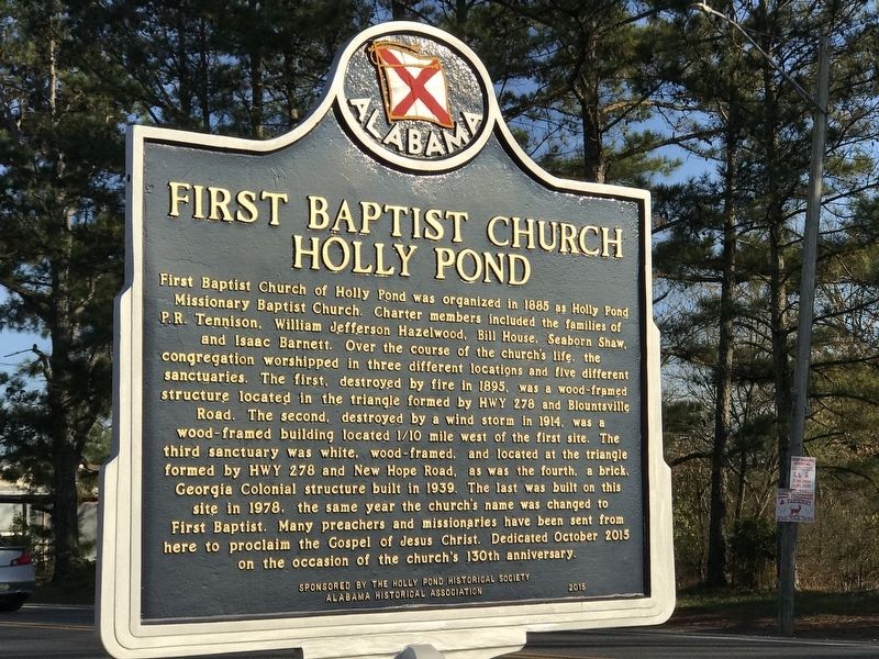
Photographed by Duane and Tracy Marsteller, November 21, 2020
1. First Baptist Church Holly Pond Marker
Erected 2015 by Alabama Historical Association; Sponsored by Holly Pond Historical
this page online
Topics and series. This historical marker is listed in this topic list: Religion & Religious Structures. In addition, it is included in the Alabama Historical Association series list. A significant historical year for this entry is 1885.
Location. 34° 10.466′ N, 86° 37.074′ W. Marker is in Holly Pond, Alabama, in Cullman County. It is on U.S. 278 west of Wesley Avenue (County Road 1669), on the right when traveling west. Touch for map. Marker is at or near this postal address: 10751 US 278, Holly Pond AL 35083, United States of America. Touch for directions.

Regionally, this marker is in North Alabama. It is also in the American South and specifically in the Deep South. Globally, it is in North America, a Gulf of Mexico state, the Western Hemisphere, the Western World, and the Anglosphere. Historically, it finds itself in what was once the original Cherokee Nation, the territory of the Mississippian Culture, one of the Confederate States of America, and the Antebellum South.
Other nearby markers. At least 8 other markers are within 7 miles of this marker, measured as the crow flies: The History of Holly Pond School
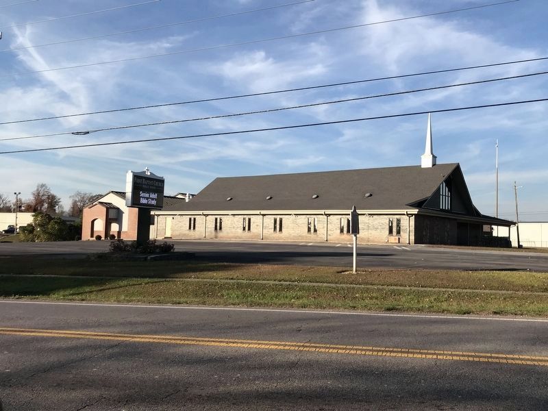
Photographed by Duane and Tracy Marsteller, November 21, 2020
2. First Baptist Church Holly Pond Marker
Other markers no longer nearby. Holly Pond Cemetery (was approx. 0.6 miles away but has been replaced with another marker now near it); a different marker also named Federal Raid (was approx. 5.7 miles away but has been permanently removed).
Credits. This page was last revised on November 22, 2020. It was originally submitted on September 18, 2020, by Duane and Tracy Marsteller of Murfreesboro, Tennessee. This page has been viewed 720 times since then and 46 times this year. Photos: 1. submitted on September 18, 2020, by Duane and Tracy Marsteller of Murfreesboro, Tennessee. 2. submitted on November 22, 2020, by Duane and Tracy Marsteller of Murfreesboro, Tennessee. • Mark Hilton was the editor who published this page.
