Blaine in Mineral County, West Virginia — The American South (Appalachia)
Mineral County / State of Maryland
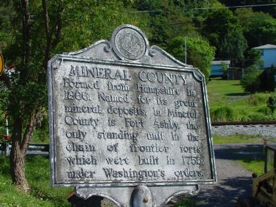
Mineral County. Formed from Hampshire in 1866. Named for its great mineral deposits. In Mineral County is Fort Ashby, the only standing unit in the chain of frontier forts which were built in 1755 under Washington’s orders.
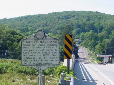
State of Maryland. Named for Queen Henrietta Maria, the wife of Charles I, who gave a royal charter to Cecil Calvert, second Lord Baltimore, in 1632. First settlement at St. Mary’s City in 1634. It was one of the 13 original colonies.
Topics and series. This historical marker is listed in these topic lists: Colonial Era • Forts and Castles • Political Subdivisions • Settlements & Settlers. In addition, it is included in the West Virginia Archives and History series list. A significant historical year for this entry is 1866.
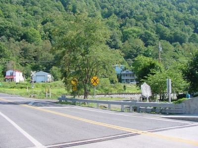
Location. 39° 23.199′ N, 79° 10.834′ W. Marker is in Blaine, West Virginia, in Mineral County. Marker is on Kitzmiller Bridge (Maryland Route 38) (West Virginia Route 42). Touch for map. Marker is in this post office area: Elk Garden WV 26717, United States of America. Touch for directions.
Other nearby markers. At least 8 other markers are within 9 miles of this marker, measured as the crow flies. Dr. John Green (approx. 4.1 miles away); Mineral County / Grant County (approx. 4.8 miles away); Altamont (approx. 6 miles away in Maryland); Claysville United Methodist Church (approx. 6.8 miles away); Honor Roll (approx. 8.2 miles away); Deer Park Hotel (approx. 8.3 miles away in Maryland); Cleveland Cottage (approx. 8.4 miles away in Maryland); James Cardinal Gibbons (approx. 8.4 miles away in Maryland).
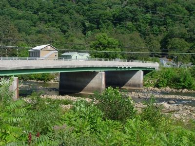
More about this marker. Marker marks the border of the states of Maryland and West Virginia, on the West Virginia side of the North Branch of the Potomac River.
Also see . . . Mineral County Historical Society. Website homepage (Submitted on February 24, 2024, by Larry Gertner of New York, New York.)
Photographed By J. J. Prats, August 13, 2006
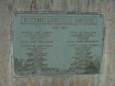
4. Kitzmillerville Bridge Builder's Plate
Built 1955. State of West Virginia: William C. Marland, Governor. State of Maryland: Theodore R. McKeldin, Governor. West Virginia State Road Commission: H.R. Griffith, Commissioner; William T. Brice, Secretary; George W. McAlpin, State Engineer; L.L. Jemison, Bridge Engineer; K.M. Dunn, District Engineer; J.J. Melody, District Construction Engineer. Maryland State Roads Commission: Russell McCain, Chairman; Edgar T. Bennett, Commissioner; Bramwell Kelly, Commissioner; Norman M. Pritchett, Chieff Engineer; Walter G. Hopkins, Deputy Chief Engineer; Albert L. Grubb, Chief, Bureau of Bridges.
Credits. This page was last revised on February 24, 2024. It was originally submitted on November 25, 2006, by J. J. Prats of Powell, Ohio. This page has been viewed 1,924 times since then and 47 times this year. Last updated on September 18, 2020, by Bradley Owen of Morgantown, West Virginia. Photos: 1, 2, 3, 4, 5. submitted on November 25, 2006, by J. J. Prats of Powell, Ohio. • Devry Becker Jones was the editor who published this page.
