Appomattox in Appomattox County, Virginia — The American South (Mid-Atlantic)
Battle of Appomattox Station
Final Blow
— Lee's Retreat —
Inscription.
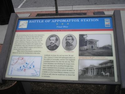
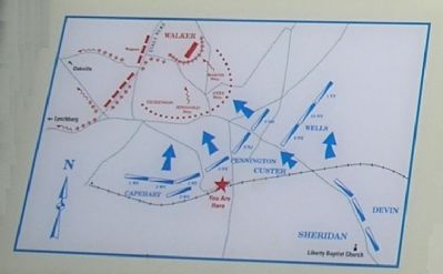
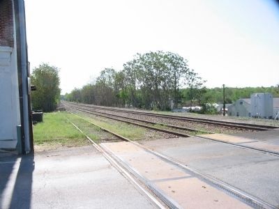
You are standing near the site of Appomattox Station Depot on the South Side Railroad. Here, on the afternoon of April 8, 1865, Union cavalrymen under Gen. George A. Custer dealt the Army of Northern Virginia a final blow. First, they captured trains loaded with supplies for Confederates, then they attacked and captured Gen. R. Lindsay Walker’s wagons and artillery in bivouac half a mile to the north.
When word of this disaster reached Gen. Robert E. Lee at his headquarters a few miles northeast, he knew the end was near. He and Gen. Ulysses S. Grant had exchanged letters on the subject of surrender, and Lee had suggested a meeting between the lines the next day. With Union horsemen now blocking his escape route, Lee’s only hope lay in punching through them with a combined force of infantry and cavalry, and he scheduled a breakout attack for dawn. If it failed, or if he found Federal infantry in front of him as well, then he would have no choice but to surrender.
Erected by Virginia Civil War Trails.
Topics and series. This historical marker is listed in this topic list: War, US Civil. In addition, it is included in the Virginia Civil War Trails series list. A significant historical date for this entry is April 8, 1790.
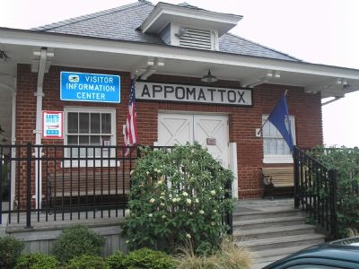
Location. 37° 21.211′ N, 78° 49.652′ W. Marker is in Appomattox, Virginia, in Appomattox County. Marker is on Main Street (Virginia Route 131), on the right. Marker is next to the Appomattox Visitors Center. Touch for map. Marker is in this post office area: Appomattox VA 24522, United States of America. Touch for directions.
Other nearby markers. At least 8 other markers are within walking distance of this marker. Battle of Appomattox Station — 1865 (a few steps from this marker); a different marker also named Battle of Appomattox Station (within shouting distance of this marker); Veterans Memorial (approx. 0.2 miles away); Appomattox Court House (approx. 0.2 miles away); Appomattox County Confederate Monument (approx. 0.2 miles away); Appomattox County Units (approx. 0.2 miles away); Appomattox County Eternal Flame (approx. 0.2 miles away); Winonah Camp / Mozella Price Home (approx. half a mile away). Touch for a list and map of all markers in Appomattox.
More about this marker. A map showing the operational situation described in the marker's text is on the lower left of the marker. Portraits of Gens. Custer and Walker are in the upper center. The upper right photo is "Appomattox Station in 1865" from the Collection of Bob Zeller. The lower right photo is of the station in 1900, Courtesy of C.P. and M.S. Stuntz.
Also see . . . The Battle of Appomattox Station. Civil War Preservation Trust page offering detailed information
about the battle. Despite the growth of the town of Appomattox, a portion of this battlefield remains undeveloped. (Submitted on April 24, 2010, by Craig Swain of Leesburg, Virginia.)
Photographed By Craig Swain, April 18, 2010
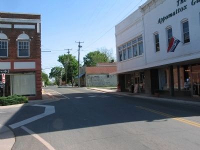
6. Church Street Looking North
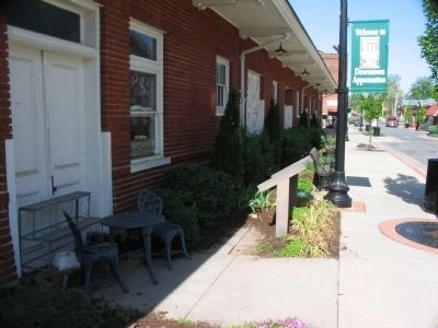
At the time of the battle, the area north of the station featured broken fields and wood lots. Parts of Custer's command, the 1st and 2nd New York along with the 3rd West Virginia Cavalry Regiments, advanced north from the area of the station, toward Walker's position.
Credits. This page was last revised on September 21, 2020. It was originally submitted on November 29, 2007. This page has been viewed 6,545 times since then and 48 times this year. Last updated on September 20, 2020, by Bradley Owen of Morgantown, West Virginia. Photos: 1, 2. submitted on November 29, 2007, by Bill Coughlin of Woodland Park, New Jersey. 3. submitted on April 24, 2010, by Craig Swain of Leesburg, Virginia. 4. submitted on November 29, 2007, by Bill Coughlin of Woodland Park, New Jersey. 5, 6. submitted on April 24, 2010, by Craig Swain of Leesburg, Virginia. • J. Makali Bruton was the editor who published this page.
