Hannibal in Marion County, Missouri — The American Midwest (Upper Plains)
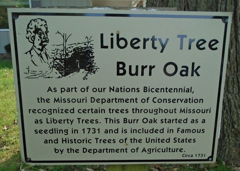
Liberty Tree
Burr Oak
the Missouri Department of Conservation
recognized certain trees throughout Missouri
as Liberty Trees. This Burr Oak started as a
seedling in 1731 and is included in Famous
and Historic Trees of the United States
by the Department of Agriculture.
Circa 1731
Topics and series. This historical marker is listed in this topic list: Natural Features. In addition, it is included in the Historic Trees series list. A significant historical year for this entry is 1731.
Location. 39° 41.317′ N, 91° 19.924′ W. Marker is in Hannibal, Missouri, in Marion County. Marker is on Cave Hollow Road (County Highway 453) 0.2 miles south of State Highway 79, on the left when traveling south. Liberty Tree and Marker are at the Mark Twain Cave & Campground. Touch for map. Marker is at or near this postal address: 300 Cave Hollow Rd, Hannibal MO 63401, United States of America. Touch for directions.
Other nearby markers. At least 8 other markers are within 2 miles of this marker, measured as the crow flies. Veterans Memorial (approx. half a mile away); A Piece of the Rock of Gethsemane (approx. 0.6 miles away); Admiral Robert E. Coontz (approx. 0.6 miles away); a different marker also named Veterans Memorial (approx. 0.6 miles away); a different marker also named Veterans Memorial (approx. 1.1 miles away); 9/11 Memorial (approx. 1.3 miles away); Craig Dowell • Joey Hoag • Billy Hoag (approx. 1.3 miles away); The Legend of Lovers Leap (approx. 1.3 miles away). Touch for a list and map of all markers in Hannibal.
Credits. This page was last revised on September 23, 2020. It was originally submitted on September 22, 2020, by William Fischer, Jr. of Scranton, Pennsylvania. This page has been viewed 420 times since then and 53 times this year. Photos: 1, 2. submitted on September 22, 2020, by William Fischer, Jr. of Scranton, Pennsylvania. 3, 4. submitted on September 23, 2020, by William Fischer, Jr. of Scranton, Pennsylvania.


