East Cocalico Township near Stevens in Lancaster County, Pennsylvania — The American Northeast (Mid-Atlantic)
Reamstown
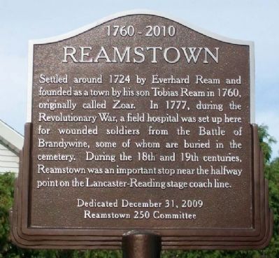
1760 - 2010
Photographed by William Fischer, Jr., September 11, 2010
1. Reamstown Marker
Settled around 1724 by Everhard Ream and founded as a town by his son Tobias Ream in 1760, originally called Zoar. In 1777, during the Revolutionary War, a field hospital was set up here for wounded soldiers from the Battle of Brandywine, some of whom are buried in the cemetery. During the 18th and 19th centuries, Reamstown was an important stop near the halfway point on the Lancaster-Reading stage coach line.
Dedicated December 31, 2009
Erected 2009 by Reamstown 250 Committee.
Topics. This historical marker is listed in these topic lists: Patriots & Patriotism • Settlements & Settlers • War, US Revolutionary. A significant historical year for this entry is 1724.
Location. 40° 12.7′ N, 76° 7.394′ W. Marker is near Stevens, Pennsylvania, in Lancaster County. It is in East Cocalico Township. It is on North Reamstown Road near Church Street, on the right when traveling north. Touch for map. Marker is at or near this postal address: 1 N Reamstown Rd, Reamstown PA 17567, United States of America. Touch for directions.

Regionally, this marker is in South-Central Pennsylvania, specifically in Pennsylvania Dutch
this page online
Other nearby markers. At least 8 other markers are within walking distance of this marker: Pioneer Settler / Founder of Reamstown (about 400 feet away, measured in a direct line); The American Indian and the American Soldier (about 400 feet away); East Cocalico Township Vietnam War Memorial (about 400 feet away); East Cocalico Township World War II Memorial (about 400 feet away); East Cocalico Township Korean War Memorial (about 400 feet away); Memorial Park of Reamstown (about 500 feet away); Old Reamstown School Building (about 700 feet away); Bucher's Mill Covered Bridge (1881) (approx. 0.6 miles away). Touch for a list and map of all markers in Stevens.
Also see . . .
1. Reamstown PA. (Submitted on December 25, 2010, by William Fischer, Jr. of Reynoldsburg, Ohio.)
2. History of Cocalico Township.
Photographed by William Fischer, Jr., September 11, 2010
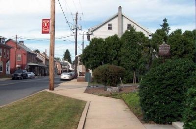
2. Reamstown Marker
Looking north along Reamstown Road
Credits. This page was last revised on February 7, 2023. It was originally submitted on December 25, 2010, by William Fischer, Jr. of Reynoldsburg, Ohio. This page has been viewed 1,783 times since then and 87 times this year. Last updated on September 23, 2020, by Carl Gordon Moore Jr. of North East, Maryland. Photos: 1, 2. submitted on December 25, 2010, by William Fischer, Jr. of Reynoldsburg, Ohio. • Bill Pfingsten was the editor who published this page.
