Williamsville in Sangamon County, Illinois — The American Midwest (Great Lakes)
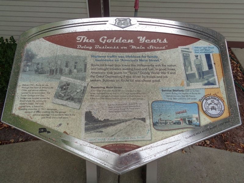
The Golden Years
Doing Business on "Main Street"
Before 1941, Route 66 ran through the heart of Williamsville. Cafes and service stations opened to serve travelers. The Turner Garage and Gas Station was located across the street where the community center is today. The road curved here, a hazard to speeding motorists. A 1941 newspaper account of a car crashing into the garage (above) reported “15 accidents here in the past three and a half years.”
Bypassing Main Street
To be faster and safer, Route 66 was enlarged to four lanes, bypassed towns, and in 1977 was replaced by I-55. With each change, businesses moved or died. Today, only a few franchise service stations survive at access ramps.
Service Stations lived up to their name during the heyday of Route 66. Station owners, like Bill Fawns, wore their uniforms with pride!
(photo captions:)
Lula Yocum snapped this photo of the new Route 66 bypass around Williamsville in 1941, cutting through the family's farm. Notice her hand-written notes.
Fawn’s Service Station and Route 66 Café, located on the bypass, served travelers during the 1950s and 60s.
Erected by Illinois Route 66 Scenic Byway.
Topics and series. This historical marker is listed in these topic lists: Industry & Commerce • Roads & Vehicles. In addition, it is included in the U.S. Route 66 series list. A significant historical year for this entry is 1941.
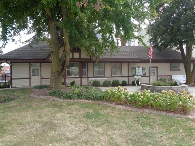
Location. 39° 57.24′ N, 89° 32.977′ W. Marker is in Williamsville, Illinois, in Sangamon County. Marker is at the intersection of South Elm Street and West Main Street, on the right when traveling north on South Elm Street. Marker is located in front of Williamsville Railroad Depot and Museum. Touch for map. Marker is at or near this postal address: 102 S Elm St, Williamsville IL 62693, United States of America. Touch for directions.
Other nearby markers. At least 8 other markers are within 6 miles of this marker, measured as the crow flies. The Williamsville Depot (here, next to this marker); The Early American Farming Community (about 300 feet away, measured in a direct line); Illinois Terminal System (about 400 feet away); When the Wagons Rolled (approx. 0.2 miles away); Abraham Lincoln (approx. 5.2 miles away); Illinois Remembers POW/MIA (approx. 5.3 miles
away); Elkhart, Illinois (approx. 5½ miles away); Lincoln With John Dean Gillett (approx. 5.8 miles away). Touch for a list and map of all markers in Williamsville.
More about this marker. The nonprofit group "Illinois Route 66 Scenic Byway" has established 31 wayside exhibits along Old Route 66 in Illinois. Each wayside was placed at a site with historic significance and tells the story of the site’s relationship to Route 66. The interpretive stations use illustrations, pictures, and audio to explore each site.
Each Wayside also has a passport stamp that can be collected by simply placing a piece of paper over the raised engraving and using a pencil to make a rubbing of the stamp.
Credits. This page was last revised on September 27, 2020. It was originally submitted on September 27, 2020, by Jason Voigt of Glen Carbon, Illinois. This page has been viewed 211 times since then and 23 times this year. Photos: 1, 2. submitted on September 27, 2020, by Jason Voigt of Glen Carbon, Illinois.

