Near Killen in Lauderdale County, Alabama — The American South (East South Central)
Earliest Methodist Congregation in Lauderdale County, Alabama
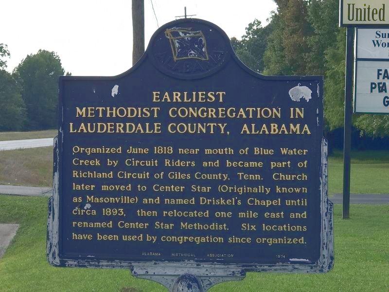
Photographed by Duane and Tracy Marsteller, September 27, 2020
1. Earliest Methodist Congregation in Lauderdale County, Alabama Marker
Erected 1974 by Alabama Historical Association.
Topics and series. This historical marker is listed in this topic list: Religion & Religious Structures. In addition, it is included in the Alabama Historical Association series list. A significant historical month for this entry is June 1818.
Location. 34° 51.688′ N, 87° 27.572′ W. Marker is near Killen, Alabama, in Lauderdale County. It is on Lee Highway (U.S. 72) 0.2 miles west of County Road 69, on the right when traveling west. Touch for map. Marker is at or near this postal address: 6293 Lee Highway, Killen AL 35645, United States of America. Touch for directions.

Regionally, this marker is in North Alabama and in the Shoals. It is also in the American South, specifically in the Deep South, in Appalachia,
this page online
Other nearby markers. At least 8 other markers are within 4 miles of this marker, measured as the crow flies: Center (Centre) Star (approx. ¼ mile away); Mitchell Town Community (approx. 1.1 miles away); Jesse James Gang Canal Payroll Robbery / Trial of Frank James (approx. 1.4 miles away); Gabriel Butler Cemetery (approx. 2½ miles away); Gabriel “Old Gabe” Butler (approx. 2½ miles away); Cherokee Chief Doublehead's Village Around 1800 (approx. 2.7 miles away); Daniel White (approx. 2.8 miles away); Elgin/Elgin Crossroads (approx. 4 miles away). Touch for a list and map of all markers in Killen.
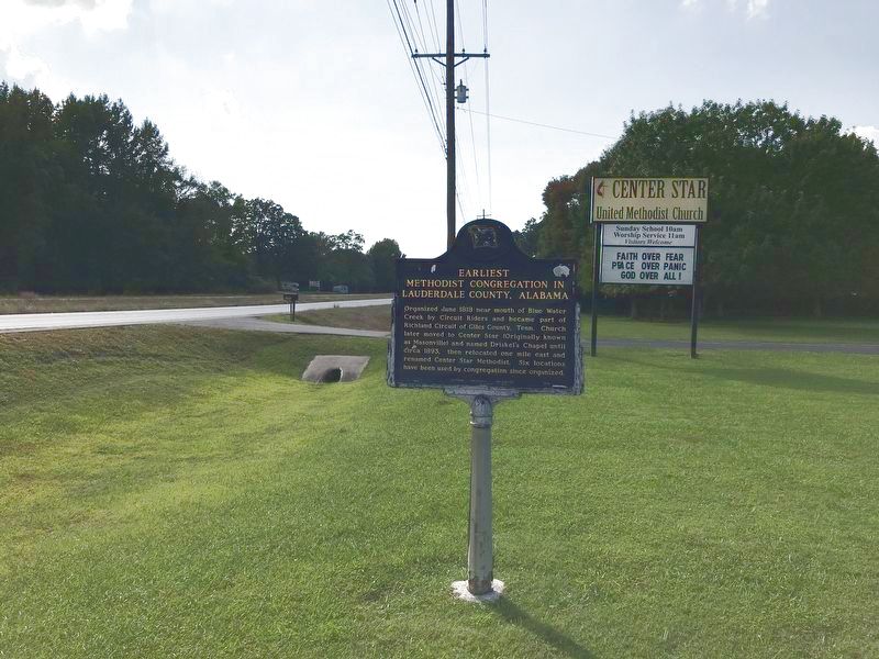
Photographed by Duane and Tracy Marsteller, September 27, 2020
2. Earliest Methodist Congregation in Lauderdale County, Alabama Marker
Credits. This page was last revised on September 28, 2020. It was originally submitted on September 28, 2020, by Duane and Tracy Marsteller of Murfreesboro, Tennessee. This page has been viewed 572 times since then and 39 times this year. Photos: 1, 2. submitted on September 28, 2020, by Duane and Tracy Marsteller of Murfreesboro, Tennessee. • Mark Hilton was the editor who published this page.
