Cumberland Township near Round Top in Adams County, Pennsylvania — The American Northeast (Mid-Atlantic)
Third Brigade
First Division - Third Corps
— Army of the Potomac —
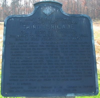
Inscription.
Third Corps First Division
Third Brigade
Col. P. Regis De Trobriand
17th. Maine 3d. 5th. Michigan 40th. New York
110th. (6 Cos.) Pennsylvania Infantry
July 2 Arrived at 10 a.m. On the advance of the Division between 2 and 3 p.m. the Brigade took position in column between First and Second Brigades for support to either. The 3d Michigan was sent to support First Brigade. The 17th Maine moved across the Wheatfield to the stone wall on the south. The 40th New York was sent to the gorge between the Devils's Den and Little Round Top. The 5th Michigan and 110th Penna. held the summit commanding a ravine in front and east of the Rose buildings until relieved by two Brigades of Fifth Corps when they retired through the Wheatfield where being joined by 17th Maine they held back a superior Confederate force until the arrival of First Division Second Corps when ammunition being exhausted this portion of the Brigade retired and at night was joined by the other regiments.
July 3 In Reserve.
Casualties. Killed 4 officers 71 men. Wounded 28 officers 366 men. Captured or missing 21 men. Total 490.
Erected 1912 by Gettysburg National Military Park Commission.
Topics. This memorial is listed in this topic list: War, US Civil. A significant historical date for this entry is July 2, 1863.
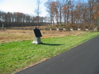
Location. 39° 47.791′ N, 77° 14.647′ W. Marker is near Round Top, Pennsylvania, in Adams County. It is in Cumberland Township. Memorial is at the intersection of Sickles Avenue and DeTrobriand Avenue, on the left when traveling west on Sickles Avenue. Located in the Wheatfield at Gettysburg National Military Park. Touch for map. Marker is in this post office area: Gettysburg PA 17325, United States of America. Touch for directions.
Other nearby markers. At least 8 other markers are within walking distance of this marker. Second Brigade (within shouting distance of this marker); 4th Michigan Infantry (within shouting distance of this marker); 57th New York Infantry (within shouting distance of this marker); Whirlpool of Death (within shouting distance of this marker); 62nd Pennsylvania Infantry (within shouting distance of this marker); 17th Maine Infantry (about 300 feet away, measured in a direct line); 115th Pennsylvania Infantry (about 300 feet away); Field Hospital of the 32nd Massachusetts Infantry (about 300 feet away). Touch for a list and map of all markers in Round Top.
Also see . . . Report of Col. P. Regis de Trobriand. Col. de Trobriand summarized the fighting in his report:
The battle was raging on my left and right to the rear on both sides, in consequence of my advanced position as already explained, and soon these two attacks came converging on the angle of which I formed the summit, with the Fifth Michigan, Lieutenant-Colonel Pulford, and the One hundred and tenth Pennsylvania, Major Jones, the only two regiments left at that point. Fortunately my position there was a strong one, in a wood commanding a narrow ravine, which the enemy attempted in vain to cross under our fire.
The unflinching bravery of the Fifth Michigan, which sustained the loss of more than one-half of its number without yielding a foot of ground, deserves to be especially mentioned here with due commendation. Had a sufficient force been there under my orders when the enemy gave up forcing our position, I would not have hesitated to try to break his line at that point; but two regiments from the Fifth Corps, sent there to my support, having fallen back without engaging the enemy (by what orders I could never ascertain), and some points

Photographed By Craig Swain, November 11, 2008
3. DeTrobriand's Brigade in the Wheatfield
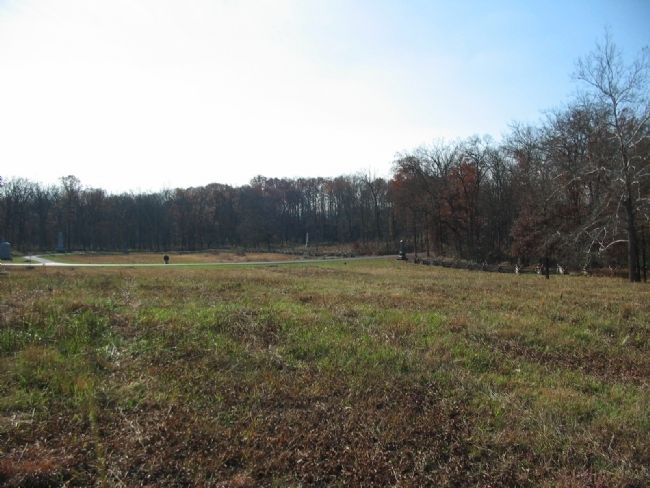
Looking from the high ground in the middle of the Wheatfield to the south at the intersection of DeTrobriand and Sickles Avenue. To the right is the Stony Hill (the "Loop"). To the left in front of the monuments is the stone wall occupied by the 17th Maine. The 110th Pennsylvania and 5th Michigan fought on the slops of the Stony Hill, to the right center. The 8th New Jersey and 115th Pennsylvania from Burling's Brigade (3rd Brigade, 2nd Division, 3rd Corps) deployed on the ground between the 17th Maine and 110th Pennsylvania, but were not under DeTrobriand's direct control.
As the enemy was pressing upon us on that side, I made a retour offensif with that regiment, re-enforced by the Fifth Michigan, keeping the enemy at bay in the woods until the arrival of sufficient re-enforcements from the Second Corps allowed us to be relieved when our ammunition was just exhausted.
By order of Major-General Birney, who was present with us in the wheat-field, I then took my command to the adjoining wood in the rear, and then farther off, to avoid unnecessary losses by the fire of the enemy, which disabled some of my men in that position. (Submitted on January 28, 2009, by Craig Swain of Leesburg, Virginia.)
Credits. This page was last revised on February 7, 2023. It was originally submitted on January 28, 2009, by Craig Swain of Leesburg, Virginia. This page has been viewed 916 times since then and 15 times this year. Photos: 1, 2, 3. submitted on January 28, 2009, by Craig Swain of Leesburg, Virginia.

