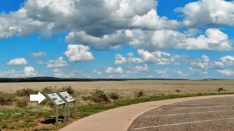
Near Watrous in Mora County, New Mexico — The American Mountains (Southwest)
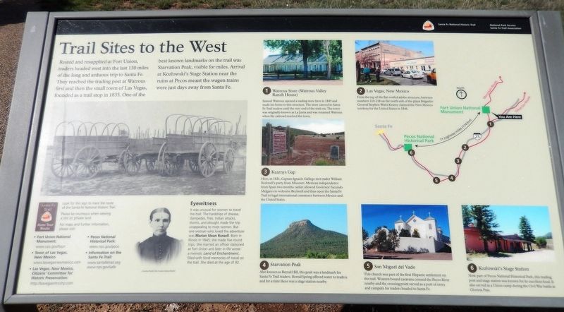
Trail Sites to the West
Santa Fe National Historic Trail
— Fort Union National Monument —
1. Watrous Store (Watrous Valley Ranch House)
Samuel Watrous opened a trading store here in 1849 and made his home in this structure. The store catered to Santa Fe Trail traders until the very end of the trail era. The town was originally known as La Junta and was renamed Watrous when the railroad reached the town.
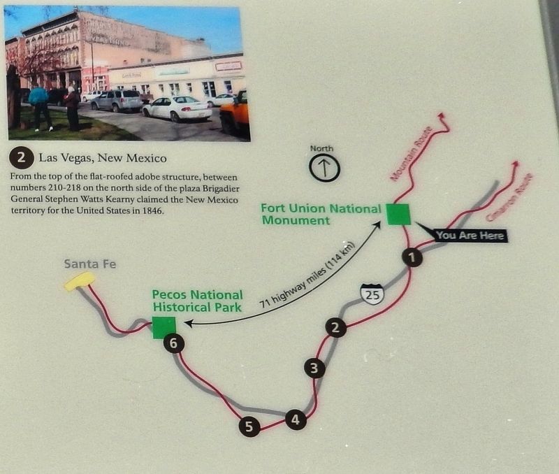
2. Las Vegas, New Mexico
From the top of the flat-roofed adobe structure, between numbers 210-218 on the north side of the plaza Brigadier General Stephen Watts Kearny claimed the New Mexico territory for the United States in 1846.
3. Kearnys Gap
Here, in 1821, Captain Ignacio Gallego met trader William Becknell's party from Missouri. Mexican independence from Spain two months earlier allowed Governor Facundo Melgares to welcome Becknell and thus open the Santa Fe Trail to legal international commerce between Mexico and the United States.
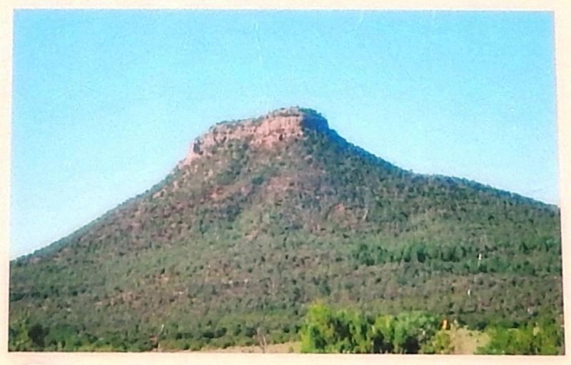
4. Starvation Peak
Also known as Bernal Hill, this peak was a landmark for Santa Fe Trail traders. Bernal Spring offered water to traders and for a time there was a stage station nearby.
5. San Miguel del Vado
This church was part of the first Hispanic settlement on the trail. Western bound caravans crossed the Pecos River nearby and the crossing point served as a port of entry and campsite for traders headed to Santa Fe.
6. Kozlowski’s Stage Station
Now part of Pecos National Historical Park, this trading post and stage station was known for its excellent food. It also served as a Union camp during the Civil War battle at Glorieta Pass.
[Santa Fe Trail Auto Tour Route logo here]
Look for this sign to trace the route of the Santa Fe National Historic Trail.
Please be courteous when viewing a site on private land.
For maps and further information please visit:
• Fort Union National Monument:
www.nps.gov/foun
• Town of Las Vegas, New Mexico
www.lasvegasnewmexico.com
• Las Vegas, New Mexico, Citizens' Committee for Historic Preservation:
http://lasbegasnmcchp.com
• Pecos National Historical Park:
www.nps.gov/peco
• Information on the Santa Fe Trail:
www.santafetrail.org
www.nps.gov/safe
Erected by National Park Service, Santa Fe Trail Association.
Topics and series. This historical marker is listed in these topic lists: Forts and Castles • Industry & Commerce • Roads & Vehicles • Settlements & Settlers. In addition, it is included in the Santa Fe Trail series list.
Location. 35° 54.298′ N, 105° 0.658′ W. Marker is near Watrous, New Mexico, in Mora County. Marker is on New Mexico Route 161, 7.6 miles north of Interstate 25. Marker is located in front of the Fort Union National Monument Visitor Center. Touch for map. Marker is at or near this postal address: 3115 New Mexico Route 161, Watrous NM 87753, United States of America. Touch for directions.
Other nearby markers. At least 8 other markers are within walking distance of this marker. Trail Sites to the North and East (here, next to this marker); The Best Hospital in 500 Miles (within shouting distance of this marker); Fort Union and the Santa Fe Trail (about 400 feet away, measured in a direct line); The Six Mule Army Wagon (about 400 feet away); The First Fort Union (about 600 feet away); Life Along Suds Row (about 800 feet away); Fort Union: 1866 (approx. 0.2 miles away); The Third Fort Union (approx. 0.2 miles away). Touch for a list and map of all markers in Watrous.
Related markers. Click here for a list of markers that are related to this marker. Fort Union National Monument
Also see . . .
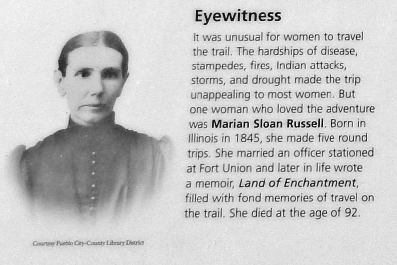
Courtesy Pueblo City-County Library District
3. Marker detail: Marion Sloan Russell
1. Santa Fe Trail Association. In 1821, the Santa Fe Trail became America's first great international commercial highway, and for nearly sixty years thereafter was one of the nation's great routes of adventure and western expansion. (Submitted on September 29, 2020, by Cosmos Mariner of Cape Canaveral, Florida.)
2. The Great Prairie Highway. Between 1821 and 1880, the Santa Fe Trail was primarily a commercial highway connecting Missouri and Santa Fe, New Mexico. The route was pioneered by Missouri trader William Becknell, who left Franklin, Missouri in September 1821. (Submitted on September 29, 2020, by Cosmos Mariner of Cape Canaveral, Florida.)
Credits. This page was last revised on September 29, 2020. It was originally submitted on September 29, 2020, by Cosmos Mariner of Cape Canaveral, Florida. This page has been viewed 155 times since then and 13 times this year. Photos: 1, 2, 3, 4, 5, 6. submitted on September 29, 2020, by Cosmos Mariner of Cape Canaveral, Florida.
