
Fort Smith in Sebastian County, Arkansas — The American South (West South Central)
Major Long Surveys the Western Frontier
Fort Smith National Historic Site
| — | National Park Service, U.S. Department of the Interior | — |
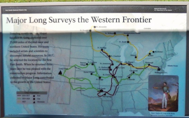
Photographed by Cosmos Mariner, May 18, 2015
1. Major Long Surveys the Western Frontier Marker
Erected by National Park Service, U.S. Department of the Interior.
Topics. This historical marker is listed in these topic lists: Exploration • Forts and Castles. A significant historical year for this entry is 1817.
Location. 35° 23.245′ N, 94° 25.939′ W. Marker is in Fort Smith, Arkansas, in Sebastian County. It can be reached from the intersection of Parker Avenue and South 3rd Street. Marker is located on the Fort Smith National Historic Site grounds, beside an interpretive kiosk near Belle Point on the west side of the fort. Touch for map. Marker is at or near this postal address: 301 Parker Avenue, Fort Smith AR 72901, United States of America. Touch for directions.

Regionally, this marker is in the Arkansas
this page online
Other nearby markers. At least 8 other markers are within walking distance of this marker: Who Served Here? (here, next to this marker); Establishing Fort Smith (here, next to this marker); Abandoned and Forgotten (a few steps from this marker); Request Denied (within shouting distance of this marker); Osage Nation (within shouting distance of this marker); Whiskey War (about 300 feet away, measured in a direct line); Defending Fort Smith (about 300 feet away); Cherokee Nation (about 300 feet away). Touch for a list and map of all markers in Fort Smith.
Also see . . .
1. Stephen Long. In the fall of 1817, General Andrew Jackson has Long travel to Arkansas where he maps out and builds Fort Smith,
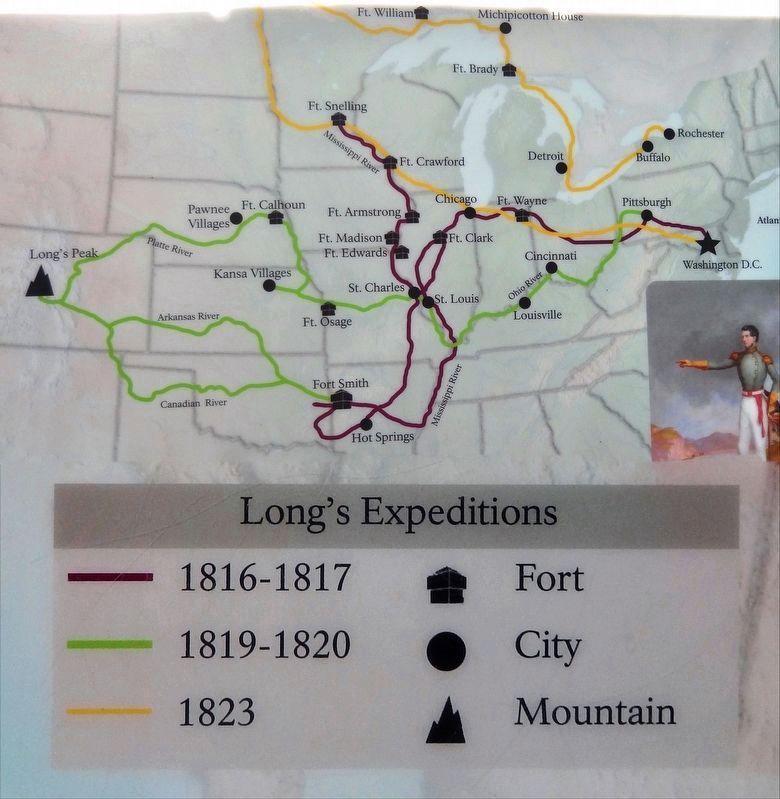
2. Marker detail: Long's Expeditions
2. Stephen Harriman Long (Wikipedia). Long was a U.S. army explorer, topographical engineer, and railway engineer. He was one of the most prolific explorers of the early 1800s. He covered over 26,000 miles in five expeditions, including a scientific expedition in the Great Plains area, which he famously confirmed as a "Great Desert." (Submitted on October 1, 2020, by Cosmos Mariner of Cape Canaveral, Florida.)
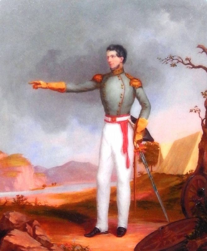
3. Marker detail: Major Stephen H. Long
Major Stephen H. Long on the Rocky Mountain Expedition 1819-1820
Artist Titian Peale
Turak Gallery, Nottingham, PA
Artist Titian Peale
Turak Gallery, Nottingham, PA
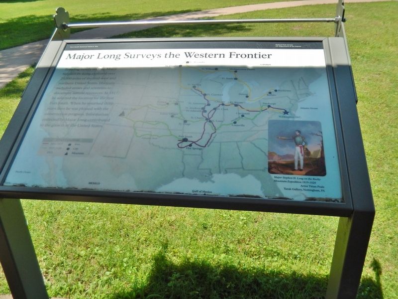
Photographed by Cosmos Mariner, May 18, 2015
4. Major Long Surveys the Western Frontier Marker
Credits. This page was last revised on October 1, 2020. It was originally submitted on September 29, 2020, by Cosmos Mariner of Cape Canaveral, Florida. This page has been viewed 764 times since then and 94 times this year. Photos: 1, 2, 3, 4. submitted on October 1, 2020, by Cosmos Mariner of Cape Canaveral, Florida.
