Richmond
[Side A]
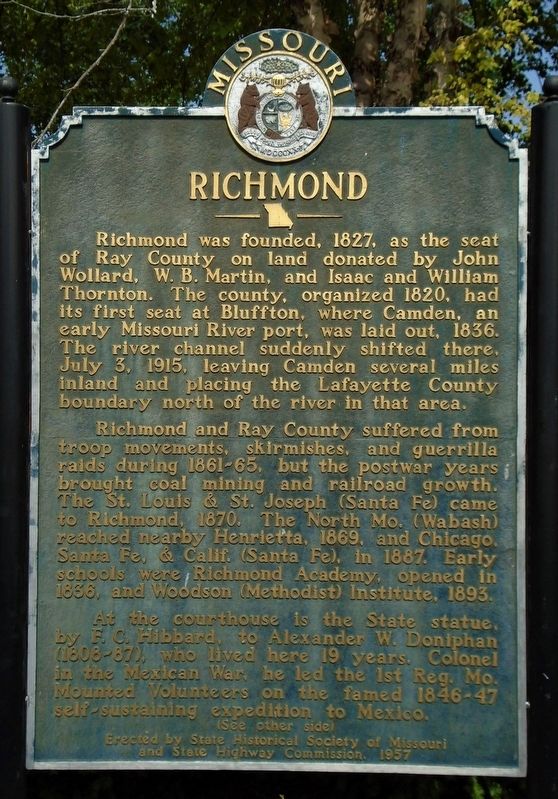
Richmond was founded, 1827, as the seat of Ray County on land donated by John Wollard, W.B. Martin, and Isaac and William Thornton. The county, organized 1820, had its first seat at Bluffton, where Camden, an early Missouri River port, was laid out, 1836. The river channel suddenly shifted there, July 3, 1915, leaving Camden several miles inland and placing the Lafayette County boundary north of the river in that area.
Richmond and Ray County suffered from troop movements, skirmishes, and guerrilla raids during 1861-65, but the postwar years brought coal mining and railroad growth. The St. Louis & St. Joseph (Santa Fe) came to Richmond, 1870. The North Mo. (Wabash) reached nearby Henrietta, 1869, and Chicago, Santa Fe, & Calif. (Santa Fe), in 1887. Early schools were Richmond Academy, opened in 1836, and Woodson (Methodist) Institute, 1893.
At the courthouse is the State statue, by F.C. Hibbard, to Alexander W. Doniphan (1808-87), who lived here 19 years. Colonel in the Mexican War, he led the 1st Reg. Mo. Mounted Volunteers on the famed 1846-47 self-sustaining expedition to Mexico.
[Side B]
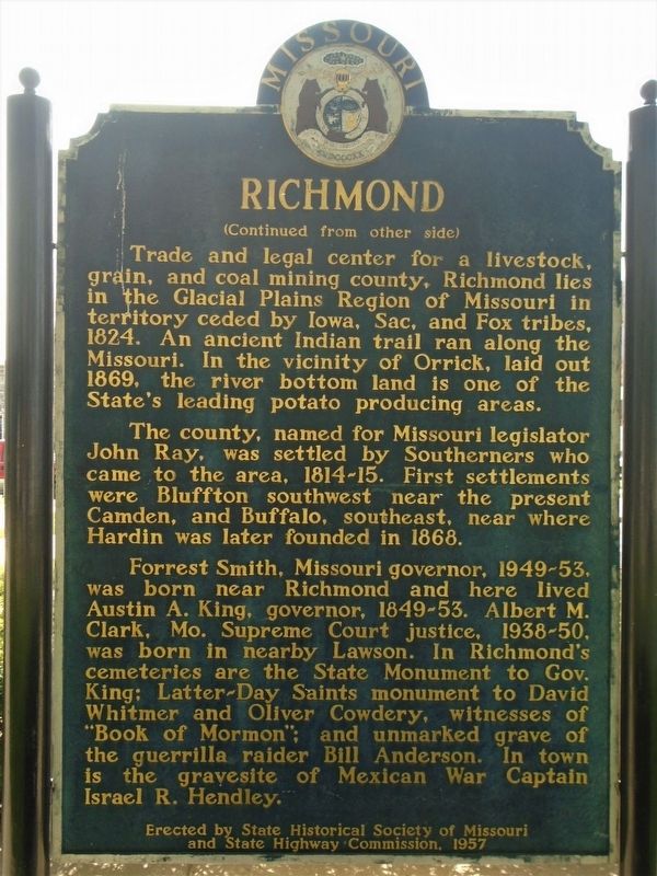
Trade and legal center for a livestock, grain, and coal mining county, Richmond lies in the Glacial
Plains Region of Missouri in territory ceded by Iowa, Sac, and Fox tribes, 1824. An ancient Indian trail ran along the Missouri. In the vicinity of Orrick, laid out 1869, the river bottom land is one of the State's leading potato producing areas.The county, named for Missouri legislator John Ray, was settled by Southerners who came to the area, 1814-15. First settlements were Bluffton, southwest, near the present Camden, and Buffalo, southeast, near where Hardin was later founded in 1868.
Forest Smith, Missouri governor, 1949-53, was born near Richmond and here lived Austin A. King, governor, 1849-53. Albert M. Clark, Mo. Supreme Court justice, 1938-50, was born in nearby Lawson. In Richmond's cemeteries are the State Monument to Gov. King; Latter-Day Saints monument to David Whitmer and Oliver Cowdery, witnesses of "Book of Mormon"; and unmarked grave of the guerrilla raider Bill Anderson. In town is the gravesite of Mexican War Captain Israel R. Hendley.
Erected by the State of Missouri.
Topics and series. This historical marker is listed in these topic lists: Churches & Religion • Settlements & Settlers • War, Mexican-American • War, US Civil. In addition, it is included in the Missouri, The State Historical Society of series list. A significant historical year for this entry is 1827.
Location.
Other nearby markers. At least 8 other markers are within walking distance of this marker. Colonel Alexander W. Doniphan (here, next to this marker); Pvt. John Wallace (here, next to this marker); Ray County Bicentennial Memorial (a few steps from this marker); 1856 Courthouse Cornice Planter (a few steps from this marker); World War II and Korean War Memorial (within shouting distance of this marker); Vietnam War Memorial (within shouting distance of this marker); World War Memorial (within shouting distance of this marker); The Bushwhacker in Missouri (within shouting distance of this marker). Touch for a list and map of all markers in Richmond.
Also see . . .
1. Ray County, Missouri, Official Website. (Submitted on October 2, 2020, by William Fischer, Jr. of Scranton, Pennsylvania.)
2. History of Ray County, Mo. (1881). (Submitted on October 2, 2020, by William Fischer, Jr. of Scranton, Pennsylvania.)
Credits. This page was last revised on October 2, 2020. It was originally submitted on October 2, 2020, by William Fischer, Jr. of Scranton, Pennsylvania. This page has been viewed 243 times since then and 34 times this year. Photos: 1, 2, 3. submitted on October 2, 2020, by William Fischer, Jr. of Scranton, Pennsylvania.


