Easton in Northampton County, Pennsylvania — The American Northeast (Mid-Atlantic)
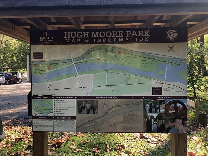
Hugh Moore Park
Map & Information
Take a Trip Back to America's Age of Canals
Easton's Hugh Moore Park is a picturesque of the City of Easton where America's golden age of canals is on full display. With more than two miles of restored Lehigh Canal, a canal boat attraction unlike any other in Pennsylvania and the rest of the northeast, and one of the country's largest canal heritage museums, the 520-acre park nestled between the Lehigh Canal and Lehigh River is a throwback to the years when mules pulling canal boats on narrow towpaths was a common sight in much of the United States east of the Mississippi River.
A Changed Landscape
The Glendon Iron Company was established in 1842 by Boston businessman Charles Jackson, Jr. It was second anthracite iron furnace in the U.S. and was put into blast in 1844 by William Firmstone, an English iron master. Firmstone purchased a site along Section 8 of the Lehigh Navigation, where he could use the water power of the canal to drive his blowing engines. A second furnace was constructed in 1846, and the works turned out over 7,000 tons of iron that year.
This historic map depicts one small section of nine hand drawn Lehigh Coal & Navigation Company maps dated 1864 that show the extension of the Lehigh and Susquehanna Railroad. Chief engineer on the mapping project was John Leisenring.
Erected by City of Easton, Pennsylvania.
Topics. This historical marker is listed in these topic lists: Industry & Commerce • Waterways & Vessels. A significant historical year for this entry is 1842.
Location. 40° 40.155′ N, 75° 14.18′ W. Marker is in Easton, Pennsylvania, in Northampton County. Marker is on Main Street just south of Hill Road, on the left when traveling south. Touch for map. Marker is at or near this postal address: 162 Main St, Easton PA 18042, United States of America. Touch for directions.
Other nearby markers. At least 8 other markers are within walking distance of this marker. The Industrial Revolution (a few steps from this marker); From Brownfields to Greenfields (within shouting distance of this marker); Men of Iron (within shouting distance of this marker); Birthplace of the American Industrial Revolution (within shouting distance of this marker); Iron in Colonial Pennsylvania (within shouting distance of this marker); Fathers of the Industrial Revolution (about 400 feet away, measured in a direct line); The Promise of Anthracite Coal (about 500 feet away); Lehigh Crane Iron Company (about 500 feet away). Touch for a list and map of all markers in Easton.
Credits. This page was last revised on October 4, 2020. It was originally submitted on October 4, 2020, by Devry Becker Jones of Washington, District of Columbia. This page has been viewed 210 times since then and 20 times this year. Photos: 1, 2. submitted on October 4, 2020, by Devry Becker Jones of Washington, District of Columbia.

