Central Oklahoma City in Oklahoma County, Oklahoma — The American South (West South Central)
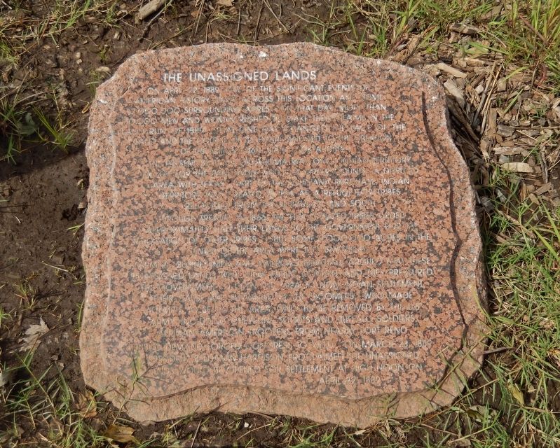
The Unassigned Lands
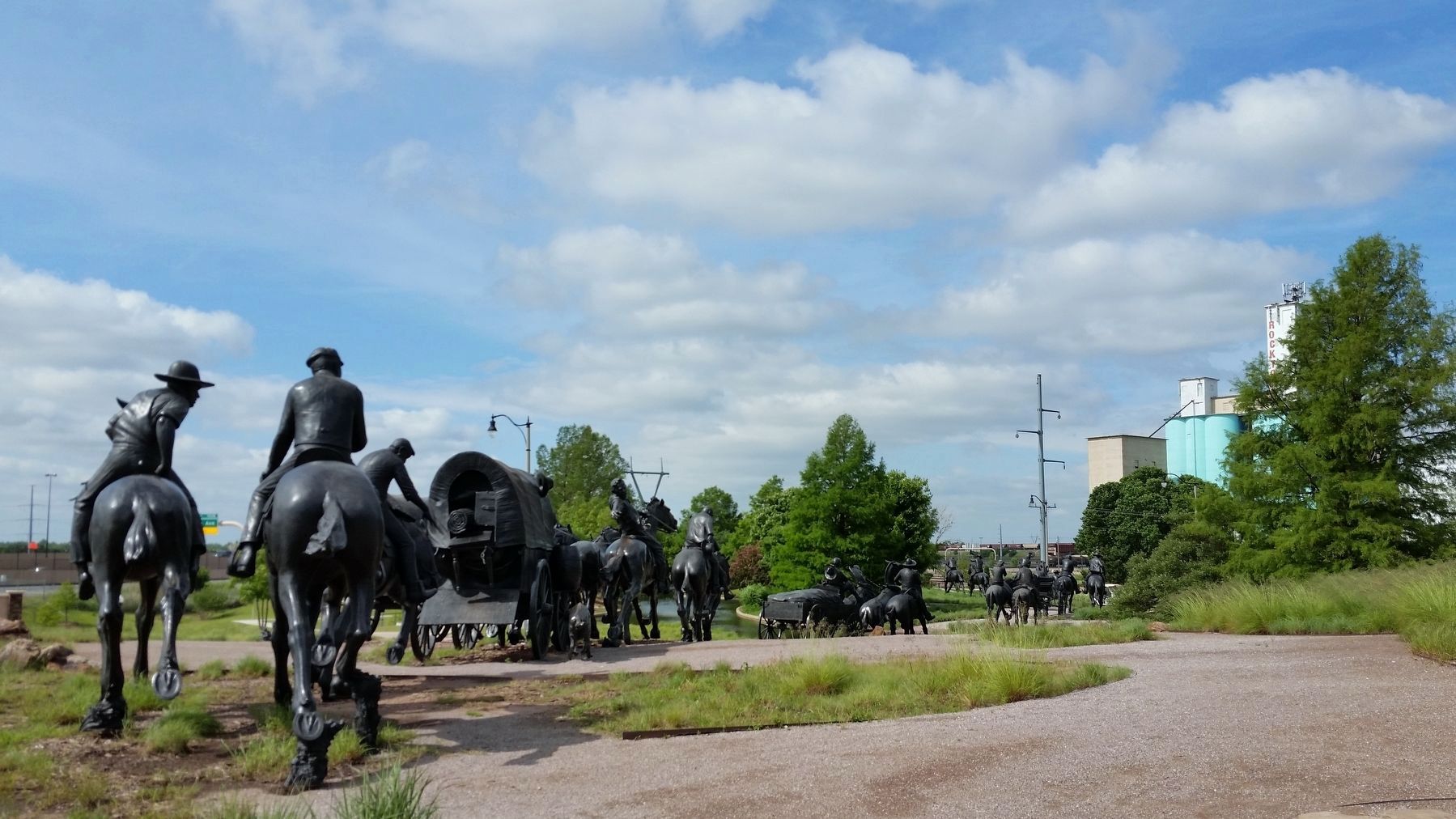
Oklahoma Centennial Land Run Monument
The present State of Oklahoma was once Indian Territory except for the panhandle and old Greer County, a disputed area with Texas. Part of the Louisiana Purchase, Indian Territory was created in 1825 as a refuge for tribes relocated from the Northeast and South. Through treaties in 1866, the Five Civilized Tribes ceded approximately half their lands to the Government for the relocation of their tribes — but some 2,000,000 acres in the center of the area were left unassigned.
Farmers, businessmen and railroad officials argued that these unassigned lands were now public domain, and they pressured the Government to open the area to non-Indian settlement. Their cause was furthered by the boomers who made attempts to settle the area only to be removed by the U.S. Army, including Cheyenne scouts and Buffalo Soldiers, African American troopers from nearby Fort Reno.
Public demand forced Congress to yield. On March 23, 1889 President Benjamin Harrison proclaimed the unassigned lands would be opened for settlement at High Noon on April 22, 1889.
Topics. This historical marker is listed in these topic lists: Native Americans • Settlements & Settlers. A significant historical date for this entry is April 22, 1889.
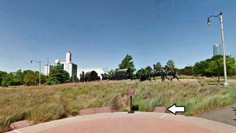
Location. 35° 27.675′ N, 97° 30.292′ W. Marker is in Oklahoma City, Oklahoma, in Oklahoma County. It is in Central Oklahoma City. Marker can be reached from Centennial Avenue, 0.2 miles south of Reno Avenue, on the right when traveling south. Marker is located near the south end of Bricktown River Walk Park, near the Oklahoma Centennial Land Run Monument. Touch for map. Marker is at or near this postal address: 200 Centennial Avenue, Oklahoma City OK 73102, United States of America. Touch for directions.
Other nearby markers. At least 8 other markers are within walking distance of this marker. The Land Run of 1889 (here, next to this marker); Centennial Land Run Monument Project (within shouting distance of this marker); Centennial Fountain at United Way Plaza (approx. 0.3 miles away); Johnny Bench (approx. 0.3 miles away); Wilber Joe Rogan (approx. 0.4 miles away); Lloyd James Waner (approx. 0.4 miles away); Paul Glee Waner (approx. 0.4 miles away); Carl Owen Hubbell (approx. 0.4 miles away). Touch for a list and map of all markers in Oklahoma City.
Related markers. Click here for a list of markers that are related to this marker. Oklahoma Centennial Land Run Monument
Also see . . .
1. Oklahoma Land Rush of 1889 (Wikipedia). The Oklahoma Land Rush of 1889 was the first land rush into the Unassigned Lands. The area that was opened to settlement included all or part of the Canadian, Cleveland, Kingfisher, Logan, Oklahoma, and Payne counties of the US state of Oklahoma. (Submitted on October 5, 2020, by Cosmos Mariner of Cape Canaveral, Florida.)
2. The Oklahoma land rush begins. By the 1890s, improved agricultural and ranching techniques led some white Americans to realize that the Indian Territory land could be valuable, and they pressured the U.S. government to allow white settlement in the region. In 1889, President Benjamin Harrison agreed, making the first of a long series of authorizations that eventually removed most of Indian Territory from Indian control. To begin the process of white settlement, Harrison chose to open a 1.9 million-acre section of Indian Territory that the government had never assigned to any specific tribe. (Submitted on October 5, 2020, by Cosmos Mariner of Cape Canaveral, Florida.)
3. Remembering the Oklahoma Land Rush. In the course of a single afternoon, new locales such as Oklahoma City suddenly emerged from the prairie. Guthrie had been transformed from a small railroad station to a tent city of 10,000 people in just hours. By nightfall, more than 11,000 agricultural
homesteads had been claimed during the Oklahoma Land Rush. (Submitted on October 6, 2020, by Cosmos Mariner of Cape Canaveral, Florida.)
Credits. This page was last revised on February 16, 2023. It was originally submitted on October 5, 2020, by Cosmos Mariner of Cape Canaveral, Florida. This page has been viewed 325 times since then and 48 times this year. Photos: 1, 2. submitted on October 5, 2020, by Cosmos Mariner of Cape Canaveral, Florida. 3. submitted on October 6, 2020, by Cosmos Mariner of Cape Canaveral, Florida.


